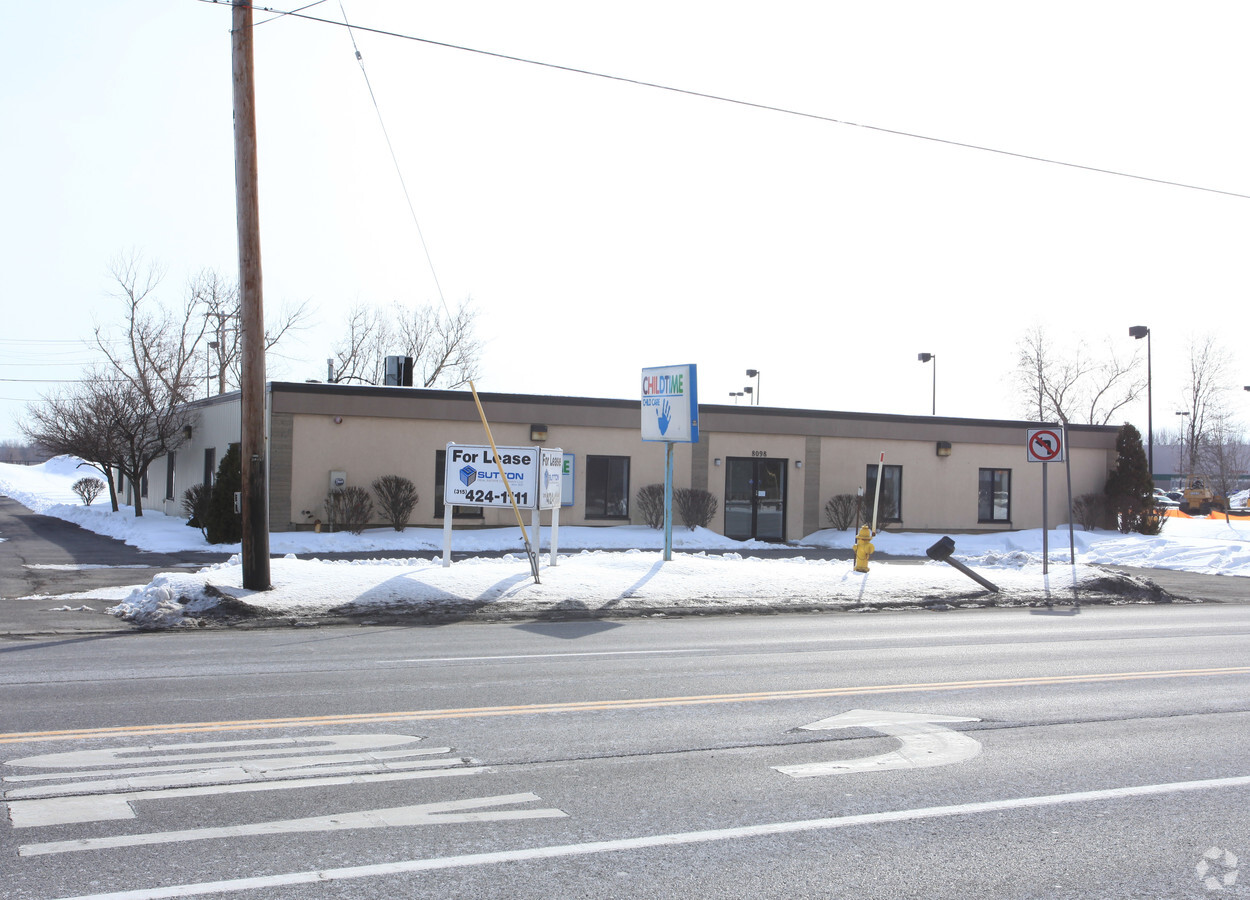
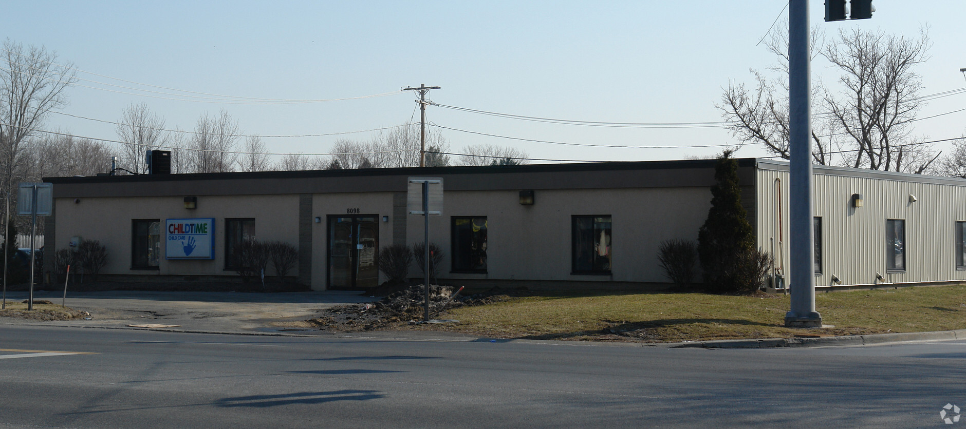
Property Record
8098 Brewerton Rd, Cicero, NY 13039
NEARBY LISTINGS FOR SALE OR LEASE
Property Detail
8098 Brewerton Rd
312289-049-000-0003-003-000-0000
FL 54 CHILD TIME DAYCARE 1152870
Storesoffices
Onondaga
X
New York
36067C0111F
3.001
2024
0.69 AC
2023
NE Outer Onondaga County
010301
Syracuse
7,880 SF
Syracuse, NY
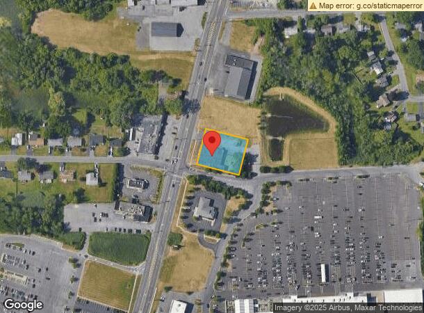
DEMOGRAPHICS near 8098 Brewerton Rd
1 Mile
3 Mile
5 Mile
2024 Total Population
4,405
36,674
71,955
2029 Population
4,268
35,574
70,005
Pop Growth 2024-2029
(3.11%)
(3.00%)
(2.71%)
Average Age
42
42
42
2024 Total Households
1,740
15,084
30,153
HH Growth 2024-2029
(3.33%)
(3.18%)
(2.90%)
Median Household Inc
$91,849
$85,981
$79,292
Avg Household Size
2.50
2.40
2.30
2024 Avg HH Vehicles
2.00
2.00
2.00
Median Home Value
$164,252
$170,283
$172,031
Median Year Built
1975
1972
1972
Nearby Places
- Restaurants
- Banks
- Shops
- Fitness
- Groceries
PUBLIC TRANSPORTATION
AIRPORT
Syracuse Hancock International
DRIVE
WALK
Distance
Syracuse Hancock International
12 min
7.5 mi
Freight Ports
Albany, NY Port
DRIVE
WALK
Distance
Albany, NY Port
176 min
146.2 mi
Nearby Properties
Address
Land Use
TOTAL SIZE
Lot Size
Zoning
Address
Land Use
TOTAL SIZE
Lot Size
Zoning
256,727 SF
70.21 AC
Address
Land Use
TOTAL SIZE
Lot Size
Zoning
439,670 SF
74.73 AC
C-G
Address
Land Use
TOTAL SIZE
Lot Size
Zoning
157,010 SF
36.98 AC
Address
Land Use
TOTAL SIZE
Lot Size
Zoning
218,439 SF
18.85 AC
Address
Land Use
TOTAL SIZE
Lot Size
Zoning
203,345 SF
18.17 AC
Address
Land Use
TOTAL SIZE
Lot Size
Zoning
8,417 SF
13.95 AC
Address
Land Use
TOTAL SIZE
Lot Size
Zoning
125,400 SF
18.11 AC
GC
Address
Land Use
TOTAL SIZE
Lot Size
Zoning
141,472 SF
12.38 AC
C-G
Address
Land Use
TOTAL SIZE
Lot Size
Zoning
120,068 SF
9.26 AC
GCPLUS
Address
Land Use
TOTAL SIZE
Lot Size
Zoning
92,844 SF
14.26 AC
C-G
Address
Land Use
TOTAL SIZE
Lot Size
Zoning
103,005 SF
12.58 AC
Address
Land Use
TOTAL SIZE
Lot Size
Zoning
86,269 SF
25.20 AC
C-G
Address
Land Use
TOTAL SIZE
Lot Size
Zoning
66,538 SF
18.24 AC
Address
Land Use
TOTAL SIZE
Lot Size
Zoning
63,140 SF
25.52 AC
Address
Land Use
TOTAL SIZE
Lot Size
Zoning
84,048 SF
19.42 AC
Address
Land Use
TOTAL SIZE
Lot Size
Zoning
33,180 SF
23.85 AC
GCPLUS
Address
Land Use
TOTAL SIZE
Lot Size
Zoning
81,439 SF
15.48 AC
Address
Land Use
TOTAL SIZE
Lot Size
Zoning
57,052 SF
16.82 AC
Address
Land Use
TOTAL SIZE
Lot Size
Zoning
92,936 SF
9.23 AC
GCPLUS
Address
Land Use
TOTAL SIZE
Lot Size
Zoning
90,292 SF
9.17 AC
GCPLUS
Address
Land Use
TOTAL SIZE
Lot Size
Zoning
67,143 SF
3.91 AC
Address
Land Use
TOTAL SIZE
Lot Size
Zoning
82,661 SF
15 AC
Address
Land Use
TOTAL SIZE
Lot Size
Zoning
2,404 SF
9.73 AC
Address
Land Use
TOTAL SIZE
Lot Size
Zoning
44,560 SF
2 AC
06 - INDUS
Address
Land Use
TOTAL SIZE
Lot Size
Zoning
57,953 SF
0.01 AC
06 - INDUS
Address
Land Use
TOTAL SIZE
Lot Size
Zoning
42,698 SF
13.85 AC
Address
Land Use
TOTAL SIZE
Lot Size
Zoning
68,021 SF
9.94 AC
C-G
Address
Land Use
TOTAL SIZE
Lot Size
Zoning
17,436 SF
98.89 AC
06000
Address
Land Use
TOTAL SIZE
Lot Size
Zoning
139,279 SF
12.14 AC
Address
Land Use
TOTAL SIZE
Lot Size
Zoning
8,224 SF
8.45 AC
PUD-R
The World's #1 Commercial Real Estate Marketplace
Connect with us
© 2025 CoStar Group
The information above has been obtained from sources believed reliable. While we do not doubt its accuracy we have not verified it and make no guarantee, warranty or representation about it. It is your responsibility to independently confirm its accuracy and completeness. Any projections, opinions, assumptions, or estimates used are for example only and do not represent the current or future performance of the property. The value of this transaction to you depends on tax and other factors which should be evaluated by your tax, financial, and legal advisors. You and your advisors should conduct a careful, independent investigation of the property to determine to your satisfaction the suitability of the property for your needs.