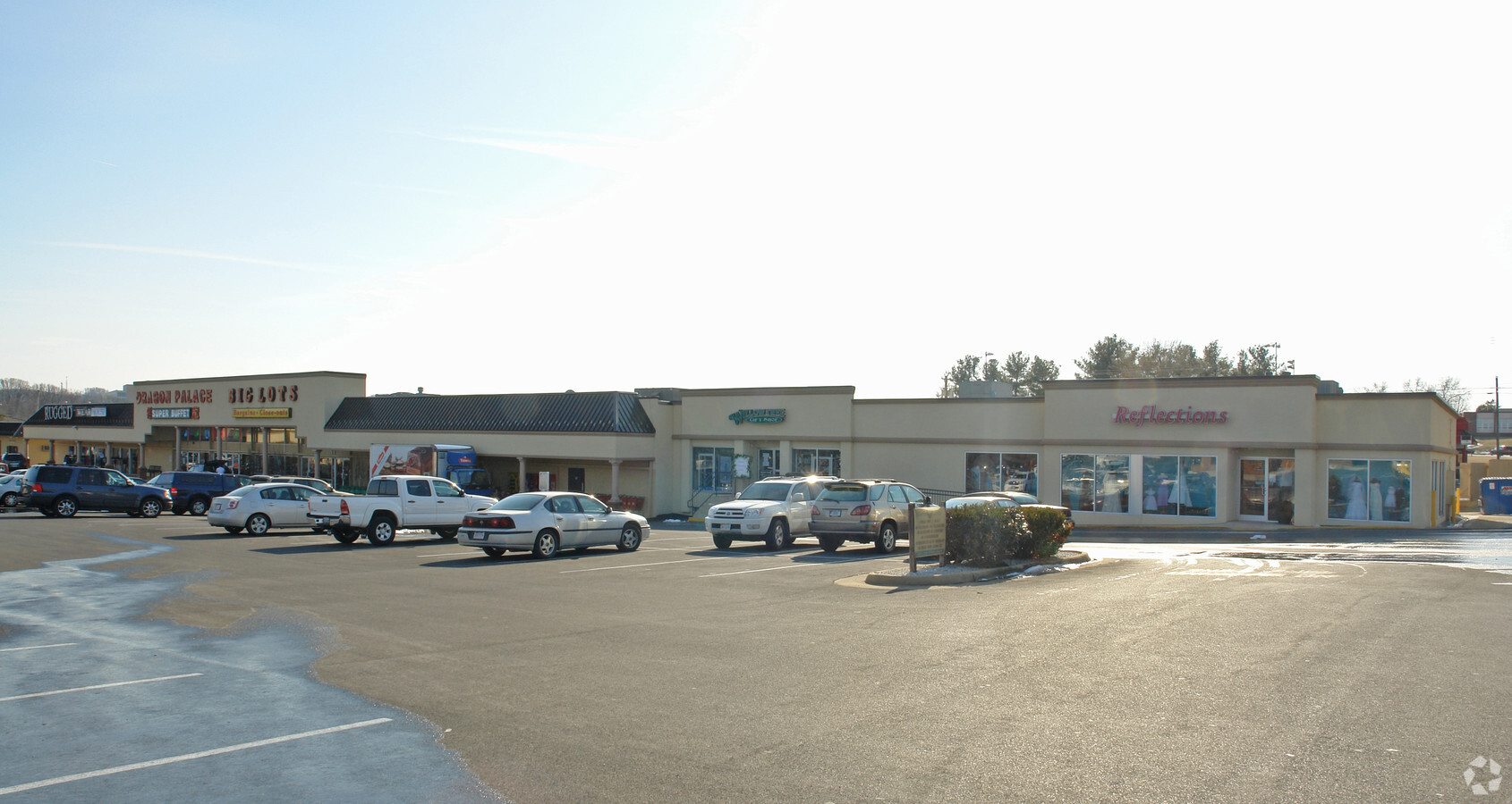
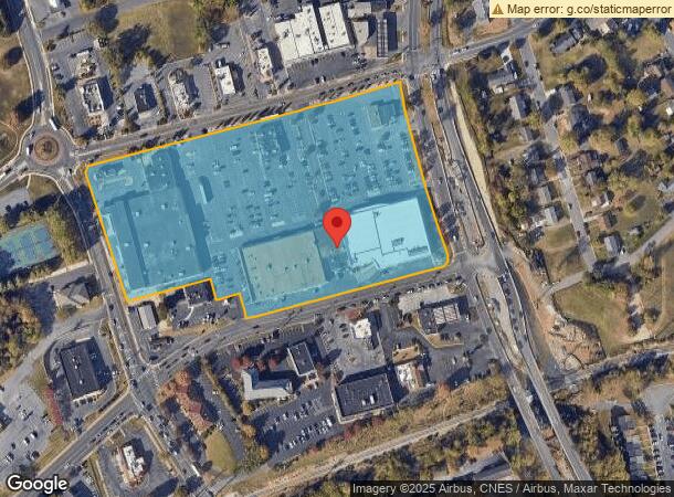
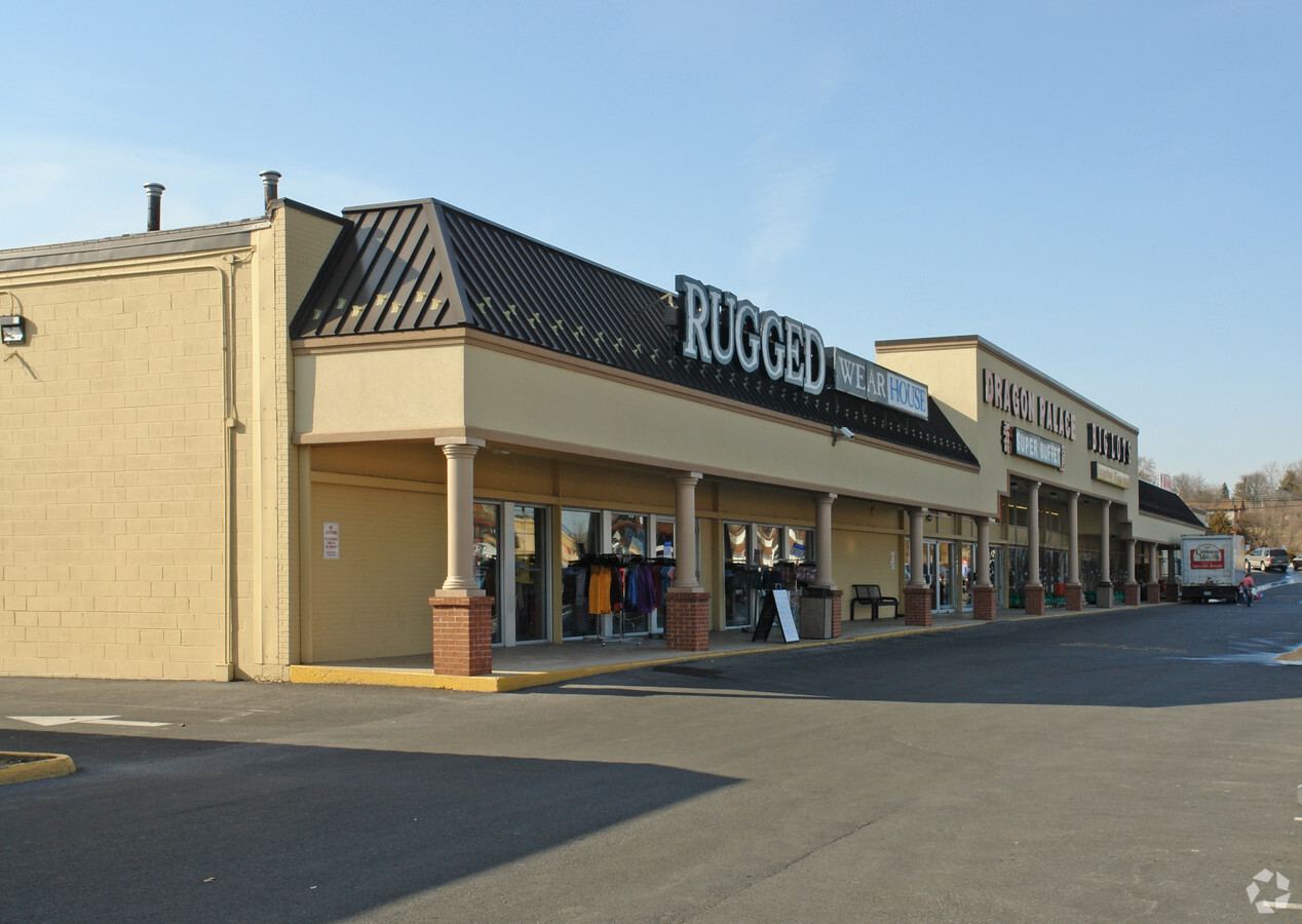
Property Record
81 S Carlton St, Harrisonburg, VA 22801
NEARBY LISTINGS FOR SALE OR LEASE
Property Detail
81 S Carlton St
027-O-1
COMMERCIAL DISTRICT 3 WS E MARKET ST
Wholesaleoutletdiscountstore
Harrisonburg
X
Virginia
51165C0403D
9.89 AC
2024
Old Town Harrisonburg
2024
Other Market Areas
000204
Harrisonburg, VA
57,759 SF
DEMOGRAPHICS near 81 S Carlton St
1 Mile
3 Mile
5 Mile
2024 Total Population
12,565
56,743
73,117
2029 Population
12,341
56,288
73,286
Pop Growth 2024-2029
(1.78%)
(0.80%)
+ 0.23%
Average Age
32
33
35
2024 Total Households
3,947
19,333
25,441
HH Growth 2024-2029
(1.98%)
(0.87%)
+ 0.27%
Median Household Inc
$52,742
$53,899
$60,582
Avg Household Size
2.50
2.50
2.50
2024 Avg HH Vehicles
2.00
2.00
2.00
Median Home Value
$248,153
$255,684
$287,379
Median Year Built
1977
1989
1990
Nearby Places
- Restaurants
- Banks
- Shops
- Fitness
- Groceries
SALE & LEASE HISTORY
LISTING DATE
SALE/LEASE

Sep 25, 2016
For Lease
Nearby Properties
Address
Land Use
TOTAL SIZE
Lot Size
Zoning
Address
Land Use
TOTAL SIZE
Lot Size
Zoning
143.09 AC
MULTI DWEL
Address
Land Use
TOTAL SIZE
Lot Size
Zoning
68.88 AC
GENERAL IN
Address
Land Use
TOTAL SIZE
Lot Size
Zoning
114.53 AC
MULTI DWEL
Address
Land Use
TOTAL SIZE
Lot Size
Zoning
9.63 AC
MULTI DWEL
Address
Land Use
TOTAL SIZE
Lot Size
Zoning
Address
Land Use
TOTAL SIZE
Lot Size
Zoning
100,172 SF
0.78 AC
MULTI DWEL
Address
Land Use
TOTAL SIZE
Lot Size
Zoning
3,960 SF
0.01 AC
MULTI DWEL
Address
Land Use
TOTAL SIZE
Lot Size
Zoning
36.81 AC
PLANNED RE
Address
Land Use
TOTAL SIZE
Lot Size
Zoning
219,561 SF
55.38 AC
GENERAL IN
Address
Land Use
TOTAL SIZE
Lot Size
Zoning
11.56 AC
GENERAL BU
Address
Land Use
TOTAL SIZE
Lot Size
Zoning
45,436 SF
44 SF
MULTI DWEL
Address
Land Use
TOTAL SIZE
Lot Size
Zoning
62.46 AC
SINGLE FAM
Address
Land Use
TOTAL SIZE
Lot Size
Zoning
510,400 SF
36.28 AC
GENERAL IN
Address
Land Use
TOTAL SIZE
Lot Size
Zoning
11.07 AC
RESIDENTIA
Address
Land Use
TOTAL SIZE
Lot Size
Zoning
236,916 SF
3.72 AC
MULTI DWEL
Address
Land Use
TOTAL SIZE
Lot Size
Zoning
4,128 SF
0.65 AC
MULTI DWEL
Address
Land Use
TOTAL SIZE
Lot Size
Zoning
16,620 SF
204 AC
HIGH DENSI
Address
Land Use
TOTAL SIZE
Lot Size
Zoning
14,490 SF
190 AC
PLANNED UN
Address
Land Use
TOTAL SIZE
Lot Size
Zoning
4,455 SF
0.02 AC
MULTI DWEL
Address
Land Use
TOTAL SIZE
Lot Size
Zoning
86,400 SF
37.26 AC
GENERAL BU
Address
Land Use
TOTAL SIZE
Lot Size
Zoning
14,856 SF
168 AC
MULTI DWEL
Address
Land Use
TOTAL SIZE
Lot Size
Zoning
87,927 SF
18.07 AC
GENERAL BU
Address
Land Use
TOTAL SIZE
Lot Size
Zoning
5,000 SF
12.96 AC
GENERAL IN
Address
Land Use
TOTAL SIZE
Lot Size
Zoning
6.10 AC
PLANNED MU
Address
Land Use
TOTAL SIZE
Lot Size
Zoning
MULTI DWEL
Address
Land Use
TOTAL SIZE
Lot Size
Zoning
99,334 SF
19.46 AC
GENERAL BU
Address
Land Use
TOTAL SIZE
Lot Size
Zoning
12.17 AC
PLANNED RE
Address
Land Use
TOTAL SIZE
Lot Size
Zoning
55,440 SF
3.41 AC
MULTI DWEL
Address
Land Use
TOTAL SIZE
Lot Size
Zoning
4,630 SF
17.31 AC
R3
Address
Land Use
TOTAL SIZE
Lot Size
Zoning
88 AC
MULTI DWEL
The World's #1 Commercial Real Estate Marketplace
Connect with us
© 2025 CoStar Group
The information above has been obtained from sources believed reliable. While we do not doubt its accuracy we have not verified it and make no guarantee, warranty or representation about it. It is your responsibility to independently confirm its accuracy and completeness. Any projections, opinions, assumptions, or estimates used are for example only and do not represent the current or future performance of the property. The value of this transaction to you depends on tax and other factors which should be evaluated by your tax, financial, and legal advisors. You and your advisors should conduct a careful, independent investigation of the property to determine to your satisfaction the suitability of the property for your needs.