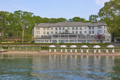
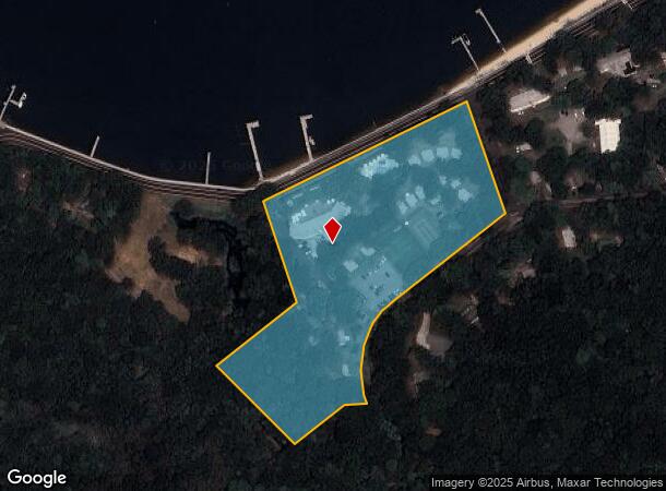
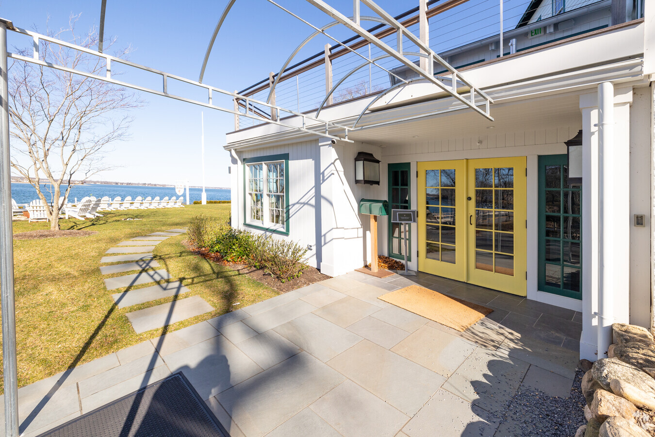
Property Record
81 Shore Rd, Shelter Island, NY 11964
NEARBY LISTINGS FOR SALE OR LEASE
-
-
View all Shelter Island listings for sale on LoopNet.com
Property Detail
81 Shore Rd
0700-013-00-01-00-020-000
Suffolk
Resorthotel
New York
VE
20
36103C0159H
7.53 AC
2023
Suffolk
2023
Long Island (New York)
180300
Nassau County-Suffolk County, NY
35,382 SF
DEMOGRAPHICS near 81 Shore Rd
1 Mile
3 Mile
5 Mile
2024 Total Population
325
12,383
20,851
2029 Population
329
12,628
21,500
Pop Growth 2024-2029
+ 1.23%
+ 1.98%
+ 3.11%
Average Age
49
47
48
2024 Total Households
144
5,217
8,973
HH Growth 2024-2029
+ 0.69%
+ 1.88%
+ 3.09%
Median Household Inc
$82,692
$92,802
$94,066
Avg Household Size
2.20
2.30
2.30
2024 Avg HH Vehicles
2.00
2.00
2.00
Median Home Value
$847,656
$770,402
$774,852
Median Year Built
1967
1969
1972
Nearby Places
- Restaurants
- Banks
- Shops
- Fitness
- Groceries
PUBLIC TRANSPORTATION
COMMUTER RAIL
Greenport Station (Greenport Branch - Long Island Rail Road)
DRIVE
WALK
Distance
Greenport Station (Greenport Branch - Long Island Rail Road)
22 min
3.5 mi
Southold Station (Greenport Branch - Long Island Rail Road)
DRIVE
WALK
Distance
Southold Station (Greenport Branch - Long Island Rail Road)
30 min
7.8 mi
Freight Ports
Port of New Haven
DRIVE
WALK
Distance
Port of New Haven
188 min
76.1 mi
Nearby Properties
Address
Land Use
TOTAL SIZE
Lot Size
Zoning
Address
Land Use
TOTAL SIZE
Lot Size
Zoning
954 AC
AA
Address
Land Use
TOTAL SIZE
Lot Size
Zoning
16,757 SF
319.50 AC
AA
Address
Land Use
TOTAL SIZE
Lot Size
Zoning
8,705 SF
138.70 AC
AA
Address
Land Use
TOTAL SIZE
Lot Size
Zoning
6,000 SF
25.70 AC
AA
Address
Land Use
TOTAL SIZE
Lot Size
Zoning
77,580 SF
8.33 AC
C
Address
Land Use
TOTAL SIZE
Lot Size
Zoning
5,695 SF
139.50 AC
AA
Address
Land Use
TOTAL SIZE
Lot Size
Zoning
9,468 SF
3.20 AC
AA
Address
Land Use
TOTAL SIZE
Lot Size
Zoning
170 AC
AA
Address
Land Use
TOTAL SIZE
Lot Size
Zoning
21,700 SF
7.90 AC
C
Address
Land Use
TOTAL SIZE
Lot Size
Zoning
23,354 SF
0.64 AC
AA
Address
Land Use
TOTAL SIZE
Lot Size
Zoning
1,396 SF
6.45 AC
AA
Address
Land Use
TOTAL SIZE
Lot Size
Zoning
12,064 SF
7.75 AC
AA
Address
Land Use
TOTAL SIZE
Lot Size
Zoning
8.70 AC
AA
Address
Land Use
TOTAL SIZE
Lot Size
Zoning
864 SF
3.20 AC
B
Address
Land Use
TOTAL SIZE
Lot Size
Zoning
2,076 SF
42.20 AC
AA
Address
Land Use
TOTAL SIZE
Lot Size
Zoning
319.50 AC
AA
Address
Land Use
TOTAL SIZE
Lot Size
Zoning
3.80 AC
A
Address
Land Use
TOTAL SIZE
Lot Size
Zoning
Address
Land Use
TOTAL SIZE
Lot Size
Zoning
8.31 AC
C
Address
Land Use
TOTAL SIZE
Lot Size
Zoning
904 SF
20.30 AC
AA
Address
Land Use
TOTAL SIZE
Lot Size
Zoning
63.60 AC
C
Address
Land Use
TOTAL SIZE
Lot Size
Zoning
8,793 SF
1.29 AC
B1
Address
Land Use
TOTAL SIZE
Lot Size
Zoning
251.50 AC
AA
Address
Land Use
TOTAL SIZE
Lot Size
Zoning
12,000 SF
5.39 AC
B
Address
Land Use
TOTAL SIZE
Lot Size
Zoning
2,925 SF
1.40 AC
B
Address
Land Use
TOTAL SIZE
Lot Size
Zoning
4,340 SF
0.88 AC
AA
Address
Land Use
TOTAL SIZE
Lot Size
Zoning
16.84 AC
C
Address
Land Use
TOTAL SIZE
Lot Size
Zoning
0.10 AC
A
Address
Land Use
TOTAL SIZE
Lot Size
Zoning
14.25 AC
A
The World's #1 Commercial Real Estate Marketplace
Connect with us
© 2025 CoStar Group
The information above has been obtained from sources believed reliable. While we do not doubt its accuracy we have not verified it and make no guarantee, warranty or representation about it. It is your responsibility to independently confirm its accuracy and completeness. Any projections, opinions, assumptions, or estimates used are for example only and do not represent the current or future performance of the property. The value of this transaction to you depends on tax and other factors which should be evaluated by your tax, financial, and legal advisors. You and your advisors should conduct a careful, independent investigation of the property to determine to your satisfaction the suitability of the property for your needs.