Property Record
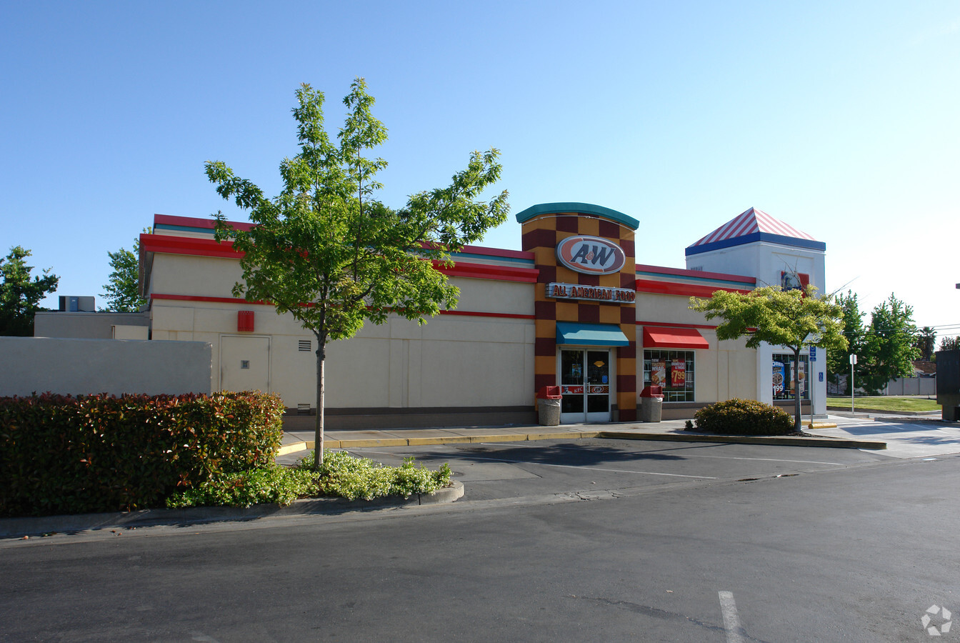
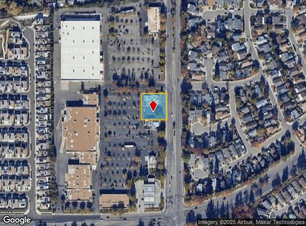
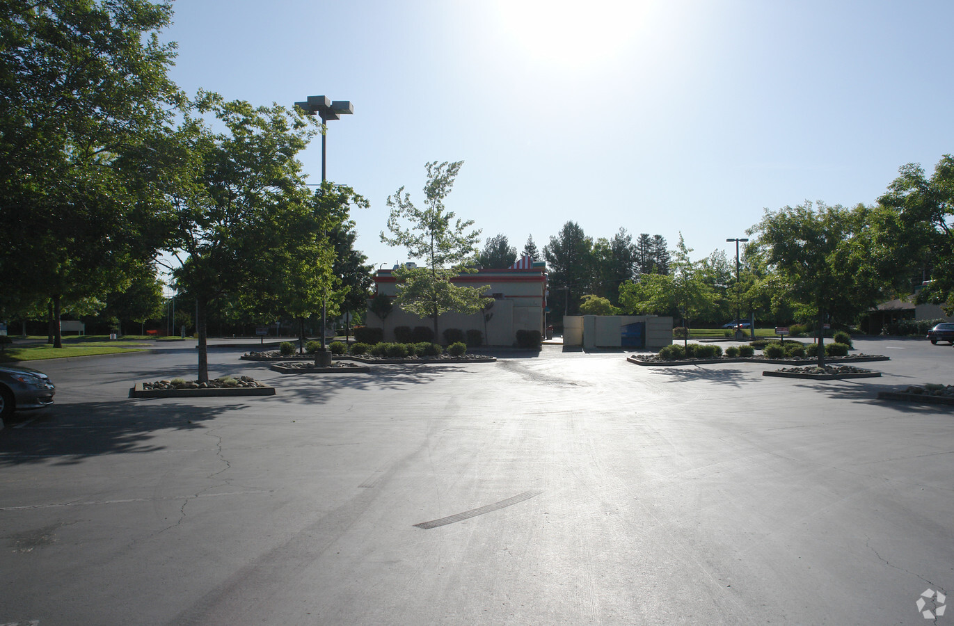
8101 Watt Ave, Antelope, CA 95843

NEARBY LISTINGS FOR SALE OR LEASE
Property Detail
8101 Watt Ave
203-0050-051
Elverta Crossing
Restaurantdrivein
PORTION LOT2
X
Sacramento
06061C1010H
California
2023
0.57 AC
2024
Rio Linda/N Highlands
007417
Sacramento
2,955 SF
Sacramento--Roseville--Arden-Arcade, CA
DEMOGRAPHICS near 8101 Watt Ave
1 Mile
3 Mile
5 Mile
2024 Total Population
15,485
87,593
226,543
2029 Population
15,513
88,244
230,740
Pop Growth 2024-2029
+ 0.18%
+ 0.74%
+ 1.85%
Average Age
37
37
38
2024 Total Households
4,818
27,340
76,675
HH Growth 2024-2029
+ 0.08%
+ 0.74%
+ 1.90%
Median Household Inc
$84,313
$83,109
$77,863
Avg Household Size
3.20
3.10
2.90
2024 Avg HH Vehicles
2.00
2.00
2.00
Median Home Value
$422,873
$404,134
$425,999
Median Year Built
1985
1985
1983
Nearby Places
- Restaurants
- Banks
- Shops
- Fitness
- Groceries
PUBLIC TRANSPORTATION
COMMUTER RAIL
Roseville (California Zephyr - Amtrak, Capitol Corridor - Amtrak)
DRIVE
WALK
Distance
Roseville (California Zephyr - Amtrak, Capitol Corridor - Amtrak)
14 min
7.5 mi
AIRPORT
Sacramento International
DRIVE
WALK
Distance
Sacramento International
26 min
15.9 mi
Freight Ports
Port of Stockton
DRIVE
WALK
Distance
Port of Stockton
76 min
60.8 mi
Nearby Properties
Address
Land Use
TOTAL SIZE
Lot Size
Zoning
Address
Land Use
TOTAL SIZE
Lot Size
Zoning
173,174 SF
8.89 AC
RD-30
Address
Land Use
TOTAL SIZE
Lot Size
Zoning
183,000 SF
12.49 AC
RD-20
Address
Land Use
TOTAL SIZE
Lot Size
Zoning
14.88 AC
RD-20
Address
Land Use
TOTAL SIZE
Lot Size
Zoning
217,380 SF
10 AC
SPA
Address
Land Use
TOTAL SIZE
Lot Size
Zoning
200,104 SF
13.85 AC
RD-20
Address
Land Use
TOTAL SIZE
Lot Size
Zoning
7,216 SF
0.54 AC
M-1
Address
Land Use
TOTAL SIZE
Lot Size
Zoning
146,283 SF
8.73 AC
RD-20
Address
Land Use
TOTAL SIZE
Lot Size
Zoning
244,048 SF
13.38 AC
RD-30
Address
Land Use
TOTAL SIZE
Lot Size
Zoning
160,497 SF
6.85 AC
RD-30
Address
Land Use
TOTAL SIZE
Lot Size
Zoning
280,864 SF
14.94 AC
RD-20
Address
Land Use
TOTAL SIZE
Lot Size
Zoning
141,274 SF
7.06 AC
RD-20
Address
Land Use
TOTAL SIZE
Lot Size
Zoning
0.13 AC
RD-7
Address
Land Use
TOTAL SIZE
Lot Size
Zoning
185,342 SF
11.13 AC
RD-20
Address
Land Use
TOTAL SIZE
Lot Size
Zoning
81,124 SF
4.81 AC
RD-20
Address
Land Use
TOTAL SIZE
Lot Size
Zoning
124,819 SF
13.10 AC
SC
Address
Land Use
TOTAL SIZE
Lot Size
Zoning
106,370 SF
5.91 AC
RD-30
Address
Land Use
TOTAL SIZE
Lot Size
Zoning
Address
Land Use
TOTAL SIZE
Lot Size
Zoning
91,526 SF
7.45 AC
SC
Address
Land Use
TOTAL SIZE
Lot Size
Zoning
149,950 SF
10.50 AC
RD-20
Address
Land Use
TOTAL SIZE
Lot Size
Zoning
83,504 SF
5.07 AC
SPA
Address
Land Use
TOTAL SIZE
Lot Size
Zoning
53.76 AC
RD-5
Address
Land Use
TOTAL SIZE
Lot Size
Zoning
168,810 SF
9.80 AC
RD-20
Address
Land Use
TOTAL SIZE
Lot Size
Zoning
95,788 SF
8.66 AC
SC
Address
Land Use
TOTAL SIZE
Lot Size
Zoning
51,460 SF
2.38 AC
SPA
Address
Land Use
TOTAL SIZE
Lot Size
Zoning
36.89 AC
RD-5
Address
Land Use
TOTAL SIZE
Lot Size
Zoning
28,316 SF
1.68 AC
RD-20
Address
Land Use
TOTAL SIZE
Lot Size
Zoning
86,400 SF
7.17 AC
GC
Address
Land Use
TOTAL SIZE
Lot Size
Zoning
97,359 SF
6.59 AC
SPA
Address
Land Use
TOTAL SIZE
Lot Size
Zoning
49,052 SF
6.27 AC
RD-20
Address
Land Use
TOTAL SIZE
Lot Size
Zoning
111,607 SF
6.08 AC
RD-20
The World's #1 Commercial Real Estate Marketplace
Connect with us
© 2025 CoStar Group
The information above has been obtained from sources believed reliable. While we do not doubt its accuracy we have not verified it and make no guarantee, warranty or representation about it. It is your responsibility to independently confirm its accuracy and completeness. Any projections, opinions, assumptions, or estimates used are for example only and do not represent the current or future performance of the property. The value of this transaction to you depends on tax and other factors which should be evaluated by your tax, financial, and legal advisors. You and your advisors should conduct a careful, independent investigation of the property to determine to your satisfaction the suitability of the property for your needs.