Property Record
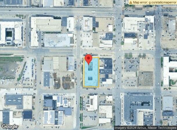
811 N St, Lincoln, NE 68508


NEARBY LISTINGS FOR SALE OR LEASE
Property Detail
811 N St
Lincoln, NE
Lincoln Original
10-26-206-016-000
LINCOLN ORIGINAL, BLOCK 70, LOT 13 - 18, & VAC E-W ALLEY ADJ
Commercialnec
Lancaster
AE
Nebraska
31109C0315F
13-18
2023
1.03 AC
2023
Downtown Lincoln
002100
Lincoln
72,047 SF
DEMOGRAPHICS near 811 N St
1 Mile
3 Mile
5 Mile
2024 Total Population
18,336
101,427
216,817
2029 Population
19,157
105,167
224,684
Pop Growth 2024-2029
+ 4.48%
+ 3.69%
+ 3.63%
Average Age
32
35
37
2024 Total Households
8,196
41,860
90,290
HH Growth 2024-2029
+ 5.33%
+ 3.97%
+ 3.81%
Median Household Inc
$30,975
$47,096
$56,311
Avg Household Size
1.80
2.20
2.30
2024 Avg HH Vehicles
1.00
2.00
2.00
Median Home Value
$131,052
$172,119
$195,141
Median Year Built
1964
1966
1974
Nearby Places
- Restaurants
- Banks
- Shops
- Fitness
- Groceries
Nearby Properties
Address
Land Use
TOTAL SIZE
Lot Size
Zoning
Address
Land Use
TOTAL SIZE
Lot Size
Zoning
684,598 SF
21.16 AC
B3
Address
Land Use
TOTAL SIZE
Lot Size
Zoning
131,328 SF
2.07 AC
P
Address
Land Use
TOTAL SIZE
Lot Size
Zoning
182,668 SF
2.07 AC
B4
Address
Land Use
TOTAL SIZE
Lot Size
Zoning
216,894 SF
1.46 AC
B4
Address
Land Use
TOTAL SIZE
Lot Size
Zoning
657,299 SF
66.04 AC
I1
Address
Land Use
TOTAL SIZE
Lot Size
Zoning
287,193 SF
6.62 AC
B4
Address
Land Use
TOTAL SIZE
Lot Size
Zoning
71,046 SF
23.72 AC
R5
Address
Land Use
TOTAL SIZE
Lot Size
Zoning
35,233 SF
28.52 AC
NULL
Address
Land Use
TOTAL SIZE
Lot Size
Zoning
65,430 SF
1.12 AC
B4
Address
Land Use
TOTAL SIZE
Lot Size
Zoning
217,115 SF
0.89 AC
B4
Address
Land Use
TOTAL SIZE
Lot Size
Zoning
189,854 SF
2.07 AC
P
Address
Land Use
TOTAL SIZE
Lot Size
Zoning
92,418 SF
0.79 AC
B4
Address
Land Use
TOTAL SIZE
Lot Size
Zoning
180,578 SF
1.32 AC
P
Address
Land Use
TOTAL SIZE
Lot Size
Zoning
56,867 SF
22.10 AC
NULL
Address
Land Use
TOTAL SIZE
Lot Size
Zoning
53,419 SF
0.43 AC
B4
Address
Land Use
TOTAL SIZE
Lot Size
Zoning
119,655 SF
2.28 AC
B4
Address
Land Use
TOTAL SIZE
Lot Size
Zoning
134,835 SF
1.22 AC
B4
Address
Land Use
TOTAL SIZE
Lot Size
Zoning
23,881 SF
0.80 AC
B4
Address
Land Use
TOTAL SIZE
Lot Size
Zoning
63,003 SF
1.22 AC
O3
Address
Land Use
TOTAL SIZE
Lot Size
Zoning
47,017 SF
0.92 AC
B4
Address
Land Use
TOTAL SIZE
Lot Size
Zoning
92,505 SF
2.96 AC
B4
Address
Land Use
TOTAL SIZE
Lot Size
Zoning
60,761 SF
0.75 AC
B4
Address
Land Use
TOTAL SIZE
Lot Size
Zoning
194,505 SF
2.07 AC
P
Address
Land Use
TOTAL SIZE
Lot Size
Zoning
149,344 SF
1.57 AC
P
Address
Land Use
TOTAL SIZE
Lot Size
Zoning
182,451 SF
2.07 AC
B4
Address
Land Use
TOTAL SIZE
Lot Size
Zoning
139,986 SF
6.53 AC
R2
Address
Land Use
TOTAL SIZE
Lot Size
Zoning
36,278 SF
0.58 AC
B4
Address
Land Use
TOTAL SIZE
Lot Size
Zoning
317,607 SF
20.80 AC
I2
Address
Land Use
TOTAL SIZE
Lot Size
Zoning
96,694 SF
1.28 AC
B4
The World's #1 Commercial Real Estate Marketplace
Connect with us
© 2025 CoStar Group
The information above has been obtained from sources believed reliable. While we do not doubt its accuracy we have not verified it and make no guarantee, warranty or representation about it. It is your responsibility to independently confirm its accuracy and completeness. Any projections, opinions, assumptions, or estimates used are for example only and do not represent the current or future performance of the property. The value of this transaction to you depends on tax and other factors which should be evaluated by your tax, financial, and legal advisors. You and your advisors should conduct a careful, independent investigation of the property to determine to your satisfaction the suitability of the property for your needs.