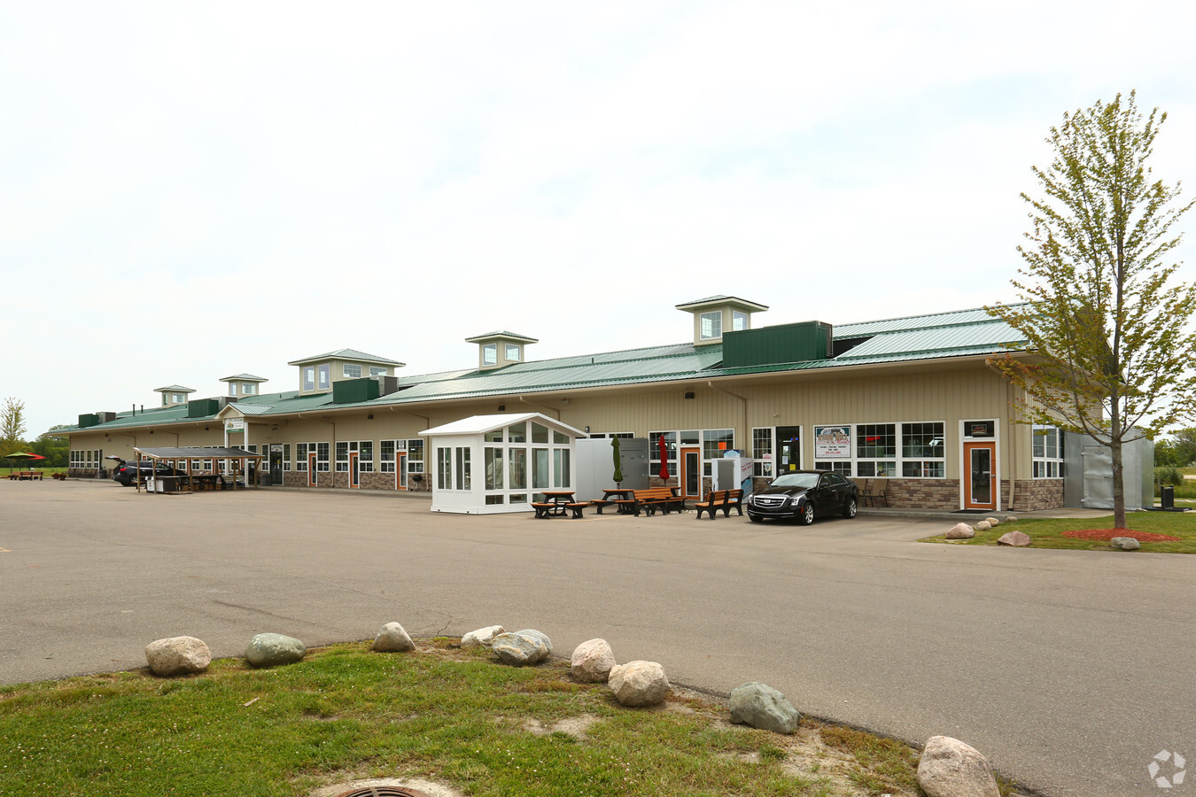
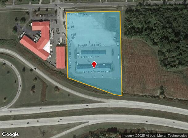
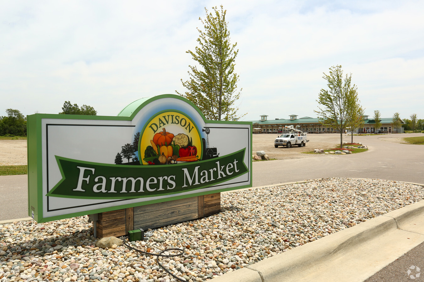
Property Record
8110 E Court St, Davison, MI 48423
NEARBY LISTINGS FOR SALE OR LEASE
Property Detail
8110 E Court St
Flint, MI
Industrial Park
05-17-501-015
LOTS 8 THRU 12 WHITE INDUSTRIAL PARK SEC 17 T7N R8E
Commercialnec
Genesee
X
Michigan
26049C0218D
8-12
2024
8.29 AC
2024
Flint
011713
Detroit
17,604 SF
DEMOGRAPHICS near 8110 E Court St
1 Mile
3 Mile
5 Mile
2024 Total Population
5,180
28,817
59,345
2029 Population
5,070
28,087
57,731
Pop Growth 2024-2029
(2.12%)
(2.53%)
(2.72%)
Average Age
38
42
42
2024 Total Households
2,742
12,696
25,161
HH Growth 2024-2029
(2.15%)
(2.48%)
(2.68%)
Median Household Inc
$49,470
$59,705
$58,197
Avg Household Size
1.80
2.20
2.30
2024 Avg HH Vehicles
1.00
2.00
2.00
Median Home Value
$172,505
$173,789
$165,320
Median Year Built
1980
1975
1972
Nearby Places
- Restaurants
- Banks
- Shops
- Fitness
- Groceries
PUBLIC TRANSPORTATION
COMMUTER RAIL
Flint Amtrak Station (Blue Water - Amtrak)
DRIVE
WALK
Distance
Flint Amtrak Station (Blue Water - Amtrak)
9 min
5.8 mi
AIRPORT
Bishop International
DRIVE
WALK
Distance
Bishop International
27 min
15.3 mi
Freight Ports
Port of Toledo
DRIVE
WALK
Distance
Port of Toledo
143 min
121.1 mi
Nearby Properties
Address
Land Use
TOTAL SIZE
Lot Size
Zoning
Address
Land Use
TOTAL SIZE
Lot Size
Zoning
51.59 AC
NOT AVAILA
Address
Land Use
TOTAL SIZE
Lot Size
Zoning
217,010 SF
18.08 AC
Address
Land Use
TOTAL SIZE
Lot Size
Zoning
46.83 AC
NOT AVAILA
Address
Land Use
TOTAL SIZE
Lot Size
Zoning
217,010 SF
22.95 AC
Address
Land Use
TOTAL SIZE
Lot Size
Zoning
302,862 SF
27.14 AC
NOT AVAILA
Address
Land Use
TOTAL SIZE
Lot Size
Zoning
227,669 SF
25.87 AC
C-2
Address
Land Use
TOTAL SIZE
Lot Size
Zoning
157,741 SF
33.61 AC
Address
Land Use
TOTAL SIZE
Lot Size
Zoning
Address
Land Use
TOTAL SIZE
Lot Size
Zoning
156,996 SF
NOT AVAILA
Address
Land Use
TOTAL SIZE
Lot Size
Zoning
157,741 SF
38.75 AC
NOT AVAILA
Address
Land Use
TOTAL SIZE
Lot Size
Zoning
19.05 AC
NOT AVAILA
Address
Land Use
TOTAL SIZE
Lot Size
Zoning
159,560 SF
9.96 AC
NOT AVAILA
Address
Land Use
TOTAL SIZE
Lot Size
Zoning
42,397 SF
15.14 AC
NOT AVAILA
Address
Land Use
TOTAL SIZE
Lot Size
Zoning
56,966 SF
1.80 AC
NOT AVAILA
Address
Land Use
TOTAL SIZE
Lot Size
Zoning
59,276 SF
3.40 AC
NOT AVAILA
Address
Land Use
TOTAL SIZE
Lot Size
Zoning
12.16 AC
NOT AVAILA
Address
Land Use
TOTAL SIZE
Lot Size
Zoning
72,603 SF
4 AC
NOT AVAILA
Address
Land Use
TOTAL SIZE
Lot Size
Zoning
34,096 SF
131.93 AC
Address
Land Use
TOTAL SIZE
Lot Size
Zoning
14.84 AC
Address
Land Use
TOTAL SIZE
Lot Size
Zoning
105,072 SF
5.18 AC
RETAIL
Address
Land Use
TOTAL SIZE
Lot Size
Zoning
44,280 SF
5.48 AC
C-3
Address
Land Use
TOTAL SIZE
Lot Size
Zoning
14,336 SF
3.29 AC
NOT AVAILA
Address
Land Use
TOTAL SIZE
Lot Size
Zoning
60,978 SF
64.65 AC
NOT AVAILA
Address
Land Use
TOTAL SIZE
Lot Size
Zoning
46,464 SF
9.69 AC
NOT AVAILA
Address
Land Use
TOTAL SIZE
Lot Size
Zoning
25.50 AC
NOT AVAILA
Address
Land Use
TOTAL SIZE
Lot Size
Zoning
79,677 SF
13.79 AC
B-1
Address
Land Use
TOTAL SIZE
Lot Size
Zoning
38,881 SF
3.70 AC
NOT AVAILA
Address
Land Use
TOTAL SIZE
Lot Size
Zoning
59,420 SF
5.25 AC
C-3
Address
Land Use
TOTAL SIZE
Lot Size
Zoning
98,410 SF
4.34 AC
C-3
Address
Land Use
TOTAL SIZE
Lot Size
Zoning
1,438 SF
40.80 AC
NOT AVAILA
The World's #1 Commercial Real Estate Marketplace
Connect with us
© 2025 CoStar Group
The information above has been obtained from sources believed reliable. While we do not doubt its accuracy we have not verified it and make no guarantee, warranty or representation about it. It is your responsibility to independently confirm its accuracy and completeness. Any projections, opinions, assumptions, or estimates used are for example only and do not represent the current or future performance of the property. The value of this transaction to you depends on tax and other factors which should be evaluated by your tax, financial, and legal advisors. You and your advisors should conduct a careful, independent investigation of the property to determine to your satisfaction the suitability of the property for your needs.