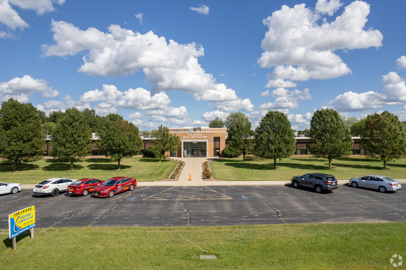
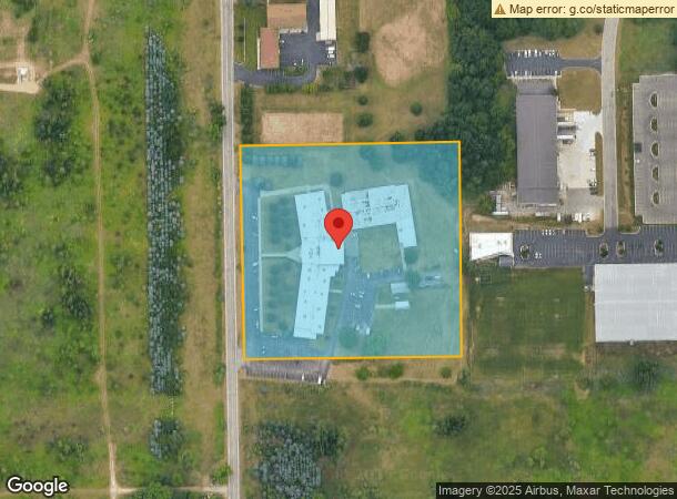
Property Record
8135 Coxs Dr, Portage, MI 49002

Current Lease Availabilities
NEARBY LISTINGS FOR SALE OR LEASE
Property Detail
8135 Coxs Dr
10-00024-080-O
SEC 24-3-11 BEG AT NW COR OF S 3/4 OF W 1/2 OF NW 1/4 SEC 24, TH W 22.21 FT TO CNTR LI OF COX'S DR, TH S ALG SD CNTR LI 567.3 FT, TH E 617.93 FT, TH N APPROX 567 FT TH W 617.93 FT TO P.O.B., RES COX DR ROW, ALSO RES S 66 FT FOR PRIVATE EASEMENT.
Commercialnec
Kalamazoo
X
Michigan
26077C0310E
7.62 AC
2023
Southern Kalamazoo County
2024
West Michigan
001905
Kalamazoo-Portage, MI
46,424 SF
DEMOGRAPHICS near 8135 Coxs Dr
1 Mile
3 Mile
5 Mile
2024 Total Population
2,079
23,089
69,867
2029 Population
2,068
23,006
69,594
Pop Growth 2024-2029
(0.53%)
(0.36%)
(0.39%)
Average Age
40
41
39
2024 Total Households
808
10,031
29,369
HH Growth 2024-2029
(0.50%)
(0.40%)
(0.44%)
Median Household Inc
$75,579
$66,736
$66,975
Avg Household Size
2.50
2.20
2.30
2024 Avg HH Vehicles
2.00
2.00
2.00
Median Home Value
$215,726
$211,523
$198,675
Median Year Built
1972
1973
1972
Nearby Places
- Restaurants
- Banks
- Shops
- Fitness
- Groceries
PUBLIC TRANSPORTATION
COMMUTER RAIL
Kalamazoo (Blue Water - Amtrak, Wolverine - Amtrak)
DRIVE
WALK
Distance
Kalamazoo (Blue Water - Amtrak, Wolverine - Amtrak)
18 min
7.8 mi
AIRPORT
Kalamazoo/Battle Creek International
DRIVE
WALK
Distance
Kalamazoo/Battle Creek International
15 min
5.2 mi
Freight Ports
Port of Toledo
DRIVE
WALK
Distance
Port of Toledo
179 min
146.8 mi
Nearby Properties
Address
Land Use
TOTAL SIZE
Lot Size
Zoning
Address
Land Use
TOTAL SIZE
Lot Size
Zoning
435.98 AC
I-2
Address
Land Use
TOTAL SIZE
Lot Size
Zoning
Address
Land Use
TOTAL SIZE
Lot Size
Zoning
Address
Land Use
TOTAL SIZE
Lot Size
Zoning
35,119 SF
50.85 AC
Address
Land Use
TOTAL SIZE
Lot Size
Zoning
2,075,706 SF
12.34 AC
Address
Land Use
TOTAL SIZE
Lot Size
Zoning
82,520 SF
39.35 AC
Address
Land Use
TOTAL SIZE
Lot Size
Zoning
78.75 AC
I-2
Address
Land Use
TOTAL SIZE
Lot Size
Zoning
Address
Land Use
TOTAL SIZE
Lot Size
Zoning
Address
Land Use
TOTAL SIZE
Lot Size
Zoning
Address
Land Use
TOTAL SIZE
Lot Size
Zoning
19.39 AC
OTR
Address
Land Use
TOTAL SIZE
Lot Size
Zoning
383,638 SF
25.85 AC
B-2
Address
Land Use
TOTAL SIZE
Lot Size
Zoning
37.40 AC
Address
Land Use
TOTAL SIZE
Lot Size
Zoning
16.71 AC
B-2
Address
Land Use
TOTAL SIZE
Lot Size
Zoning
61,533 SF
8.42 AC
Address
Land Use
TOTAL SIZE
Lot Size
Zoning
Address
Land Use
TOTAL SIZE
Lot Size
Zoning
17,858 SF
15.27 AC
Address
Land Use
TOTAL SIZE
Lot Size
Zoning
61.61 AC
Address
Land Use
TOTAL SIZE
Lot Size
Zoning
151,395 SF
33.79 AC
Address
Land Use
TOTAL SIZE
Lot Size
Zoning
35.87 AC
Address
Land Use
TOTAL SIZE
Lot Size
Zoning
66.34 AC
Address
Land Use
TOTAL SIZE
Lot Size
Zoning
Address
Land Use
TOTAL SIZE
Lot Size
Zoning
18.57 AC
Address
Land Use
TOTAL SIZE
Lot Size
Zoning
104,366 SF
9.76 AC
B-3
Address
Land Use
TOTAL SIZE
Lot Size
Zoning
28.49 AC
I-2
Address
Land Use
TOTAL SIZE
Lot Size
Zoning
13.77 AC
B-2
Address
Land Use
TOTAL SIZE
Lot Size
Zoning
31.79 AC
Address
Land Use
TOTAL SIZE
Lot Size
Zoning
202,798 SF
17.67 AC
I-1
Address
Land Use
TOTAL SIZE
Lot Size
Zoning
291,184 SF
26.35 AC
Address
Land Use
TOTAL SIZE
Lot Size
Zoning
20,760 SF
12.86 AC
The World's #1 Commercial Real Estate Marketplace
Connect with us
© 2025 CoStar Group
The information above has been obtained from sources believed reliable. While we do not doubt its accuracy we have not verified it and make no guarantee, warranty or representation about it. It is your responsibility to independently confirm its accuracy and completeness. Any projections, opinions, assumptions, or estimates used are for example only and do not represent the current or future performance of the property. The value of this transaction to you depends on tax and other factors which should be evaluated by your tax, financial, and legal advisors. You and your advisors should conduct a careful, independent investigation of the property to determine to your satisfaction the suitability of the property for your needs.