Property Record
815 N Greenwood St, Lagrange, GA 30240
NEARBY LISTINGS FOR SALE OR LEASE
-
-
View all Lagrange listings for sale on LoopNet.com
Property Detail
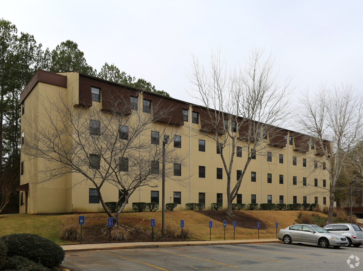
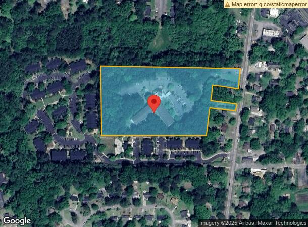
815 N Greenwood St
LaGrange, GA
Brays Lakeview Farms
061-1D-004-006
815 N GREENWOOD ST/PB 19 PG 77
Apartment
Troup
X
Georgia
13285C0141E
84
2024
8.10 AC
2024
Troup County
960401
Columbus GA
75,699 SF
DEMOGRAPHICS near 815 N Greenwood St
1 Mile
3 Mile
5 Mile
2024 Total Population
6,488
30,517
39,339
2029 Population
6,479
31,044
39,987
Pop Growth 2024-2029
(0.14%)
+ 1.73%
+ 1.65%
Average Age
38
38
38
2024 Total Households
2,733
11,993
15,279
HH Growth 2024-2029
(0.11%)
+ 1.74%
+ 1.66%
Median Household Inc
$43,262
$44,033
$46,522
Avg Household Size
2.30
2.40
2.50
2024 Avg HH Vehicles
1.00
2.00
2.00
Median Home Value
$183,373
$151,305
$168,147
Median Year Built
1973
1979
1982
Nearby Places
- Restaurants
- Banks
- Shops
- Fitness
- Groceries
Nearby Properties
Address
Land Use
TOTAL SIZE
Lot Size
Zoning
Address
Land Use
TOTAL SIZE
Lot Size
Zoning
2,095 SF
16.50 AC
16- CP-GB
Address
Land Use
TOTAL SIZE
Lot Size
Zoning
17,328 SF
10.66 AC
16- CP-GB
Address
Land Use
TOTAL SIZE
Lot Size
Zoning
95,472 SF
30.05 AC
16- CR-MR
Address
Land Use
TOTAL SIZE
Lot Size
Zoning
109,533 SF
1.80 AC
16- DT-MX
Address
Land Use
TOTAL SIZE
Lot Size
Zoning
323,137 SF
34.65 AC
16- CP-GI
Address
Land Use
TOTAL SIZE
Lot Size
Zoning
174,899 SF
7.52 AC
16- TN-R
Address
Land Use
TOTAL SIZE
Lot Size
Zoning
35,269 SF
22.34 AC
16- CR-MR
Address
Land Use
TOTAL SIZE
Lot Size
Zoning
2,152 SF
21.70 AC
16- CR-MR
Address
Land Use
TOTAL SIZE
Lot Size
Zoning
117,684 SF
12.61 AC
16- AC-MX
Address
Land Use
TOTAL SIZE
Lot Size
Zoning
141,328 SF
7.18 AC
16- TN-MX
Address
Land Use
TOTAL SIZE
Lot Size
Zoning
159,645 SF
2.98 AC
16- DT-MX
Address
Land Use
TOTAL SIZE
Lot Size
Zoning
3,798 SF
22.81 AC
16- CR-MR
Address
Land Use
TOTAL SIZE
Lot Size
Zoning
29,520 SF
1.92 AC
16- CP-GB
Address
Land Use
TOTAL SIZE
Lot Size
Zoning
56,620 SF
5.22 AC
16- CR-MX
Address
Land Use
TOTAL SIZE
Lot Size
Zoning
20,129 SF
357.53 AC
01-LR
Address
Land Use
TOTAL SIZE
Lot Size
Zoning
26,595 SF
20.13 AC
16- CR-MX
Address
Land Use
TOTAL SIZE
Lot Size
Zoning
551,306 SF
72.64 AC
16- CP-GI
Address
Land Use
TOTAL SIZE
Lot Size
Zoning
89,395 SF
28.47 AC
16- TN-R
Address
Land Use
TOTAL SIZE
Lot Size
Zoning
27,080 SF
27.40 AC
16- CP-GB
Address
Land Use
TOTAL SIZE
Lot Size
Zoning
9,290 SF
11.58 AC
16- CP-GB
Address
Land Use
TOTAL SIZE
Lot Size
Zoning
56,580 SF
12.87 AC
16- CR-MX
Address
Land Use
TOTAL SIZE
Lot Size
Zoning
8,448 SF
25.78 AC
16- CR-MX
Address
Land Use
TOTAL SIZE
Lot Size
Zoning
3,433 SF
19.65 AC
16- CR-MR
Address
Land Use
TOTAL SIZE
Lot Size
Zoning
4,428 SF
9.67 AC
16- CR-MR
Address
Land Use
TOTAL SIZE
Lot Size
Zoning
2,366 SF
8.70 AC
16- CR-MR
Address
Land Use
TOTAL SIZE
Lot Size
Zoning
57,971 SF
7.98 AC
16- CP-GB
Address
Land Use
TOTAL SIZE
Lot Size
Zoning
14,232 SF
2.59 AC
16- DT-MX
Address
Land Use
TOTAL SIZE
Lot Size
Zoning
26,150 SF
3.28 AC
16- CR-MX
Address
Land Use
TOTAL SIZE
Lot Size
Zoning
133,950 SF
1.94 AC
16- DT-MX
Address
Land Use
TOTAL SIZE
Lot Size
Zoning
92,762 SF
78.28 AC
16- SU-R
The World's #1 Commercial Real Estate Marketplace
Connect with us
© 2025 CoStar Group
The information above has been obtained from sources believed reliable. While we do not doubt its accuracy we have not verified it and make no guarantee, warranty or representation about it. It is your responsibility to independently confirm its accuracy and completeness. Any projections, opinions, assumptions, or estimates used are for example only and do not represent the current or future performance of the property. The value of this transaction to you depends on tax and other factors which should be evaluated by your tax, financial, and legal advisors. You and your advisors should conduct a careful, independent investigation of the property to determine to your satisfaction the suitability of the property for your needs.