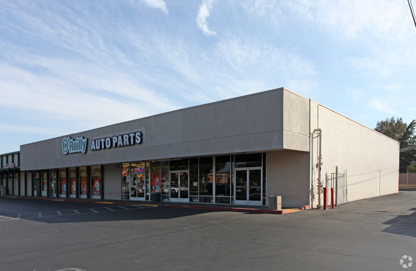
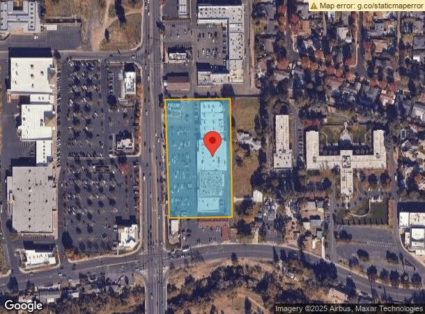
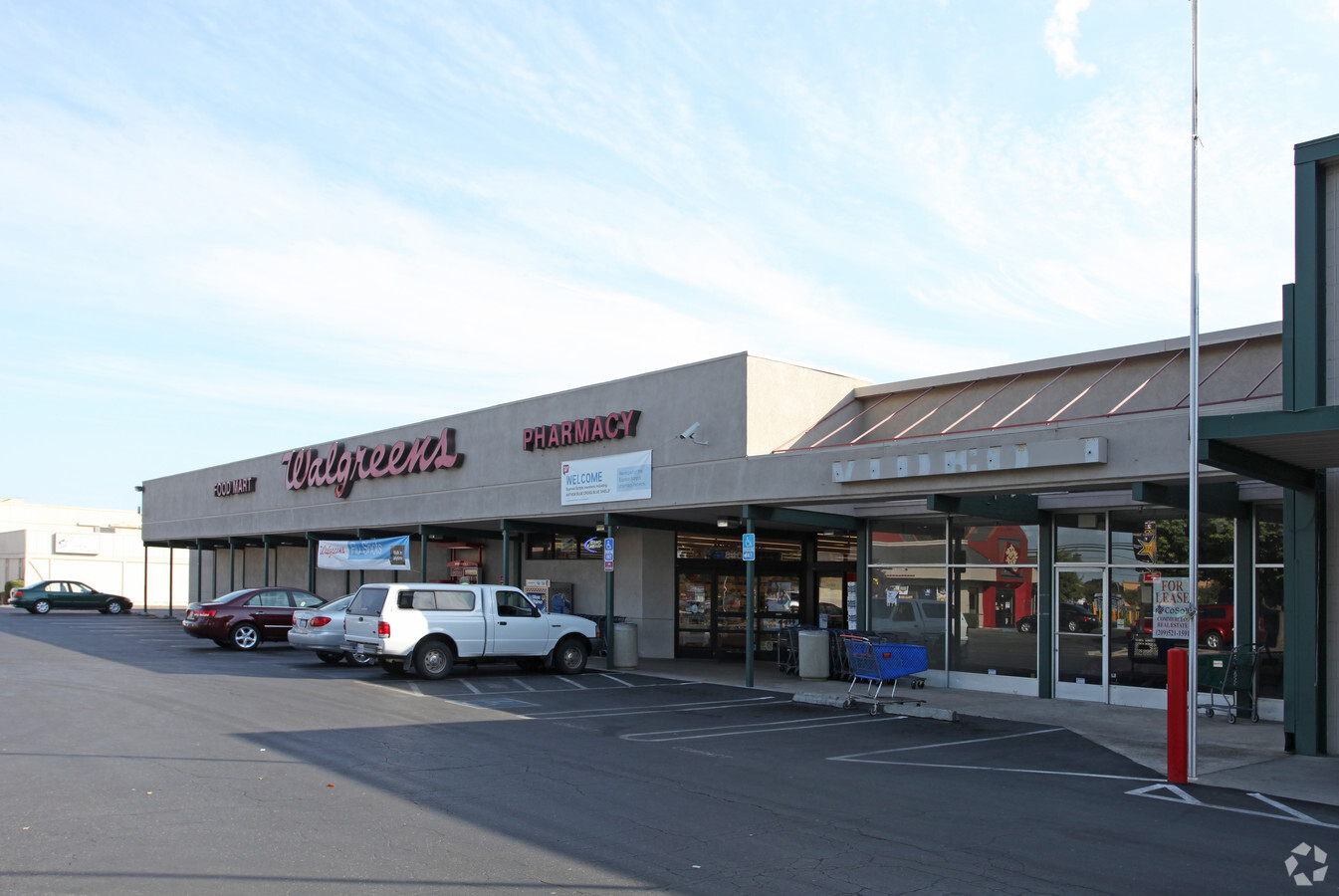
Property Record
832 Oakdale Rd, Modesto, CA 95355
NEARBY LISTINGS FOR SALE OR LEASE
Property Detail
832 Oakdale Rd
067-25-03
EQUIPMENT & SUPPLIES DD
Regionalshoppingcenterormallwithanchorstore
Stanislaus
X
California
06099C0339F
3.48 AC
2024
Modesto
2024
Stockton/Modesto
000905
Modesto, CA
51,911 SF
DEMOGRAPHICS near 832 Oakdale Rd
1 Mile
3 Mile
5 Mile
2024 Total Population
17,244
134,685
293,084
2029 Population
17,213
134,863
293,311
Pop Growth 2024-2029
(0.18%)
+ 0.13%
+ 0.08%
Average Age
40
38
37
2024 Total Households
6,445
46,816
93,867
HH Growth 2024-2029
(0.25%)
+ 0.10%
+ 0.07%
Median Household Inc
$69,823
$75,198
$71,129
Avg Household Size
2.60
2.80
3.00
2024 Avg HH Vehicles
2.00
2.00
2.00
Median Home Value
$384,693
$402,548
$383,594
Median Year Built
1973
1976
1977
Nearby Places
- Restaurants
- Banks
- Shops
- Fitness
- Groceries
PUBLIC TRANSPORTATION
COMMUTER RAIL
Modesto (San Joaquins - Amtrak)
DRIVE
WALK
Distance
Modesto (San Joaquins - Amtrak)
7 min
3.3 mi
AIRPORT
Stockton Metro
DRIVE
WALK
Distance
Stockton Metro
37 min
27.3 mi
Freight Ports
Port of Stockton
DRIVE
WALK
Distance
Port of Stockton
46 min
35.7 mi
Nearby Properties
Address
Land Use
TOTAL SIZE
Lot Size
Zoning
Address
Land Use
TOTAL SIZE
Lot Size
Zoning
322,629 SF
71.35 AC
Address
Land Use
TOTAL SIZE
Lot Size
Zoning
817,526 SF
17.31 AC
Address
Land Use
TOTAL SIZE
Lot Size
Zoning
766,000 SF
22.69 AC
MODPD
Address
Land Use
TOTAL SIZE
Lot Size
Zoning
373,574 SF
23 AC
Address
Land Use
TOTAL SIZE
Lot Size
Zoning
450,277 SF
15.29 AC
Address
Land Use
TOTAL SIZE
Lot Size
Zoning
448,549 SF
58.48 AC
Address
Land Use
TOTAL SIZE
Lot Size
Zoning
153,937 SF
7.87 AC
Address
Land Use
TOTAL SIZE
Lot Size
Zoning
151,288 SF
6.50 AC
Address
Land Use
TOTAL SIZE
Lot Size
Zoning
138,618 SF
3.99 AC
Address
Land Use
TOTAL SIZE
Lot Size
Zoning
50,688 SF
2.60 AC
Address
Land Use
TOTAL SIZE
Lot Size
Zoning
854,100 SF
67.24 AC
MI
Address
Land Use
TOTAL SIZE
Lot Size
Zoning
154,264 SF
7.63 AC
Address
Land Use
TOTAL SIZE
Lot Size
Zoning
230,282 SF
9.40 AC
MODSP
Address
Land Use
TOTAL SIZE
Lot Size
Zoning
266,975 SF
1.90 AC
Address
Land Use
TOTAL SIZE
Lot Size
Zoning
182,100 SF
21 AC
Address
Land Use
TOTAL SIZE
Lot Size
Zoning
131,958 SF
8.11 AC
Address
Land Use
TOTAL SIZE
Lot Size
Zoning
775,280 SF
30.42 AC
COUM
Address
Land Use
TOTAL SIZE
Lot Size
Zoning
327,227 SF
13.52 AC
Address
Land Use
TOTAL SIZE
Lot Size
Zoning
224,972 SF
10.04 AC
R3
Address
Land Use
TOTAL SIZE
Lot Size
Zoning
65,294 SF
4.20 AC
Address
Land Use
TOTAL SIZE
Lot Size
Zoning
120,383 SF
5.52 AC
MODCM
Address
Land Use
TOTAL SIZE
Lot Size
Zoning
476,580 SF
44.60 AC
Address
Land Use
TOTAL SIZE
Lot Size
Zoning
79,084 SF
5.32 AC
Address
Land Use
TOTAL SIZE
Lot Size
Zoning
280,223 SF
23.52 AC
MOD C-2
Address
Land Use
TOTAL SIZE
Lot Size
Zoning
120,160 SF
6 AC
PD
Address
Land Use
TOTAL SIZE
Lot Size
Zoning
164,740 SF
9.35 AC
Address
Land Use
TOTAL SIZE
Lot Size
Zoning
16,000 SF
16.14 AC
Address
Land Use
TOTAL SIZE
Lot Size
Zoning
102,200 SF
9.85 AC
Address
Land Use
TOTAL SIZE
Lot Size
Zoning
231,424 SF
14.65 AC
Address
Land Use
TOTAL SIZE
Lot Size
Zoning
94,140 SF
6.04 AC
The World's #1 Commercial Real Estate Marketplace
Connect with us
© 2025 CoStar Group
The information above has been obtained from sources believed reliable. While we do not doubt its accuracy we have not verified it and make no guarantee, warranty or representation about it. It is your responsibility to independently confirm its accuracy and completeness. Any projections, opinions, assumptions, or estimates used are for example only and do not represent the current or future performance of the property. The value of this transaction to you depends on tax and other factors which should be evaluated by your tax, financial, and legal advisors. You and your advisors should conduct a careful, independent investigation of the property to determine to your satisfaction the suitability of the property for your needs.