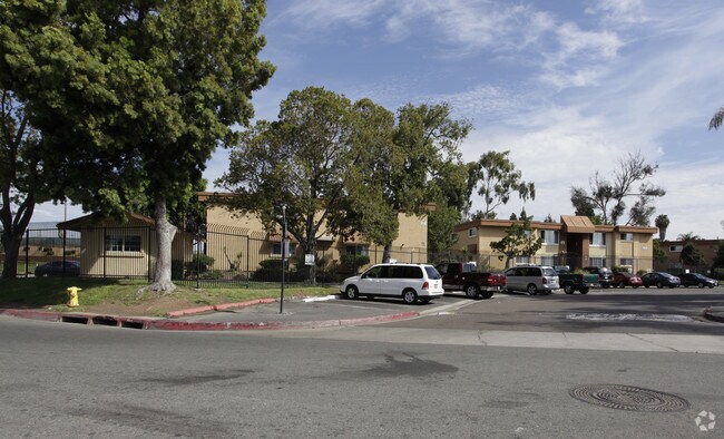
Property Record
817 Eta St, National City, CA 91950


NEARBY LISTINGS FOR SALE OR LEASE
Property Detail
817 Eta St
San Diego-Carlsbad, CA
Hortons Purchase
551-480-26
PAR 1 TR PM21936
Multifamilydwelling
San Diego
AO
California
06073C1903H
69
2024
12.19 AC
2025
National City
011700
San Diego
99,999 SF
DEMOGRAPHICS near 817 Eta St
1 Mile
3 Mile
5 Mile
2024 Total Population
39,063
205,741
550,051
2029 Population
38,757
203,853
546,830
Pop Growth 2024-2029
(0.78%)
(0.92%)
(0.59%)
Average Age
35
36
38
2024 Total Households
10,740
59,473
193,947
HH Growth 2024-2029
(0.89%)
(1.09%)
(0.50%)
Median Household Inc
$53,598
$61,544
$70,172
Avg Household Size
3.50
3.20
2.60
2024 Avg HH Vehicles
2.00
2.00
2.00
Median Home Value
$451,249
$542,039
$659,121
Median Year Built
1969
1966
1972
Nearby Places
Map Layers
Map Styles
 Street
 Aerial
- Restaurants
- Banks
- Shops
- Fitness
- Groceries
PUBLIC TRANSPORTATION
COMMUTER RAIL
San Diego (Santa Fe Depot) (Coaster - San Diego North County Transit District (Coaster/Sprinter/Breeze))
DRIVE
WALK
Distance
San Diego (Santa Fe Depot) (Coaster - San Diego North County Transit District (Coaster/Sprinter/Breeze))
10 min
5.8 mi
Old Town Transit Center (Coaster - San Diego North County Transit District (Coaster/Sprinter/Breeze))
DRIVE
WALK
Distance
Old Town Transit Center (Coaster - San Diego North County Transit District (Coaster/Sprinter/Breeze))
12 min
9.0 mi
AIRPORT
San Diego International
DRIVE
WALK
Distance
San Diego International
13 min
8.4 mi
Freight Ports
Port of San Diego
DRIVE
WALK
Distance
Port of San Diego
8 min
4.3 mi
Nearby Properties
Address
Land Use
TOTAL SIZE
Lot Size
Zoning
Address
Land Use
TOTAL SIZE
Lot Size
Zoning
125.69 AC
M
Address
Land Use
TOTAL SIZE
Lot Size
Zoning
6.55 AC
MXD-2
Address
Land Use
TOTAL SIZE
Lot Size
Zoning
15.72 AC
RM-2-5
Address
Land Use
TOTAL SIZE
Lot Size
Zoning
115.70 AC
Marine Ter
Address
Land Use
TOTAL SIZE
Lot Size
Zoning
8.99 AC
IL-2-1
Address
Land Use
TOTAL SIZE
Lot Size
Zoning
10.92 AC
RM-2-5
Address
Land Use
TOTAL SIZE
Lot Size
Zoning
9.62 AC
MXD-2
Address
Land Use
TOTAL SIZE
Lot Size
Zoning
10.43 AC
RM-2
Address
Land Use
TOTAL SIZE
Lot Size
Zoning
9.84 AC
C
Address
Land Use
TOTAL SIZE
Lot Size
Zoning
24.06 AC
R3
Address
Land Use
TOTAL SIZE
Lot Size
Zoning
7.52 AC
MCR-2
Address
Land Use
TOTAL SIZE
Lot Size
Zoning
6.85 AC
IL
Address
Land Use
TOTAL SIZE
Lot Size
Zoning
6.07 AC
MXD-1
Address
Land Use
TOTAL SIZE
Lot Size
Zoning
Address
Land Use
TOTAL SIZE
Lot Size
Zoning
4.12 AC
RM-2-5
Address
Land Use
TOTAL SIZE
Lot Size
Zoning
0.68 AC
MXU
Address
Land Use
TOTAL SIZE
Lot Size
Zoning
3,274 SF
8.58 AC
RM-2-5
Address
Land Use
TOTAL SIZE
Lot Size
Zoning
86,920 SF
2.38 AC
RM-2
Address
Land Use
TOTAL SIZE
Lot Size
Zoning
0.89 AC
MXU
Address
Land Use
TOTAL SIZE
Lot Size
Zoning
4.42 AC
MM
Address
Land Use
TOTAL SIZE
Lot Size
Zoning
13.87 AC
MXD-2
Address
Land Use
TOTAL SIZE
Lot Size
Zoning
26.39 AC
M
Address
Land Use
TOTAL SIZE
Lot Size
Zoning
76,798 SF
7.21 AC
I
Address
Land Use
TOTAL SIZE
Lot Size
Zoning
9,764 SF
20.67 AC
Marine Ter
Address
Land Use
TOTAL SIZE
Lot Size
Zoning
Address
Land Use
TOTAL SIZE
Lot Size
Zoning
79,463 SF
1.03 AC
MXC-2
Address
Land Use
TOTAL SIZE
Lot Size
Zoning
71,647 SF
4.07 AC
BLPD-REDEV
Address
Land Use
TOTAL SIZE
Lot Size
Zoning
14.62 AC
MXD-2
Address
Land Use
TOTAL SIZE
Lot Size
Zoning
6.53 AC
IL-3-1
The World's #1 Commercial Real Estate Marketplace
Connect with us
© 2025 CoStar Group
The information above has been obtained from sources believed reliable. While we do not doubt its accuracy we have not verified it and make no guarantee, warranty or representation about it. It is your responsibility to independently confirm its accuracy and completeness. Any projections, opinions, assumptions, or estimates used are for example only and do not represent the current or future performance of the property. The value of this transaction to you depends on tax and other factors which should be evaluated by your tax, financial, and legal advisors. You and your advisors should conduct a careful, independent investigation of the property to determine to your satisfaction the suitability of the property for your needs.