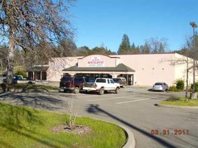
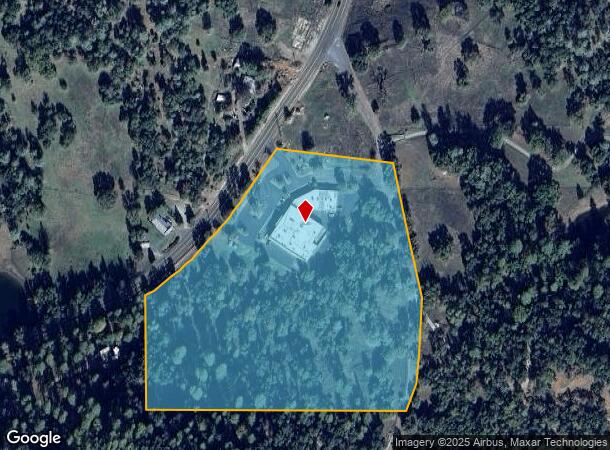
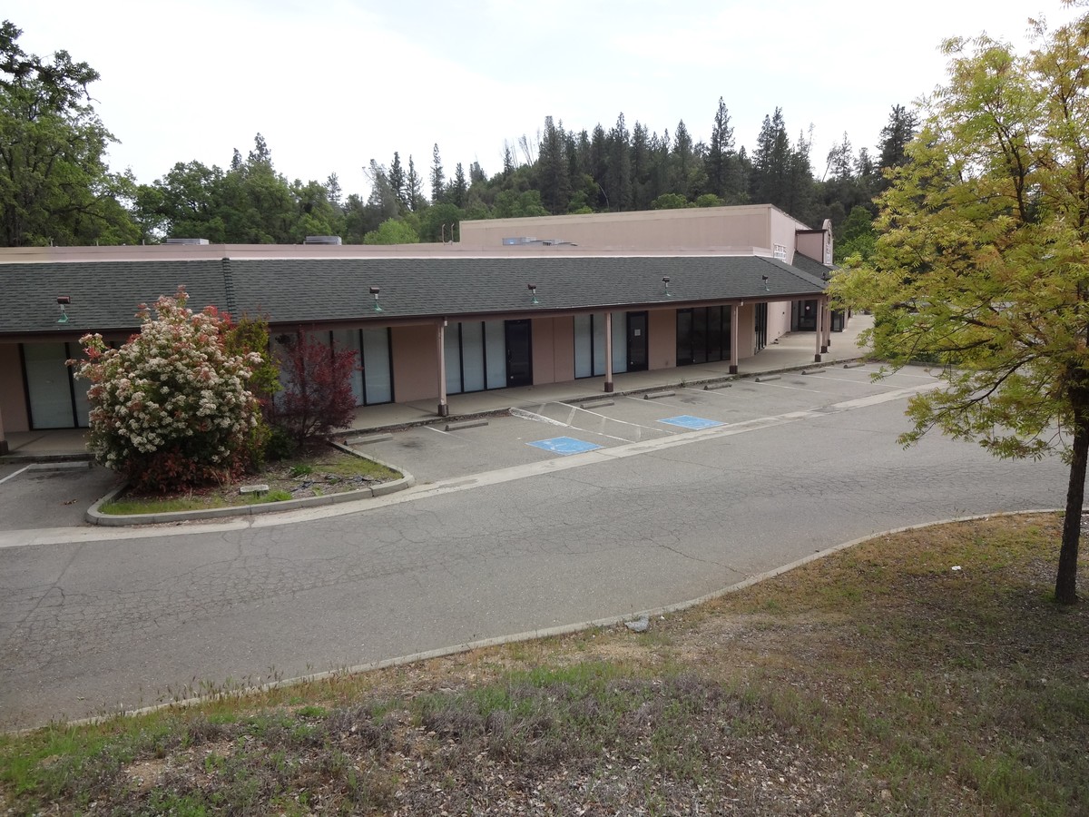
Property Record
8171 Mount Aukum Rd, Mount Aukum, CA 95656
NEARBY LISTINGS FOR SALE OR LEASE
-
-
View all Mount Aukum listings for lease on LoopNet.com
Property Detail
8171 Mount Aukum Rd
046-180-035-000
SEC 11 8 11
Storebuilding
El Dorado
X
California
06005C0150F
14.85 AC
2023
Outer El Dorado Cnty
2024
Sacramento
031409
Sacramento--Roseville--Arden-Arcade, CA
23,536 SF
DEMOGRAPHICS near 8171 Mount Aukum Rd
1 Mile
3 Mile
5 Mile
2024 Total Population
29
761
2,948
2029 Population
28
741
2,942
Pop Growth 2024-2029
(3.45%)
(2.63%)
(0.20%)
Average Age
51
50
50
2024 Total Households
12
323
1,262
HH Growth 2024-2029
0.00%
(2.48%)
+ 0.08%
Median Household Inc
$49,999
$70,499
$71,412
Avg Household Size
2.00
2.20
2.30
2024 Avg HH Vehicles
2.00
2.00
3.00
Median Home Value
$499,999
$554,598
$521,303
Median Year Built
1979
1982
1983
Nearby Places
- Restaurants
- Banks
- Shops
- Fitness
- Groceries
SALE & LEASE HISTORY
LISTING DATE
SALE/LEASE

Sep 25, 2016
For Lease
Dec 20, 2017
For Lease
Aug 01, 2020
For Lease
Nearby Properties
Address
Land Use
TOTAL SIZE
Lot Size
Zoning
Address
Land Use
TOTAL SIZE
Lot Size
Zoning
1,866 SF
29.93 AC
R1A
Address
Land Use
TOTAL SIZE
Lot Size
Zoning
848 SF
80 AC
A
Address
Land Use
TOTAL SIZE
Lot Size
Zoning
2,138 SF
113.03 AC
A
Address
Land Use
TOTAL SIZE
Lot Size
Zoning
129.12 AC
AE
Address
Land Use
TOTAL SIZE
Lot Size
Zoning
162.53 AC
R1A
Address
Land Use
TOTAL SIZE
Lot Size
Zoning
5,538 SF
46.53 AC
AP
Address
Land Use
TOTAL SIZE
Lot Size
Zoning
29.01 AC
R1A
Address
Land Use
TOTAL SIZE
Lot Size
Zoning
3,886 SF
53.79 AC
AG
Address
Land Use
TOTAL SIZE
Lot Size
Zoning
2,984 SF
20.79 AC
AE
Address
Land Use
TOTAL SIZE
Lot Size
Zoning
5,461 SF
120 AC
AG
Address
Land Use
TOTAL SIZE
Lot Size
Zoning
2,307 SF
36.06 AC
R1A
Address
Land Use
TOTAL SIZE
Lot Size
Zoning
4,860 SF
1.65 AC
C
Address
Land Use
TOTAL SIZE
Lot Size
Zoning
2,820 SF
77 AC
R1A
Address
Land Use
TOTAL SIZE
Lot Size
Zoning
2,563 SF
55.64 AC
PA
Address
Land Use
TOTAL SIZE
Lot Size
Zoning
6,760 SF
80.40 AC
AE
Address
Land Use
TOTAL SIZE
Lot Size
Zoning
2,666 SF
20.70 AC
RA20
Address
Land Use
TOTAL SIZE
Lot Size
Zoning
2,044 SF
55.70 AC
AG
Address
Land Use
TOTAL SIZE
Lot Size
Zoning
1,276 SF
160.94 AC
AG
Address
Land Use
TOTAL SIZE
Lot Size
Zoning
54.84 AC
PA20
Address
Land Use
TOTAL SIZE
Lot Size
Zoning
36.81 AC
SA10
Address
Land Use
TOTAL SIZE
Lot Size
Zoning
1,910 SF
507.56 AC
R1A
Address
Land Use
TOTAL SIZE
Lot Size
Zoning
2,704 SF
10 AC
U
Address
Land Use
TOTAL SIZE
Lot Size
Zoning
4,638 SF
2.77 AC
RE5
Address
Land Use
TOTAL SIZE
Lot Size
Zoning
1,071 SF
54 AC
R1A
Address
Land Use
TOTAL SIZE
Lot Size
Zoning
138 AC
AG
Address
Land Use
TOTAL SIZE
Lot Size
Zoning
1,961 SF
50.22 AC
AG
Address
Land Use
TOTAL SIZE
Lot Size
Zoning
1,600 SF
4.94 AC
R1A
Address
Land Use
TOTAL SIZE
Lot Size
Zoning
2,340 SF
10.38 AC
AE
Address
Land Use
TOTAL SIZE
Lot Size
Zoning
1,600 SF
55 AC
R1A
The World's #1 Commercial Real Estate Marketplace
Connect with us
© 2025 CoStar Group
The information above has been obtained from sources believed reliable. While we do not doubt its accuracy we have not verified it and make no guarantee, warranty or representation about it. It is your responsibility to independently confirm its accuracy and completeness. Any projections, opinions, assumptions, or estimates used are for example only and do not represent the current or future performance of the property. The value of this transaction to you depends on tax and other factors which should be evaluated by your tax, financial, and legal advisors. You and your advisors should conduct a careful, independent investigation of the property to determine to your satisfaction the suitability of the property for your needs.