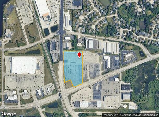
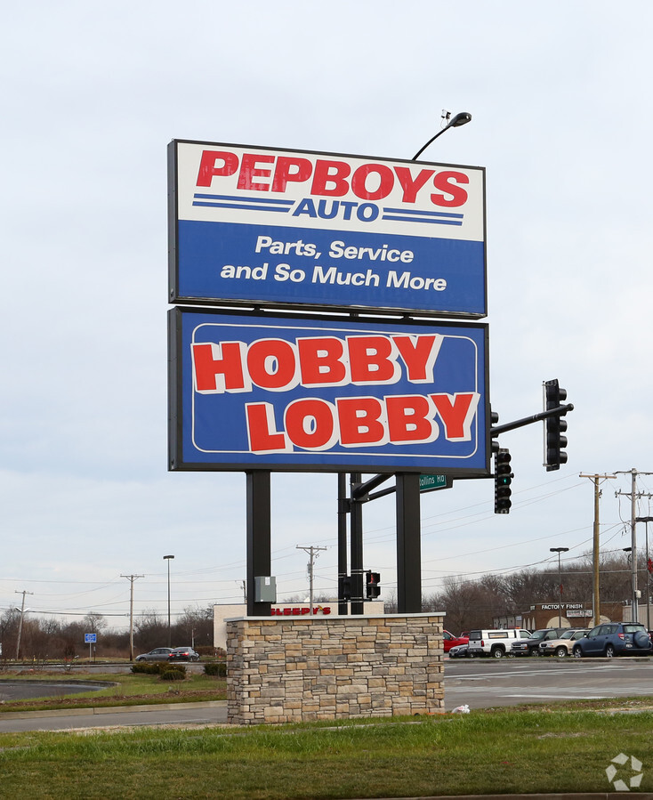
Property Record
818 E Rollins Rd, Round Lake Beach, IL 60073
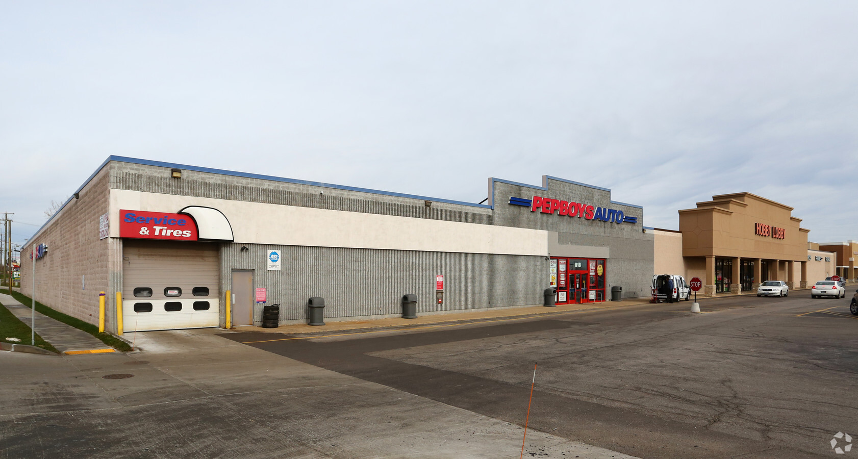
This Property Is For Sale
NEARBY LISTINGS FOR SALE OR LEASE
Property Detail
818 E Rollins Rd
Chicago-Naperville-Elgin, IL-IN-WI
Pt Sw
06-15-100-063
PT SW NW 15-45-10 BEG AT A PNT ON N ROW CH31 1113.52 SWLY F R E LN SW NW, N AT RA 200, SE AT RA 167.68 TO ELY LN RTE 8 3, NW ALG ROW LN 150.68TO PNT OF ANG, N550.69, E436.33, S
Commercialbuilding
Lake
X
Illinois
17097C0043L
2
2022
6.89 AC
2023
Central Northwest
861202
Chicago
86,920 SF
DEMOGRAPHICS near 818 E Rollins Rd
1 Mile
3 Mile
5 Mile
2024 Total Population
8,871
73,158
143,739
2029 Population
8,715
72,001
141,713
Pop Growth 2024-2029
(1.76%)
(1.58%)
(1.41%)
Average Age
38
38
39
2024 Total Households
2,837
24,650
50,461
HH Growth 2024-2029
(1.90%)
(1.70%)
(1.49%)
Median Household Inc
$101,384
$91,278
$96,270
Avg Household Size
3.10
2.90
2.80
2024 Avg HH Vehicles
2.00
2.00
2.00
Median Home Value
$197,129
$202,364
$234,839
Median Year Built
1991
1987
1990
Nearby Places
- Restaurants
- Banks
- Shops
- Fitness
- Groceries
PUBLIC TRANSPORTATION
COMMUTER RAIL
Round Lake Beach Station (North Central Service - Northeast Illinois Regional Commuter Railroad (Metra))
DRIVE
WALK
Distance
Round Lake Beach Station (North Central Service - Northeast Illinois Regional Commuter Railroad (Metra))
2 min
9 min
0.5 mi
Washington St (Grayslake) Station (Ncs) (North Central Service - Northeast Illinois Regional Commuter Railroad (Metra))
DRIVE
WALK
Distance
Washington St (Grayslake) Station (Ncs) (North Central Service - Northeast Illinois Regional Commuter Railroad (Metra))
6 min
2.7 mi
AIRPORT
Chicago O'Hare International
DRIVE
WALK
Distance
Chicago O'Hare International
50 min
38.1 mi
Freight Ports
Port Milwaukee
DRIVE
WALK
Distance
Port Milwaukee
64 min
52.1 mi
Nearby Properties
Address
Land Use
TOTAL SIZE
Lot Size
Zoning
Address
Land Use
TOTAL SIZE
Lot Size
Zoning
1,656,984 SF
11.84 AC
Address
Land Use
TOTAL SIZE
Lot Size
Zoning
5,303,058 SF
26.82 AC
Address
Land Use
TOTAL SIZE
Lot Size
Zoning
194,075 SF
14.84 AC
Address
Land Use
TOTAL SIZE
Lot Size
Zoning
83.45 AC
Address
Land Use
TOTAL SIZE
Lot Size
Zoning
2,415,756 SF
12.61 AC
Address
Land Use
TOTAL SIZE
Lot Size
Zoning
1,407,234 SF
12.09 AC
Address
Land Use
TOTAL SIZE
Lot Size
Zoning
190,034 SF
22.32 AC
Address
Land Use
TOTAL SIZE
Lot Size
Zoning
854,280 SF
18.40 AC
Address
Land Use
TOTAL SIZE
Lot Size
Zoning
Address
Land Use
TOTAL SIZE
Lot Size
Zoning
129,483 SF
15.64 AC
Address
Land Use
TOTAL SIZE
Lot Size
Zoning
46,068 SF
0.65 AC
Address
Land Use
TOTAL SIZE
Lot Size
Zoning
17,484 SF
3.52 AC
Address
Land Use
TOTAL SIZE
Lot Size
Zoning
115,805 SF
4.38 AC
Address
Land Use
TOTAL SIZE
Lot Size
Zoning
50,540 SF
1.54 AC
Address
Land Use
TOTAL SIZE
Lot Size
Zoning
104,143 SF
11.96 AC
Address
Land Use
TOTAL SIZE
Lot Size
Zoning
41,925 SF
5.15 AC
Address
Land Use
TOTAL SIZE
Lot Size
Zoning
188,183 SF
17.16 AC
Address
Land Use
TOTAL SIZE
Lot Size
Zoning
62,821 SF
6.79 AC
Address
Land Use
TOTAL SIZE
Lot Size
Zoning
87,233 SF
7.72 AC
Address
Land Use
TOTAL SIZE
Lot Size
Zoning
43,777 SF
5.49 AC
Address
Land Use
TOTAL SIZE
Lot Size
Zoning
57,398 SF
5.23 AC
Address
Land Use
TOTAL SIZE
Lot Size
Zoning
112,675 SF
4.84 AC
Address
Land Use
TOTAL SIZE
Lot Size
Zoning
58,442 SF
3.70 AC
Address
Land Use
TOTAL SIZE
Lot Size
Zoning
62,388 SF
8.05 AC
Address
Land Use
TOTAL SIZE
Lot Size
Zoning
291,820 SF
4.27 AC
Address
Land Use
TOTAL SIZE
Lot Size
Zoning
29,707 SF
7.12 AC
Address
Land Use
TOTAL SIZE
Lot Size
Zoning
21.62 AC
Address
Land Use
TOTAL SIZE
Lot Size
Zoning
3.53 AC
Address
Land Use
TOTAL SIZE
Lot Size
Zoning
75,672 SF
7.18 AC
The World's #1 Commercial Real Estate Marketplace
Connect with us
© 2025 CoStar Group
The information above has been obtained from sources believed reliable. While we do not doubt its accuracy we have not verified it and make no guarantee, warranty or representation about it. It is your responsibility to independently confirm its accuracy and completeness. Any projections, opinions, assumptions, or estimates used are for example only and do not represent the current or future performance of the property. The value of this transaction to you depends on tax and other factors which should be evaluated by your tax, financial, and legal advisors. You and your advisors should conduct a careful, independent investigation of the property to determine to your satisfaction the suitability of the property for your needs.