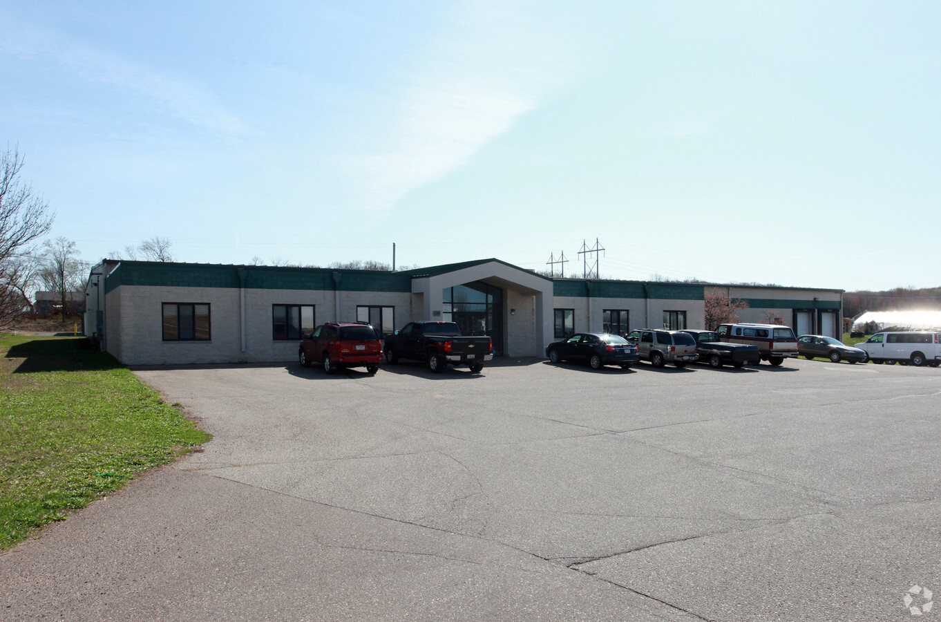
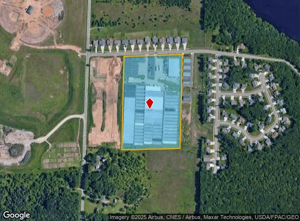
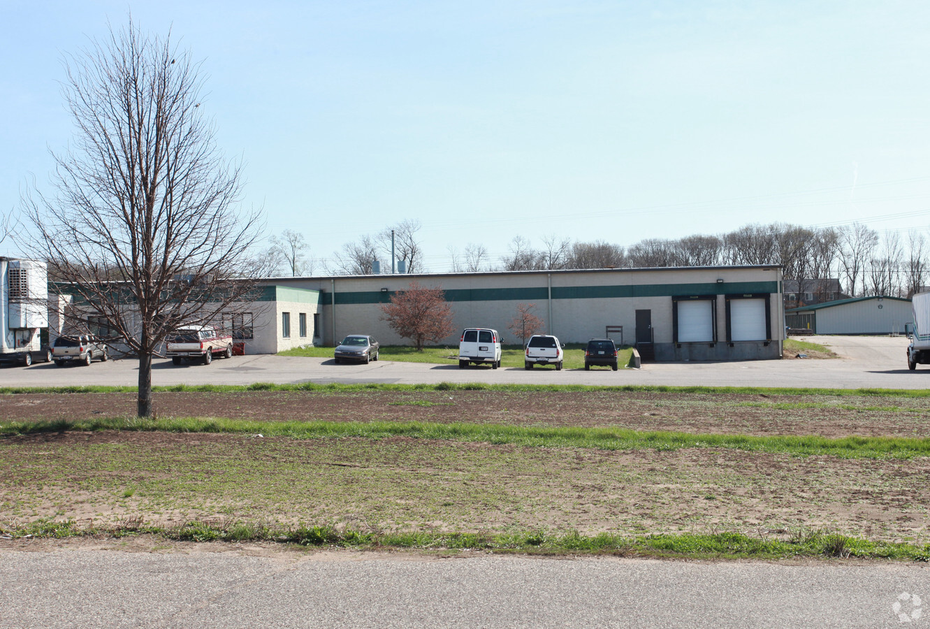
Property Record
819 W Shorewood Dr, Eau Claire, WI 54703
NEARBY LISTINGS FOR SALE OR LEASE
Property Detail
819 W Shorewood Dr
Warehouse
PRT OF THE SE-NW SEC 6-27-9 DESC AS FOLL COMM AT THE NE COR OF SD SE-NW THC S 90 DEG W ALG N LN OF SD SE-NW 246.39 FT TO POB
X
Eau Claire
55017C0707E
Wisconsin
2023
16.02 AC
2023
Other Market Areas
001500
Eau Claire, WI
9,220 SF
14-0748-B
DEMOGRAPHICS near 819 W Shorewood Dr
1 Mile
3 Mile
5 Mile
2024 Total Population
2,795
26,788
67,916
2029 Population
2,940
27,863
70,499
Pop Growth 2024-2029
+ 5.19%
+ 4.01%
+ 3.80%
Average Age
41
39
38
2024 Total Households
1,158
11,274
27,703
HH Growth 2024-2029
+ 5.18%
+ 4.04%
+ 3.89%
Median Household Inc
$73,802
$63,927
$60,796
Avg Household Size
2.40
2.30
2.30
2024 Avg HH Vehicles
2.00
2.00
2.00
Median Home Value
$269,767
$206,822
$212,878
Median Year Built
2001
1972
1971
Nearby Places
- Restaurants
- Banks
- Shops
- Fitness
- Groceries
Nearby Properties
Address
Land Use
TOTAL SIZE
Lot Size
Zoning
Address
Land Use
TOTAL SIZE
Lot Size
Zoning
203,723 SF
20.28 AC
CBDP
Address
Land Use
TOTAL SIZE
Lot Size
Zoning
33.32 AC
I1
Address
Land Use
TOTAL SIZE
Lot Size
Zoning
206,042 SF
5.59 AC
Address
Land Use
TOTAL SIZE
Lot Size
Zoning
40.76 AC
I1P
Address
Land Use
TOTAL SIZE
Lot Size
Zoning
21.83 AC
I1
Address
Land Use
TOTAL SIZE
Lot Size
Zoning
1.04 AC
P
Address
Land Use
TOTAL SIZE
Lot Size
Zoning
105,434 SF
1.55 AC
CBD
Address
Land Use
TOTAL SIZE
Lot Size
Zoning
65,378 SF
1.83 AC
CBDP
Address
Land Use
TOTAL SIZE
Lot Size
Zoning
68,024 SF
0.80 AC
CBD
Address
Land Use
TOTAL SIZE
Lot Size
Zoning
169,740 SF
19.59 AC
C3P
Address
Land Use
TOTAL SIZE
Lot Size
Zoning
163,428 SF
30.30 AC
I1P
Address
Land Use
TOTAL SIZE
Lot Size
Zoning
36.58 AC
I1
Address
Land Use
TOTAL SIZE
Lot Size
Zoning
66,497 SF
0.81 AC
CBDP
Address
Land Use
TOTAL SIZE
Lot Size
Zoning
7,084 SF
26.73 AC
I2P
Address
Land Use
TOTAL SIZE
Lot Size
Zoning
10.68 AC
I1P
Address
Land Use
TOTAL SIZE
Lot Size
Zoning
207,960 SF
9.22 AC
I1P
Address
Land Use
TOTAL SIZE
Lot Size
Zoning
38,808 SF
11.65 AC
I1P
Address
Land Use
TOTAL SIZE
Lot Size
Zoning
103,890 SF
6.30 AC
R4P
Address
Land Use
TOTAL SIZE
Lot Size
Zoning
14.28 AC
I1P
Address
Land Use
TOTAL SIZE
Lot Size
Zoning
70,965 SF
0.78 AC
CBD
Address
Land Use
TOTAL SIZE
Lot Size
Zoning
73,414 SF
2.46 AC
C3P
Address
Land Use
TOTAL SIZE
Lot Size
Zoning
42.25 AC
I1
Address
Land Use
TOTAL SIZE
Lot Size
Zoning
69,320 SF
5.98 AC
I1P
Address
Land Use
TOTAL SIZE
Lot Size
Zoning
39.51 AC
I1
Address
Land Use
TOTAL SIZE
Lot Size
Zoning
187,686 SF
68.56 AC
I1P
Address
Land Use
TOTAL SIZE
Lot Size
Zoning
25.27 AC
I2
Address
Land Use
TOTAL SIZE
Lot Size
Zoning
64,850 SF
8.01 AC
I1P
Address
Land Use
TOTAL SIZE
Lot Size
Zoning
60.40 AC
Address
Land Use
TOTAL SIZE
Lot Size
Zoning
54,420 SF
2.30 AC
CBDP
Address
Land Use
TOTAL SIZE
Lot Size
Zoning
100,800 SF
10.25 AC
I1P
The World's #1 Commercial Real Estate Marketplace
Connect with us
© 2025 CoStar Group
The information above has been obtained from sources believed reliable. While we do not doubt its accuracy we have not verified it and make no guarantee, warranty or representation about it. It is your responsibility to independently confirm its accuracy and completeness. Any projections, opinions, assumptions, or estimates used are for example only and do not represent the current or future performance of the property. The value of this transaction to you depends on tax and other factors which should be evaluated by your tax, financial, and legal advisors. You and your advisors should conduct a careful, independent investigation of the property to determine to your satisfaction the suitability of the property for your needs.