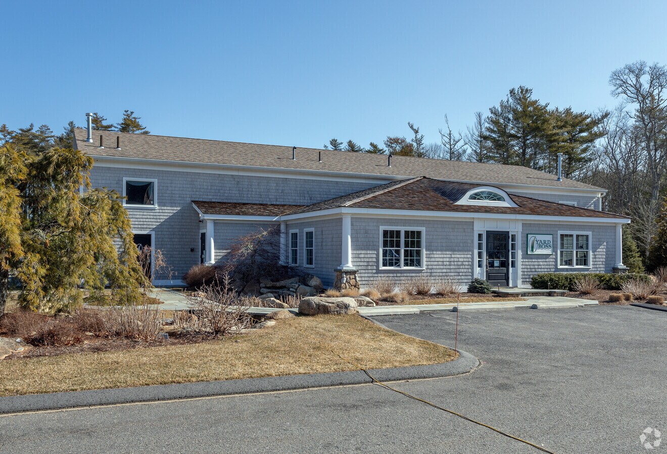
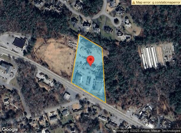
Property Record
81B County Rd, Mattapoisett, MA 02739
NEARBY LISTINGS FOR SALE OR LEASE
-
-
View all Mattapoisett listings for lease on LoopNet.com
Property Detail
81B County Rd
MATT-000080-000000-000310
Plymouth
Commercialofficeresidentialmixeduse
Massachusetts
X
31.0
25023C0566K
3.41 AC
2024
Route 3 South
2024
Boston
560100
Boston-Cambridge-Newton, MA-NH
4,648 SF
DEMOGRAPHICS near 81B County Rd
1 Mile
3 Mile
5 Mile
2024 Total Population
2,391
8,714
21,286
2029 Population
2,424
8,968
21,702
Pop Growth 2024-2029
+ 1.38%
+ 2.91%
+ 1.95%
Average Age
50
48
47
2024 Total Households
1,085
3,688
8,756
HH Growth 2024-2029
+ 1.20%
+ 2.85%
+ 2.00%
Median Household Inc
$93,467
$112,677
$104,124
Avg Household Size
2.20
2.30
2.40
2024 Avg HH Vehicles
2.00
2.00
2.00
Median Home Value
$622,396
$651,662
$539,193
Median Year Built
1963
1976
1970
Nearby Places
- Restaurants
- Banks
- Shops
- Fitness
- Groceries
PUBLIC TRANSPORTATION
COMMUTER RAIL
Wareham Village (CapeFLYER - Cape Cod Regional Transit Authority)
Drive
Walk
Distance
Wareham Village (CapeFLYER - Cape Cod Regional Transit Authority)
15 min
9.4 mi
Freight Ports
Port of New Bedford Harbor
Drive
Walk
Distance
Port of New Bedford Harbor
13 min
7.9 mi
SALE & LEASE HISTORY
LISTING DATE
SALE/LEASE

Sep 27, 2021
For Lease
Mar 22, 2018
For Lease
Nearby Properties
Address
Land Use
TOTAL SIZE
Lot Size
Zoning
Address
Land Use
TOTAL SIZE
Lot Size
Zoning
93.69 AC
RR3
Address
Land Use
TOTAL SIZE
Lot Size
Zoning
75,674 SF
7.62 AC
VR1
Address
Land Use
TOTAL SIZE
Lot Size
Zoning
73,520 SF
18.44 AC
R45
Address
Land Use
TOTAL SIZE
Lot Size
Zoning
288 SF
22.53 AC
RR8
Address
Land Use
TOTAL SIZE
Lot Size
Zoning
1,280 SF
11.12 AC
Address
Land Use
TOTAL SIZE
Lot Size
Zoning
8,498 SF
8.28 AC
Address
Land Use
TOTAL SIZE
Lot Size
Zoning
7,822 SF
2.76 AC
Address
Land Use
TOTAL SIZE
Lot Size
Zoning
6,670 SF
12.30 AC
GB
Address
Land Use
TOTAL SIZE
Lot Size
Zoning
114,900 SF
10.67 AC
LI
Address
Land Use
TOTAL SIZE
Lot Size
Zoning
6.11 AC
R30
Address
Land Use
TOTAL SIZE
Lot Size
Zoning
11,064 SF
0.72 AC
VR1
Address
Land Use
TOTAL SIZE
Lot Size
Zoning
207 AC
W30
Address
Land Use
TOTAL SIZE
Lot Size
Zoning
4.50 AC
MR3
Address
Land Use
TOTAL SIZE
Lot Size
Zoning
3 AC
1737
Address
Land Use
TOTAL SIZE
Lot Size
Zoning
41,750 SF
4.01 AC
LI
Address
Land Use
TOTAL SIZE
Lot Size
Zoning
24.40 AC
RR3
Address
Land Use
TOTAL SIZE
Lot Size
Zoning
1.50 AC
VR1
Address
Land Use
TOTAL SIZE
Lot Size
Zoning
3.66 AC
R30
Address
Land Use
TOTAL SIZE
Lot Size
Zoning
1,362 SF
1.92 AC
R30
Address
Land Use
TOTAL SIZE
Lot Size
Zoning
199 AC
RR8
Address
Land Use
TOTAL SIZE
Lot Size
Zoning
5.33 AC
LI
Address
Land Use
TOTAL SIZE
Lot Size
Zoning
401.90 AC
RR4
Address
Land Use
TOTAL SIZE
Lot Size
Zoning
5.42 AC
VR1
Address
Land Use
TOTAL SIZE
Lot Size
Zoning
6.31 AC
LI
Address
Land Use
TOTAL SIZE
Lot Size
Zoning
2,346 SF
34.55 AC
R45
Address
Land Use
TOTAL SIZE
Lot Size
Zoning
405 SF
6.08 AC
Address
Land Use
TOTAL SIZE
Lot Size
Zoning
12,096 SF
1.57 AC
VR1
Address
Land Use
TOTAL SIZE
Lot Size
Zoning
1.17 AC
MR3
Address
Land Use
TOTAL SIZE
Lot Size
Zoning
1.15 AC
MR3
Start a new search to find other properties for sale or lease
Connect with us
© 2024 CoStar Group
The information above has been obtained from sources believed reliable. While we do not doubt its accuracy we have not verified it and make no guarantee, warranty or representation about it. It is your responsibility to independently confirm its accuracy and completeness. Any projections, opinions, assumptions, or estimates used are for example only and do not represent the current or future performance of the property. The value of this transaction to you depends on tax and other factors which should be evaluated by your tax, financial, and legal advisors. You and your advisors should conduct a careful, independent investigation of the property to determine to your satisfaction the suitability of the property for your needs.