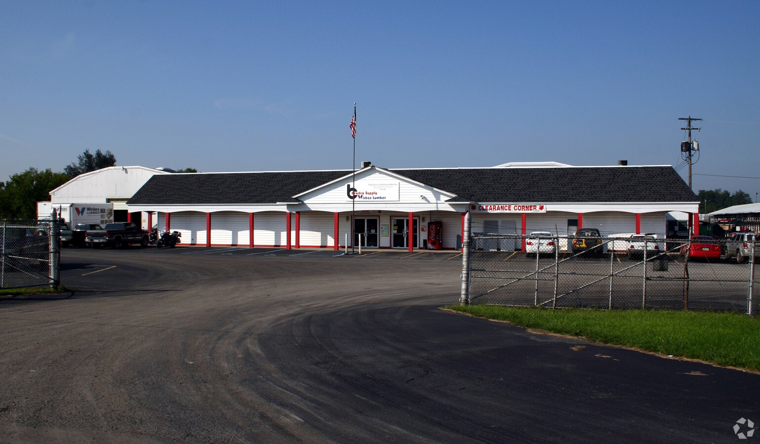
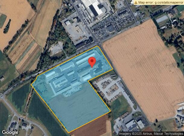
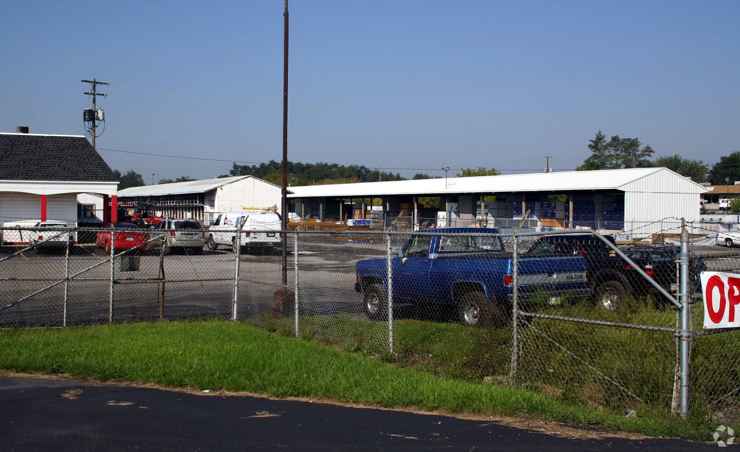
Property Record
82 Garden Spot Rd, Ephrata, PA 17522
NEARBY LISTINGS FOR SALE OR LEASE
Property Detail
82 Garden Spot Rd
Lancaster, PA
Carl W Fuehrer Surv
270-84103-0-0000
82 GARDEN SPOT RD
Lightindustrial
Lancaster
X
Pennsylvania
42071C0183F
2
2024
34.60 AC
2024
Lancaster County
012404
Philadelphia
96,337 SF
DEMOGRAPHICS near 82 Garden Spot Rd
1 Mile
3 Mile
5 Mile
2024 Total Population
2,034
32,983
55,873
2029 Population
2,043
33,169
56,167
Pop Growth 2024-2029
+ 0.44%
+ 0.56%
+ 0.53%
Average Age
40
41
40
2024 Total Households
726
12,765
21,174
HH Growth 2024-2029
+ 0.55%
+ 0.61%
+ 0.57%
Median Household Inc
$75,647
$68,226
$71,305
Avg Household Size
2.70
2.50
2.60
2024 Avg HH Vehicles
2.00
2.00
2.00
Median Home Value
$254,687
$226,256
$233,311
Median Year Built
1978
1977
1978
Nearby Places
- Restaurants
- Banks
- Shops
- Fitness
- Groceries
Nearby Properties
Address
Land Use
TOTAL SIZE
Lot Size
Zoning
Address
Land Use
TOTAL SIZE
Lot Size
Zoning
273,832 SF
57.10 AC
INS
Address
Land Use
TOTAL SIZE
Lot Size
Zoning
287,197 SF
40.40 AC
INS
Address
Land Use
TOTAL SIZE
Lot Size
Zoning
251,634 SF
16.28 AC
Address
Land Use
TOTAL SIZE
Lot Size
Zoning
419,345 SF
48.05 AC
I-1
Address
Land Use
TOTAL SIZE
Lot Size
Zoning
226,686 SF
28 AC
RLD
Address
Land Use
TOTAL SIZE
Lot Size
Zoning
229,049 SF
26.80 AC
RLD
Address
Land Use
TOTAL SIZE
Lot Size
Zoning
155,373 SF
4.50 AC
Address
Land Use
TOTAL SIZE
Lot Size
Zoning
198,400 SF
36.90 AC
C-2
Address
Land Use
TOTAL SIZE
Lot Size
Zoning
392 SF
1,710.80 AC
FR
Address
Land Use
TOTAL SIZE
Lot Size
Zoning
90,600 SF
6.98 AC
Address
Land Use
TOTAL SIZE
Lot Size
Zoning
135,900 SF
11.79 AC
Address
Land Use
TOTAL SIZE
Lot Size
Zoning
1,350 SF
28.77 AC
Address
Land Use
TOTAL SIZE
Lot Size
Zoning
513,058 SF
36.40 AC
I-1
Address
Land Use
TOTAL SIZE
Lot Size
Zoning
69,993 SF
Address
Land Use
TOTAL SIZE
Lot Size
Zoning
152,537 SF
17.20 AC
HC
Address
Land Use
TOTAL SIZE
Lot Size
Zoning
55,896 SF
3.49 AC
Address
Land Use
TOTAL SIZE
Lot Size
Zoning
117,000 SF
12.98 AC
I-1
Address
Land Use
TOTAL SIZE
Lot Size
Zoning
88,413 SF
5.30 AC
RMD
Address
Land Use
TOTAL SIZE
Lot Size
Zoning
85,104 SF
24.20 AC
Address
Land Use
TOTAL SIZE
Lot Size
Zoning
57,966 SF
6.03 AC
Address
Land Use
TOTAL SIZE
Lot Size
Zoning
213,220 SF
22.80 AC
I-1
Address
Land Use
TOTAL SIZE
Lot Size
Zoning
107,888 SF
28.30 AC
I-2
Address
Land Use
TOTAL SIZE
Lot Size
Zoning
75,760 SF
4.85 AC
RMD
Address
Land Use
TOTAL SIZE
Lot Size
Zoning
87,504 SF
59.27 AC
Address
Land Use
TOTAL SIZE
Lot Size
Zoning
73,290 SF
12.83 AC
Address
Land Use
TOTAL SIZE
Lot Size
Zoning
33,134 SF
0.42 AC
NC-2
Address
Land Use
TOTAL SIZE
Lot Size
Zoning
59,996 SF
6 AC
Address
Land Use
TOTAL SIZE
Lot Size
Zoning
44,302 SF
9.58 AC
RLD
Address
Land Use
TOTAL SIZE
Lot Size
Zoning
55,334 SF
5.70 AC
The World's #1 Commercial Real Estate Marketplace
Connect with us
© 2025 CoStar Group
The information above has been obtained from sources believed reliable. While we do not doubt its accuracy we have not verified it and make no guarantee, warranty or representation about it. It is your responsibility to independently confirm its accuracy and completeness. Any projections, opinions, assumptions, or estimates used are for example only and do not represent the current or future performance of the property. The value of this transaction to you depends on tax and other factors which should be evaluated by your tax, financial, and legal advisors. You and your advisors should conduct a careful, independent investigation of the property to determine to your satisfaction the suitability of the property for your needs.