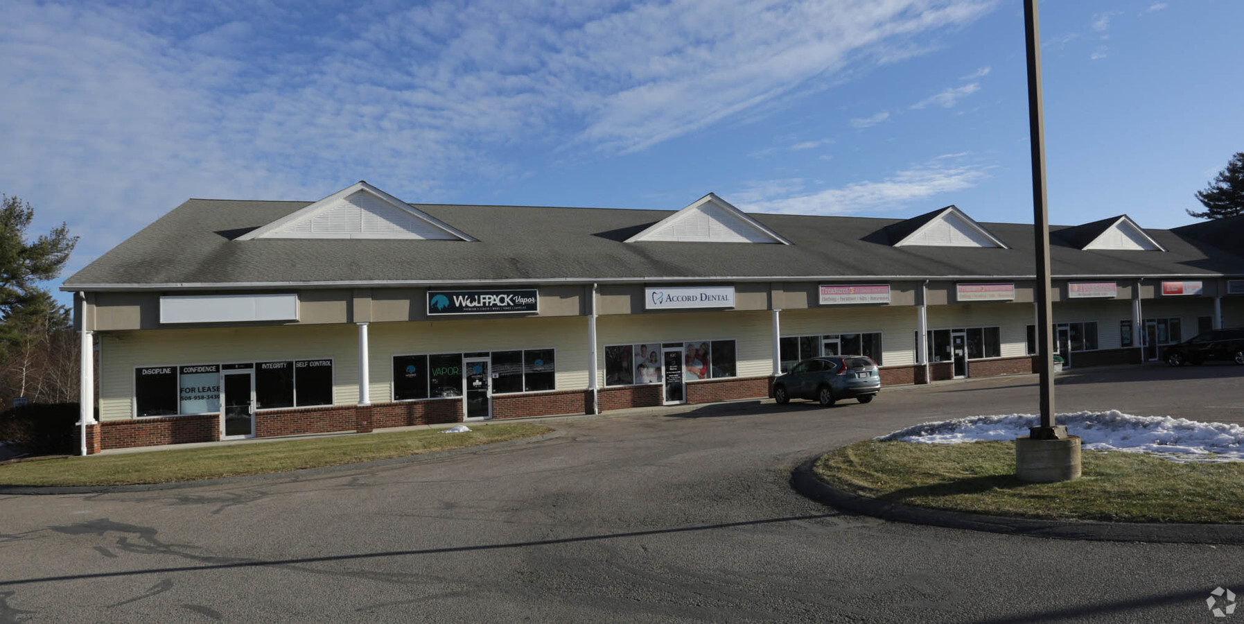
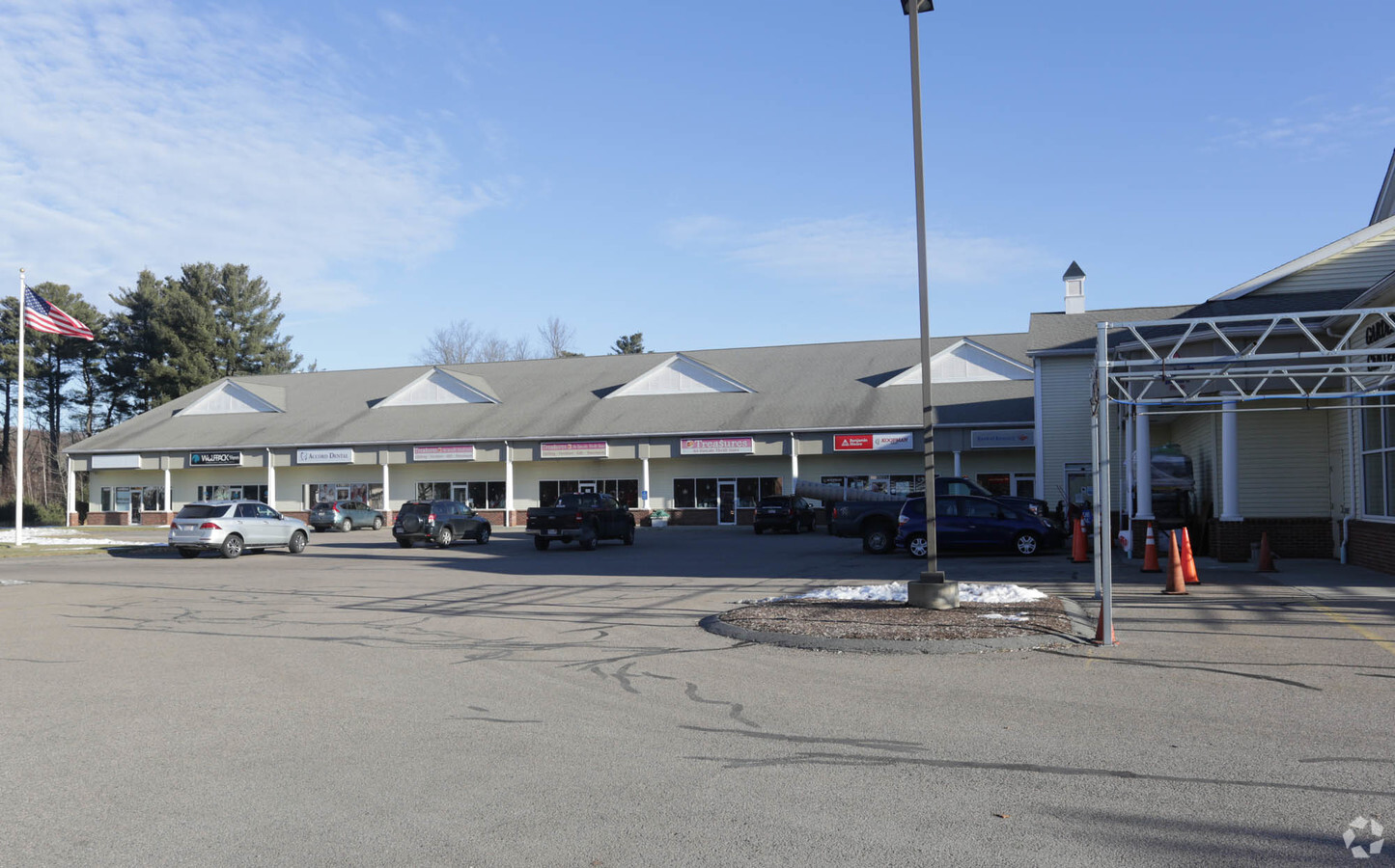
Property Record
82 Worcester St, North Grafton, MA 01536
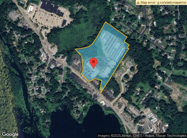
NEARBY LISTINGS FOR SALE OR LEASE
Property Detail
82 Worcester St
GRAF-055.0 0101 0097.0
Worcester
Commercialnec
Massachusetts
X
97.0
25027C0829E
5.29 AC
2025
Outlying Worcester
2025
Boston
738202
Worcester, MA-CT
9,300 SF
DEMOGRAPHICS near 82 Worcester St
1 Mile
3 Mile
5 Mile
2024 Total Population
2,882
24,006
92,595
2029 Population
2,882
24,015
92,645
Pop Growth 2024-2029
0.00%
+ 0.04%
+ 0.05%
Average Age
42
41
41
2024 Total Households
1,194
9,197
36,063
HH Growth 2024-2029
0.00%
+ 0.01%
+ 0.06%
Median Household Inc
$97,471
$111,618
$109,081
Avg Household Size
2.40
2.50
2.50
2024 Avg HH Vehicles
2.00
2.00
2.00
Median Home Value
$445,785
$448,032
$431,447
Median Year Built
1975
1980
1978
Nearby Places
- Restaurants
- Banks
- Shops
- Fitness
- Groceries
PUBLIC TRANSPORTATION
COMMUTER RAIL
Grafton (Framingham/Worcester Line - Massachusetts Bay Transportation Authority Commuter Rail (Purple Line))
DRIVE
WALK
Distance
Grafton (Framingham/Worcester Line - Massachusetts Bay Transportation Authority Commuter Rail (Purple Line))
7 min
3.4 mi
Westborough (Framingham/Worcester Line - Massachusetts Bay Transportation Authority Commuter Rail (Purple Line))
DRIVE
WALK
Distance
Westborough (Framingham/Worcester Line - Massachusetts Bay Transportation Authority Commuter Rail (Purple Line))
14 min
6.4 mi
AIRPORT
Worcester Regional
DRIVE
WALK
Distance
Worcester Regional
25 min
12.7 mi
Freight Ports
Port of Boston
DRIVE
WALK
Distance
Port of Boston
61 min
43.8 mi
Nearby Properties
Address
Land Use
TOTAL SIZE
Lot Size
Zoning
Address
Land Use
TOTAL SIZE
Lot Size
Zoning
46.50 AC
R4
Address
Land Use
TOTAL SIZE
Lot Size
Zoning
375.66 AC
OLI
Address
Land Use
TOTAL SIZE
Lot Size
Zoning
134,896 SF
15.10 AC
LIM IN
Address
Land Use
TOTAL SIZE
Lot Size
Zoning
93,092 SF
162.83 AC
OLI
Address
Land Use
TOTAL SIZE
Lot Size
Zoning
55.79 AC
R4
Address
Land Use
TOTAL SIZE
Lot Size
Zoning
40.46 AC
R4
Address
Land Use
TOTAL SIZE
Lot Size
Zoning
82,843 SF
15.70 AC
R4
Address
Land Use
TOTAL SIZE
Lot Size
Zoning
17.80 AC
R2
Address
Land Use
TOTAL SIZE
Lot Size
Zoning
57,288 SF
11.95 AC
CB
Address
Land Use
TOTAL SIZE
Lot Size
Zoning
84,672 SF
17.85 AC
COM BU
Address
Land Use
TOTAL SIZE
Lot Size
Zoning
12.50 AC
RMF
Address
Land Use
TOTAL SIZE
Lot Size
Zoning
43,542 SF
20.90 AC
R2
Address
Land Use
TOTAL SIZE
Lot Size
Zoning
9.29 AC
RMF
Address
Land Use
TOTAL SIZE
Lot Size
Zoning
10 AC
R2
Address
Land Use
TOTAL SIZE
Lot Size
Zoning
32,802 SF
13.11 AC
LIM IN
Address
Land Use
TOTAL SIZE
Lot Size
Zoning
32,573 SF
8.25 AC
R2
Address
Land Use
TOTAL SIZE
Lot Size
Zoning
2,228 SF
2.57 AC
R2
Address
Land Use
TOTAL SIZE
Lot Size
Zoning
30,624 SF
4.75 AC
OLI
Address
Land Use
TOTAL SIZE
Lot Size
Zoning
128,388 SF
19.21 AC
LIM IN
Address
Land Use
TOTAL SIZE
Lot Size
Zoning
25,964 SF
0.60 AC
NB
Address
Land Use
TOTAL SIZE
Lot Size
Zoning
14,000 SF
104.37 AC
OLI
Address
Land Use
TOTAL SIZE
Lot Size
Zoning
77,251 SF
14.48 AC
OLI
Address
Land Use
TOTAL SIZE
Lot Size
Zoning
17.30 AC
LIM IN
Address
Land Use
TOTAL SIZE
Lot Size
Zoning
20,069 SF
224.29 AC
R4
Address
Land Use
TOTAL SIZE
Lot Size
Zoning
13,500 SF
46.99 AC
R4
Address
Land Use
TOTAL SIZE
Lot Size
Zoning
10 AC
R2
Address
Land Use
TOTAL SIZE
Lot Size
Zoning
2,096 SF
70.87 AC
RUR B
Address
Land Use
TOTAL SIZE
Lot Size
Zoning
38.17 AC
R4
Address
Land Use
TOTAL SIZE
Lot Size
Zoning
11.54 AC
LIM IN
The World's #1 Commercial Real Estate Marketplace
Connect with us
© 2025 CoStar Group
The information above has been obtained from sources believed reliable. While we do not doubt its accuracy we have not verified it and make no guarantee, warranty or representation about it. It is your responsibility to independently confirm its accuracy and completeness. Any projections, opinions, assumptions, or estimates used are for example only and do not represent the current or future performance of the property. The value of this transaction to you depends on tax and other factors which should be evaluated by your tax, financial, and legal advisors. You and your advisors should conduct a careful, independent investigation of the property to determine to your satisfaction the suitability of the property for your needs.