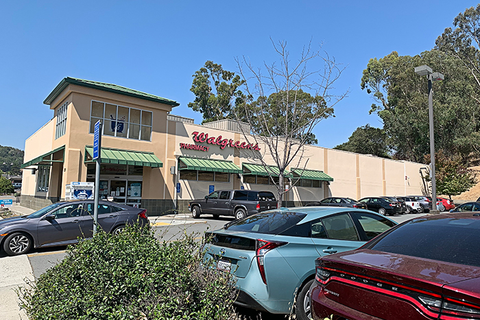
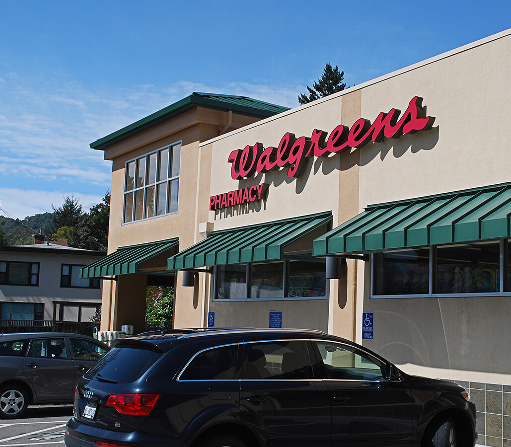
Property Record
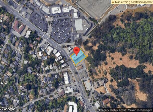
820 Sir Francis Drake Blvd, Kentfield, CA 94904

Current Lease Availabilities
NEARBY LISTINGS FOR SALE OR LEASE
Property Detail
820 Sir Francis Drake Blvd
006-061-13
Marin Golf & Cc Estates 02
Commercialnec
Marin
X
California
06041C0452E
84
2024
0.52 AC
2024
San Rafael/Larkspur
119100
North Bay/Santa Rosa
10,948 SF
San Rafael, CA
DEMOGRAPHICS near 820 Sir Francis Drake Blvd
1 Mile
3 Mile
5 Mile
2024 Total Population
13,012
76,504
127,975
2029 Population
12,609
74,343
124,230
Pop Growth 2024-2029
(3.10%)
(2.82%)
(2.93%)
Average Age
45
45
45
2024 Total Households
5,353
31,556
50,676
HH Growth 2024-2029
(3.16%)
(2.83%)
(2.93%)
Median Household Inc
$145,802
$115,018
$117,261
Avg Household Size
2.40
2.30
2.40
2024 Avg HH Vehicles
2.00
2.00
2.00
Median Home Value
$1,117,961
$1,088,257
$1,084,982
Median Year Built
1952
1960
1963
Nearby Places
- Restaurants
- Banks
- Shops
- Fitness
- Groceries
PUBLIC TRANSPORTATION
COMMUTER RAIL
San Rafael Smart (Main Line - Sonoma Marin Area Rail Transit)
DRIVE
WALK
Distance
San Rafael Smart (Main Line - Sonoma Marin Area Rail Transit)
6 min
2.7 mi
Marin Civic Center Smart (Main Line - Sonoma Marin Area Rail Transit)
DRIVE
WALK
Distance
Marin Civic Center Smart (Main Line - Sonoma Marin Area Rail Transit)
11 min
6.0 mi
AIRPORT
San Francisco International
DRIVE
WALK
Distance
San Francisco International
55 min
32.4 mi
Metro Oakland International
DRIVE
WALK
Distance
Metro Oakland International
48 min
33.5 mi
Freight Ports
Port of Richmond
DRIVE
WALK
Distance
Port of Richmond
25 min
14.2 mi
Nearby Properties
Address
Land Use
TOTAL SIZE
Lot Size
Zoning
Address
Land Use
TOTAL SIZE
Lot Size
Zoning
283,663 SF
27.98 AC
Address
Land Use
TOTAL SIZE
Lot Size
Zoning
23.79 AC
Address
Land Use
TOTAL SIZE
Lot Size
Zoning
87,058 SF
1.33 AC
Address
Land Use
TOTAL SIZE
Lot Size
Zoning
221,660 SF
9.69 AC
PC
Address
Land Use
TOTAL SIZE
Lot Size
Zoning
119,185 SF
4.31 AC
Address
Land Use
TOTAL SIZE
Lot Size
Zoning
109,944 SF
5.73 AC
Address
Land Use
TOTAL SIZE
Lot Size
Zoning
147,502 SF
1.02 AC
Address
Land Use
TOTAL SIZE
Lot Size
Zoning
132,040 SF
11.74 AC
Address
Land Use
TOTAL SIZE
Lot Size
Zoning
91,158 SF
1.89 AC
Address
Land Use
TOTAL SIZE
Lot Size
Zoning
11.63 AC
Address
Land Use
TOTAL SIZE
Lot Size
Zoning
79,995 SF
3.15 AC
Address
Land Use
TOTAL SIZE
Lot Size
Zoning
72,870 SF
3.51 AC
Address
Land Use
TOTAL SIZE
Lot Size
Zoning
15.91 AC
SPD
Address
Land Use
TOTAL SIZE
Lot Size
Zoning
94,745 SF
1.46 AC
Address
Land Use
TOTAL SIZE
Lot Size
Zoning
75,888 SF
10.99 AC
Address
Land Use
TOTAL SIZE
Lot Size
Zoning
234,922 SF
6 AC
Address
Land Use
TOTAL SIZE
Lot Size
Zoning
195,460 SF
6.10 AC
Address
Land Use
TOTAL SIZE
Lot Size
Zoning
71,527 SF
1.86 AC
Address
Land Use
TOTAL SIZE
Lot Size
Zoning
177,460 SF
13 AC
Address
Land Use
TOTAL SIZE
Lot Size
Zoning
11,830 SF
0.65 AC
Address
Land Use
TOTAL SIZE
Lot Size
Zoning
48,603 SF
2.54 AC
Address
Land Use
TOTAL SIZE
Lot Size
Zoning
85,066 SF
1.29 AC
Address
Land Use
TOTAL SIZE
Lot Size
Zoning
87,840 SF
1.19 AC
Address
Land Use
TOTAL SIZE
Lot Size
Zoning
192,037 SF
511.90 AC
Address
Land Use
TOTAL SIZE
Lot Size
Zoning
Address
Land Use
TOTAL SIZE
Lot Size
Zoning
142,341 SF
5.83 AC
Address
Land Use
TOTAL SIZE
Lot Size
Zoning
132,813 SF
6.75 AC
Address
Land Use
TOTAL SIZE
Lot Size
Zoning
66,700 SF
0.99 AC
Address
Land Use
TOTAL SIZE
Lot Size
Zoning
42,410 SF
0.54 AC
Address
Land Use
TOTAL SIZE
Lot Size
Zoning
75,556 SF
0.78 AC
The World's #1 Commercial Real Estate Marketplace
Connect with us
© 2025 CoStar Group
The information above has been obtained from sources believed reliable. While we do not doubt its accuracy we have not verified it and make no guarantee, warranty or representation about it. It is your responsibility to independently confirm its accuracy and completeness. Any projections, opinions, assumptions, or estimates used are for example only and do not represent the current or future performance of the property. The value of this transaction to you depends on tax and other factors which should be evaluated by your tax, financial, and legal advisors. You and your advisors should conduct a careful, independent investigation of the property to determine to your satisfaction the suitability of the property for your needs.