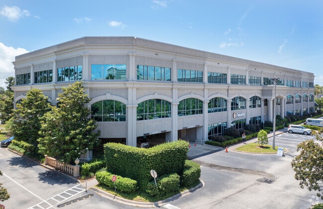
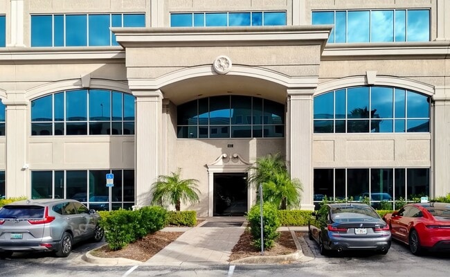
Property Record
822 A1a N, Ponte Vedra Beach, FL 32082

Current Lease Availabilities
Property Detail
822 A1a N
061940-0110
4-11 PT OF SEC 34 42 & 51 LY- ING S OF TPC BLVD & W OF A1A - 316.77FT ON A1A OR1751/1345 &2652/1802(C/D)
Commercialnec
ST. JOHNS
PUD
Florida
B and X Area of moderate flood hazard, usually the area between the limits of the 100-year and 500-year floods.
4-11
2025
0.87 AC
2026
Beaches
020705
Jacksonville (Florida)
76,556 SF
Jacksonville, FL
NEARBY LISTINGS FOR SALE OR LEASE
DEMOGRAPHICS near 822 A1a N
1 mile
3 mile
5 mile
2025 Total Population
7,144
25,026
45,772
2030 Population
8,220
28,809
51,989
Pop Growth 2025-2030
+ 15.06%
+ 15.12%
+ 13.58%
Average Age
51
49
46
2025 Total Households
3,404
10,969
19,698
HH Growth 2025-2030
+ 15.42%
+ 15.43%
+ 13.74%
Median Household Inc
$107,584
$132,521
$128,521
Avg Household Size
2.10
2.20
2.30
2025 Avg HH Vehicles
2.00
2.00
2.00
Median Home Value
$795,055
$867,698
$812,399
Median Year Built
1988
1991
1993
Nearby Places
Map Layers
Map Styles
 Street
 Aerial
Layers
 Traffic
 Biking
Places
Listings with unknown addresses are not visible on the map
- Restaurants
- Banks
- Shops
- Fitness
- Groceries
PUBLIC TRANSPORTATION
AIRPORT
Jacksonville International
Drive
Walk
Distance
Jacksonville International
40 min
34.6 mi
Freight Ports
Jacksonville Port
Drive
Walk
Distance
Jacksonville Port
1 min
18.2 mi
Nearby Properties
Address
Land Use
TOTAL SIZE
Lot Size
Zoning
Address
Land Use
TOTAL SIZE
Lot Size
Zoning
199,463 SF
131.13 AC
PUD
Address
Land Use
TOTAL SIZE
Lot Size
Zoning
159,780 SF
35.73 AC
PUD
Address
Land Use
TOTAL SIZE
Lot Size
Zoning
384,314 SF
24.30 AC
PUD
Address
Land Use
TOTAL SIZE
Lot Size
Zoning
398,312 SF
39.43 AC
Address
Land Use
TOTAL SIZE
Lot Size
Zoning
433,943 SF
24.90 AC
PUD
Address
Land Use
TOTAL SIZE
Lot Size
Zoning
129,840 SF
496.26 AC
PUD
Address
Land Use
TOTAL SIZE
Lot Size
Zoning
118,725 SF
4.37 AC
R2
Address
Land Use
TOTAL SIZE
Lot Size
Zoning
127,691 SF
36.98 AC
PUD
Address
Land Use
TOTAL SIZE
Lot Size
Zoning
80,034 SF
7 AC
PUD
Address
Land Use
TOTAL SIZE
Lot Size
Zoning
69,171 SF
263.69 AC
PUD
Address
Land Use
TOTAL SIZE
Lot Size
Zoning
62,405 SF
7.77 AC
Address
Land Use
TOTAL SIZE
Lot Size
Zoning
89,365 SF
1.54 AC
PUD
Address
Land Use
TOTAL SIZE
Lot Size
Zoning
76,140 SF
14.30 AC
RG1
Address
Land Use
TOTAL SIZE
Lot Size
Zoning
100,213 SF
32.44 AC
OR
Address
Land Use
TOTAL SIZE
Lot Size
Zoning
9,759 SF
1.99 AC
R3
Address
Land Use
TOTAL SIZE
Lot Size
Zoning
82,038 SF
19 AC
PUD
Address
Land Use
TOTAL SIZE
Lot Size
Zoning
53,383 SF
6.84 AC
PUD
Address
Land Use
TOTAL SIZE
Lot Size
Zoning
152,288 SF
2.61 AC
PUD
Address
Land Use
TOTAL SIZE
Lot Size
Zoning
76,729 SF
5 AC
OR
Address
Land Use
TOTAL SIZE
Lot Size
Zoning
22,248 SF
3.82 AC
R3
Address
Land Use
TOTAL SIZE
Lot Size
Zoning
10,399 SF
1.93 AC
R1B
Address
Land Use
TOTAL SIZE
Lot Size
Zoning
156,788 SF
33.79 AC
R1C
Address
Land Use
TOTAL SIZE
Lot Size
Zoning
43,182 SF
11.51 AC
PUD
Address
Land Use
TOTAL SIZE
Lot Size
Zoning
47,357 SF
5.37 AC
R3
Address
Land Use
TOTAL SIZE
Lot Size
Zoning
53,807 SF
12 AC
R1C
Address
Land Use
TOTAL SIZE
Lot Size
Zoning
51,520 SF
2.17 AC
R2
Address
Land Use
TOTAL SIZE
Lot Size
Zoning
63,128 SF
0.78 AC
PUD
Address
Land Use
TOTAL SIZE
Lot Size
Zoning
71,672 SF
11.07 AC
PUD
Address
Land Use
TOTAL SIZE
Lot Size
Zoning
10.33 AC
PSD
The World's #1 Commercial Real Estate Marketplace
Connect with us
© 2026 CoStar Group
The information above has been obtained from sources believed reliable. While we do not doubt its accuracy we have not verified it and make no guarantee, warranty or representation about it. It is your responsibility to independently confirm its accuracy and completeness. Any projections, opinions, assumptions, or estimates used are for example only and do not represent the current or future performance of the property. The value of this transaction to you depends on tax and other factors which should be evaluated by your tax, financial, and legal advisors. You and your advisors should conduct a careful, independent investigation of the property to determine to your satisfaction the suitability of the property for your needs.