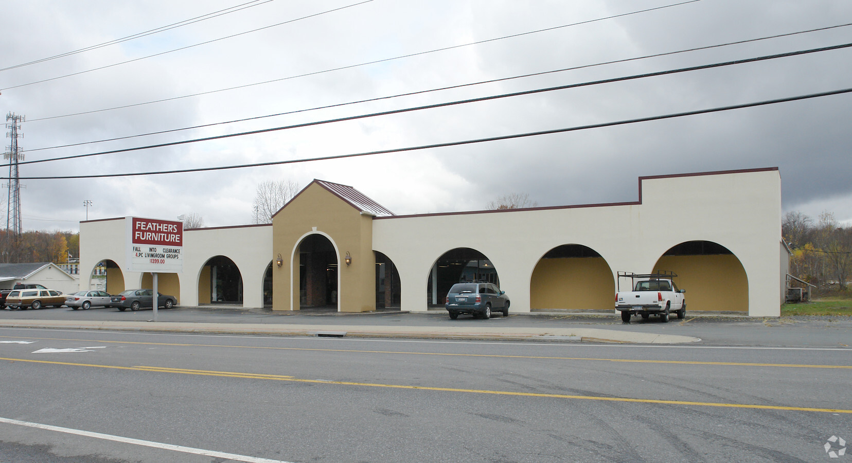
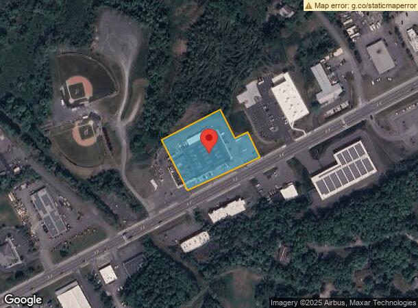
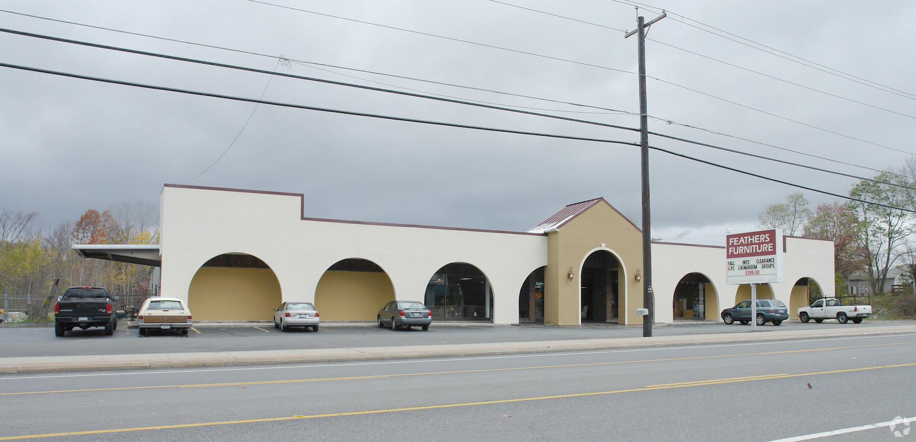
Property Record
831 Hoosick Rd, Troy, NY 12180
NEARBY LISTINGS FOR SALE OR LEASE
Property Detail
831 Hoosick Rd
2200-091-2-22.12
FURN STORE ST ACQ 234/1643
Distributionwarehouseregional
Rensselaer
ARE
New York
36083C0119D
22.012
2024
1.67 AC
2023
Outer Rensselaer County
041300
Albany/Schenectady/Troy
22,200 SF
Albany-Schenectady-Troy, NY
DEMOGRAPHICS near 831 Hoosick Rd
1 Mile
3 Mile
5 Mile
2024 Total Population
2,703
39,388
106,436
2029 Population
2,738
39,098
104,750
Pop Growth 2024-2029
+ 1.29%
(0.74%)
(1.58%)
Average Age
44
39
39
2024 Total Households
1,261
16,238
46,169
HH Growth 2024-2029
+ 1.27%
(0.74%)
(1.68%)
Median Household Inc
$98,003
$53,649
$59,185
Avg Household Size
2.10
2.10
2.10
2024 Avg HH Vehicles
2.00
1.00
1.00
Median Home Value
$262,126
$201,719
$189,986
Median Year Built
1987
1952
1951
Nearby Places
- Restaurants
- Banks
- Shops
- Fitness
- Groceries
PUBLIC TRANSPORTATION
AIRPORT
Albany International
DRIVE
WALK
Distance
Albany International
17 min
10.2 mi
Freight Ports
Albany, NY Port
DRIVE
WALK
Distance
Albany, NY Port
22 min
12.9 mi
Nearby Properties
Address
Land Use
TOTAL SIZE
Lot Size
Zoning
Address
Land Use
TOTAL SIZE
Lot Size
Zoning
34,971 SF
108.68 AC
INST
Address
Land Use
TOTAL SIZE
Lot Size
Zoning
313,907 SF
8.23 AC
INST
Address
Land Use
TOTAL SIZE
Lot Size
Zoning
9,643 SF
5.36 AC
INST
Address
Land Use
TOTAL SIZE
Lot Size
Zoning
Address
Land Use
TOTAL SIZE
Lot Size
Zoning
5,000 SF
48.44 AC
CON
Address
Land Use
TOTAL SIZE
Lot Size
Zoning
413,006 SF
37.94 AC
INST
Address
Land Use
TOTAL SIZE
Lot Size
Zoning
67,335 SF
55.02 AC
INST
Address
Land Use
TOTAL SIZE
Lot Size
Zoning
77,193 SF
28.41 AC
CON
Address
Land Use
TOTAL SIZE
Lot Size
Zoning
353,510 SF
2.94 AC
HWD
Address
Land Use
TOTAL SIZE
Lot Size
Zoning
Address
Land Use
TOTAL SIZE
Lot Size
Zoning
46.45 AC
P
Address
Land Use
TOTAL SIZE
Lot Size
Zoning
251,672 SF
16.18 AC
06 - INDUS
Address
Land Use
TOTAL SIZE
Lot Size
Zoning
113,400 SF
3.40 AC
INST
Address
Land Use
TOTAL SIZE
Lot Size
Zoning
77,928 SF
2.25 AC
HWD
Address
Land Use
TOTAL SIZE
Lot Size
Zoning
41,911 SF
15.31 AC
MULTI
Address
Land Use
TOTAL SIZE
Lot Size
Zoning
1,500 SF
7.01 AC
IND
Address
Land Use
TOTAL SIZE
Lot Size
Zoning
154,587 SF
3.79 AC
HCD
Address
Land Use
TOTAL SIZE
Lot Size
Zoning
3,600 SF
17.54 AC
MULTI
Address
Land Use
TOTAL SIZE
Lot Size
Zoning
63,828 SF
2.74 AC
INST
Address
Land Use
TOTAL SIZE
Lot Size
Zoning
3,202 SF
7.15 AC
INST
Address
Land Use
TOTAL SIZE
Lot Size
Zoning
Address
Land Use
TOTAL SIZE
Lot Size
Zoning
Address
Land Use
TOTAL SIZE
Lot Size
Zoning
135,933 SF
12.17 AC
HCD
Address
Land Use
TOTAL SIZE
Lot Size
Zoning
181,839 SF
3.42 AC
R5
Address
Land Use
TOTAL SIZE
Lot Size
Zoning
95,466 SF
7.64 AC
P
Address
Land Use
TOTAL SIZE
Lot Size
Zoning
52 AC
CON
Address
Land Use
TOTAL SIZE
Lot Size
Zoning
3,320 SF
215.98 AC
MULTI
Address
Land Use
TOTAL SIZE
Lot Size
Zoning
116,445 SF
0.76 AC
HWD
Address
Land Use
TOTAL SIZE
Lot Size
Zoning
23,768 SF
8.78 AC
05 - COMME
Address
Land Use
TOTAL SIZE
Lot Size
Zoning
4,200 SF
12.21 AC
MULTI
The World's #1 Commercial Real Estate Marketplace
Connect with us
© 2025 CoStar Group
The information above has been obtained from sources believed reliable. While we do not doubt its accuracy we have not verified it and make no guarantee, warranty or representation about it. It is your responsibility to independently confirm its accuracy and completeness. Any projections, opinions, assumptions, or estimates used are for example only and do not represent the current or future performance of the property. The value of this transaction to you depends on tax and other factors which should be evaluated by your tax, financial, and legal advisors. You and your advisors should conduct a careful, independent investigation of the property to determine to your satisfaction the suitability of the property for your needs.