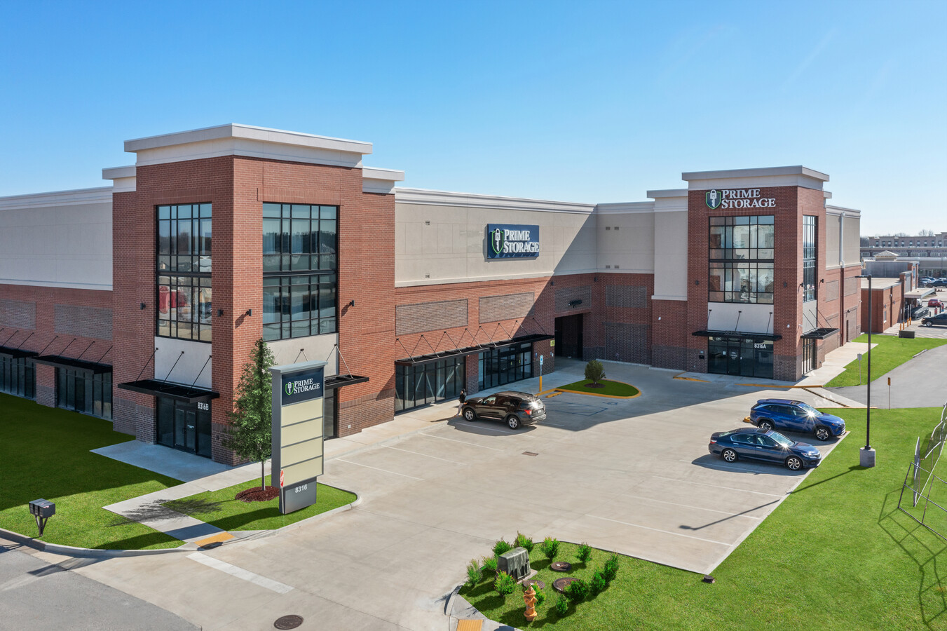
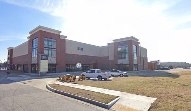
Property Record
8316 E 102Nd St, Tulsa, OK 74133

Current Lease Availabilities
NEARBY LISTINGS FOR SALE OR LEASE
Property Detail
8316 E 102Nd St
Tulsa, OK
101 South Memorial Plaza Replat Prt 101
58287-83-25-67715
LT 1 LESS BEG SECR THEREOF TH W253.67 N300.51 E23.49 CRV LF106.19 NE101.04 CRV RT99.38 E95.26 S62 W165 S293.49 POB BLOCK 2
Publicstorage
Tulsa
X
Oklahoma
40143C0369L
1
2023
2.08 AC
2024
South
007527
Tulsa
105,734 SF
DEMOGRAPHICS near 8316 E 102Nd St
1 Mile
3 Mile
5 Mile
2024 Total Population
9,530
72,144
182,008
2029 Population
9,882
74,290
187,913
Pop Growth 2024-2029
+ 3.69%
+ 2.97%
+ 3.24%
Average Age
40
40
40
2024 Total Households
3,576
28,296
71,622
HH Growth 2024-2029
+ 3.61%
+ 2.94%
+ 3.23%
Median Household Inc
$99,123
$94,257
$79,567
Avg Household Size
2.60
2.50
2.50
2024 Avg HH Vehicles
2.00
2.00
2.00
Median Home Value
$309,362
$292,151
$248,988
Median Year Built
1994
1993
1988
Nearby Places
- Restaurants
- Banks
- Shops
- Fitness
- Groceries
PUBLIC TRANSPORTATION
AIRPORT
Tulsa International
DRIVE
WALK
Distance
Tulsa International
26 min
18.1 mi
Freight Ports
Tulsa Port Of Catoosa
DRIVE
WALK
Distance
Tulsa Port Of Catoosa
29 min
21.9 mi
Nearby Properties
Address
Land Use
TOTAL SIZE
Lot Size
Zoning
Address
Land Use
TOTAL SIZE
Lot Size
Zoning
323,882 SF
20 AC
CO
Address
Land Use
TOTAL SIZE
Lot Size
Zoning
157,138 SF
9.28 AC
CO
Address
Land Use
TOTAL SIZE
Lot Size
Zoning
204,580 SF
78.45 AC
AG
Address
Land Use
TOTAL SIZE
Lot Size
Zoning
162,957 SF
29.92 AC
AG
Address
Land Use
TOTAL SIZE
Lot Size
Zoning
390,154 SF
52.94 AC
A1
Address
Land Use
TOTAL SIZE
Lot Size
Zoning
55,384 SF
14.81 AC
AG
Address
Land Use
TOTAL SIZE
Lot Size
Zoning
73,113 SF
28.52 AC
R2
Address
Land Use
TOTAL SIZE
Lot Size
Zoning
62,086 SF
79.79 AC
AG
Address
Land Use
TOTAL SIZE
Lot Size
Zoning
8,388 SF
63.49 AC
AG
Address
Land Use
TOTAL SIZE
Lot Size
Zoning
176,243 SF
5.77 AC
CS
Address
Land Use
TOTAL SIZE
Lot Size
Zoning
64,283 SF
29.41 AC
A1
Address
Land Use
TOTAL SIZE
Lot Size
Zoning
65,812 SF
14.12 AC
RS1
Address
Land Use
TOTAL SIZE
Lot Size
Zoning
65,385 SF
16.59 AC
AG
Address
Land Use
TOTAL SIZE
Lot Size
Zoning
152,902 SF
44.60 AC
AG
Address
Land Use
TOTAL SIZE
Lot Size
Zoning
33,668 SF
8.04 AC
CO
Address
Land Use
TOTAL SIZE
Lot Size
Zoning
27,278 SF
2.49 AC
CS
Address
Land Use
TOTAL SIZE
Lot Size
Zoning
56,526 SF
25.18 AC
AG
Address
Land Use
TOTAL SIZE
Lot Size
Zoning
84,314 SF
12.05 AC
A1
Address
Land Use
TOTAL SIZE
Lot Size
Zoning
86,747 SF
19.01 AC
RS3
Address
Land Use
TOTAL SIZE
Lot Size
Zoning
355,931 SF
29.06 AC
RM1
Address
Land Use
TOTAL SIZE
Lot Size
Zoning
91,314 SF
19.62 AC
RS3
Address
Land Use
TOTAL SIZE
Lot Size
Zoning
22,594 SF
2.07 AC
ON
Address
Land Use
TOTAL SIZE
Lot Size
Zoning
35,904 SF
4.08 AC
RM1
Address
Land Use
TOTAL SIZE
Lot Size
Zoning
59,175 SF
8.28 AC
RS3
Address
Land Use
TOTAL SIZE
Lot Size
Zoning
356,659 SF
14.18 AC
CO
Address
Land Use
TOTAL SIZE
Lot Size
Zoning
260,059 SF
19.98 AC
CO
Address
Land Use
TOTAL SIZE
Lot Size
Zoning
219,987 SF
6.97 AC
RM3
Address
Land Use
TOTAL SIZE
Lot Size
Zoning
288,501 SF
19.31 AC
CN
Address
Land Use
TOTAL SIZE
Lot Size
Zoning
178,999 SF
23.87 AC
CO
Address
Land Use
TOTAL SIZE
Lot Size
Zoning
330,744 SF
17.43 AC
RM3
The World's #1 Commercial Real Estate Marketplace
Connect with us
© 2025 CoStar Group
The information above has been obtained from sources believed reliable. While we do not doubt its accuracy we have not verified it and make no guarantee, warranty or representation about it. It is your responsibility to independently confirm its accuracy and completeness. Any projections, opinions, assumptions, or estimates used are for example only and do not represent the current or future performance of the property. The value of this transaction to you depends on tax and other factors which should be evaluated by your tax, financial, and legal advisors. You and your advisors should conduct a careful, independent investigation of the property to determine to your satisfaction the suitability of the property for your needs.