Property Record
8337 S Greenwich Rd, Derby, KS 67037
NEARBY LISTINGS FOR SALE OR LEASE
-
-
View all Derby listings for sale on LoopNet.com
Property Detail
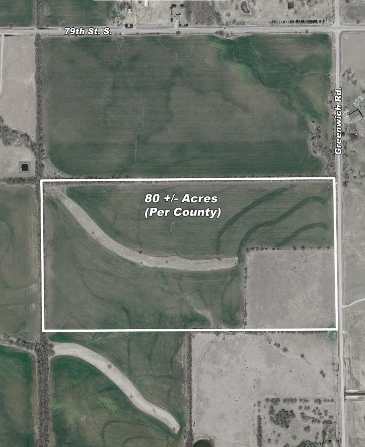
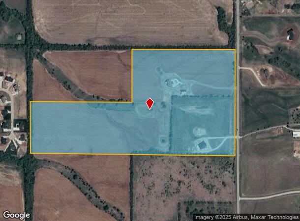
8337 S Greenwich Rd
232-09-0-13-00-001.00
S 1/2 NE 1/4 EXC TH PT COMM NE COR S 1/2 TH W 1342.29 FT FOR POB TH W 1290.15 FT TO PT W LI NE 1/4 S 664.92 FT E 1287.8 FT N 667.61 FT TO BEG & EXC TH PT BEG NE COR S 1/2 NE 1/4 TH W 1342.29 FT S 667.61 FT E 1342.32 FT TO PT E LI NE 1/4 TH N 670. 44
Farms
Sedgwick
X
Kansas
20173C0540G
1.13 AC
2023
Derby/Haysville/Mulvane
2023
Wichita
009901
Wichita, KS
6,524 SF
DEMOGRAPHICS near 8337 S Greenwich Rd
1 Mile
3 Mile
5 Mile
2024 Total Population
199
16,942
35,981
2029 Population
194
16,835
36,019
Pop Growth 2024-2029
(2.51%)
(0.63%)
+ 0.11%
Average Age
43
40
39
2024 Total Households
69
6,521
13,524
HH Growth 2024-2029
(2.90%)
(0.94%)
(0.12%)
Median Household Inc
$103,409
$79,311
$75,141
Avg Household Size
2.60
2.50
2.60
2024 Avg HH Vehicles
3.00
2.00
2.00
Median Home Value
$273,809
$216,175
$189,999
Median Year Built
1987
1990
1988
Nearby Places
- Restaurants
- Banks
- Shops
- Fitness
- Groceries
PUBLIC TRANSPORTATION
AIRPORT
Wichita Dwight D Eisenhower Ntl
DRIVE
WALK
Distance
Wichita Dwight D Eisenhower Ntl
35 min
20.8 mi
Freight Ports
Tulsa Port Of Catoosa
DRIVE
WALK
Distance
Tulsa Port Of Catoosa
210 min
188.8 mi
Nearby Properties
Address
Land Use
TOTAL SIZE
Lot Size
Zoning
Address
Land Use
TOTAL SIZE
Lot Size
Zoning
306,621 SF
66.86 AC
R1
Address
Land Use
TOTAL SIZE
Lot Size
Zoning
202,301 SF
34.22 AC
R1
Address
Land Use
TOTAL SIZE
Lot Size
Zoning
102,994 SF
19.96 AC
R1
Address
Land Use
TOTAL SIZE
Lot Size
Zoning
82,912 SF
23.59 AC
I1
Address
Land Use
TOTAL SIZE
Lot Size
Zoning
64,858 SF
11.38 AC
R1
Address
Land Use
TOTAL SIZE
Lot Size
Zoning
72,472 SF
2.73 AC
R3
Address
Land Use
TOTAL SIZE
Lot Size
Zoning
37,640 SF
9.36 AC
Address
Land Use
TOTAL SIZE
Lot Size
Zoning
62,829 SF
7.14 AC
R1
Address
Land Use
TOTAL SIZE
Lot Size
Zoning
35,032 SF
12.62 AC
I1
Address
Land Use
TOTAL SIZE
Lot Size
Zoning
37,860 SF
4.77 AC
R1
Address
Land Use
TOTAL SIZE
Lot Size
Zoning
15,596 SF
11.59 AC
Address
Land Use
TOTAL SIZE
Lot Size
Zoning
49,454 SF
23 AC
Address
Land Use
TOTAL SIZE
Lot Size
Zoning
53,691 SF
8.23 AC
R1
Address
Land Use
TOTAL SIZE
Lot Size
Zoning
21,420 SF
2.39 AC
R1
Address
Land Use
TOTAL SIZE
Lot Size
Zoning
43,300 SF
6.10 AC
I1
Address
Land Use
TOTAL SIZE
Lot Size
Zoning
33,846 SF
3.25 AC
R3
Address
Land Use
TOTAL SIZE
Lot Size
Zoning
24,900 SF
4.30 AC
Address
Land Use
TOTAL SIZE
Lot Size
Zoning
60,753 SF
10.02 AC
B3
Address
Land Use
TOTAL SIZE
Lot Size
Zoning
17,020 SF
0.83 AC
B3
Address
Land Use
TOTAL SIZE
Lot Size
Zoning
14,024 SF
2.10 AC
R1
Address
Land Use
TOTAL SIZE
Lot Size
Zoning
118,352 SF
11.49 AC
B3
Address
Land Use
TOTAL SIZE
Lot Size
Zoning
6,174 SF
9.32 AC
Address
Land Use
TOTAL SIZE
Lot Size
Zoning
3,381 SF
56.91 AC
AA
Address
Land Use
TOTAL SIZE
Lot Size
Zoning
125,550 SF
10.94 AC
B3
Address
Land Use
TOTAL SIZE
Lot Size
Zoning
24,469 SF
3.38 AC
R1
Address
Land Use
TOTAL SIZE
Lot Size
Zoning
37.22 AC
R1
Address
Land Use
TOTAL SIZE
Lot Size
Zoning
11,576 SF
0.71 AC
B3
Address
Land Use
TOTAL SIZE
Lot Size
Zoning
52,551 SF
7.04 AC
B3
Address
Land Use
TOTAL SIZE
Lot Size
Zoning
32,600 SF
2.02 AC
R3
Address
Land Use
TOTAL SIZE
Lot Size
Zoning
19,181 SF
0.91 AC
R1
The World's #1 Commercial Real Estate Marketplace
Connect with us
© 2025 CoStar Group
The information above has been obtained from sources believed reliable. While we do not doubt its accuracy we have not verified it and make no guarantee, warranty or representation about it. It is your responsibility to independently confirm its accuracy and completeness. Any projections, opinions, assumptions, or estimates used are for example only and do not represent the current or future performance of the property. The value of this transaction to you depends on tax and other factors which should be evaluated by your tax, financial, and legal advisors. You and your advisors should conduct a careful, independent investigation of the property to determine to your satisfaction the suitability of the property for your needs.