Property Record
8351 Rockville Rd, Indianapolis, IN 46234


NEARBY LISTINGS FOR SALE OR LEASE
Property Detail
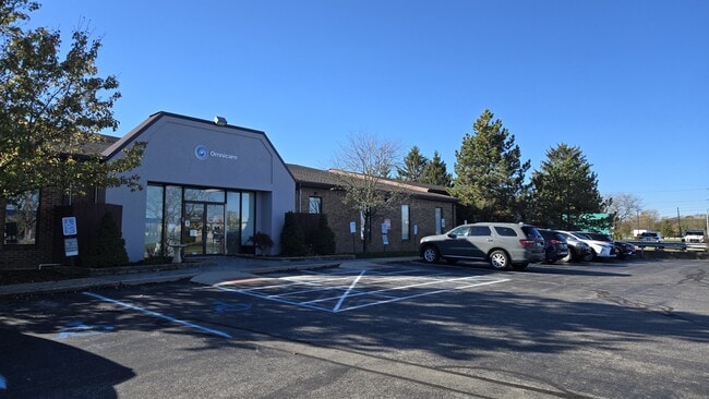
8351 Rockville Rd
49-12-10-103-002.000-900
PT NW1/4 S10 & NE1/4 S9 T15 R2 BEG NE COR OF NE1/4 SEC S319.57TO POB; NE1.1,SE294.28,SE59.79ALG ARC,SW381.58, IRR NW512.53,E150.06, NE261.59 TO POB 3.410 AC.
Warehouse
Marion
AE
Indiana
18097C0118F
3.41 AC
2023
Airport
2024
Indianapolis
340101
Indianapolis-Carmel-Anderson, IN
39,149 SF
DEMOGRAPHICS near 8351 Rockville Rd
1 Mile
3 Mile
5 Mile
2024 Total Population
5,702
66,435
170,343
2029 Population
5,590
67,537
174,664
Pop Growth 2024-2029
(1.96%)
+ 1.66%
+ 2.54%
Average Age
42
37
37
2024 Total Households
2,390
25,256
65,405
HH Growth 2024-2029
(1.76%)
+ 1.60%
+ 2.28%
Median Household Inc
$60,287
$58,436
$58,684
Avg Household Size
2.30
2.60
2.50
2024 Avg HH Vehicles
2.00
2.00
2.00
Median Home Value
$168,254
$162,202
$167,175
Median Year Built
1975
1986
1981
Nearby Places
Map Layers
Map Styles
 Street
 Aerial
- Restaurants
- Banks
- Shops
- Fitness
- Groceries
PUBLIC TRANSPORTATION
COMMUTER RAIL
DRIVE
WALK
Distance
16 min
8.5 mi
AIRPORT
Indianapolis International
DRIVE
WALK
Distance
Indianapolis International
20 min
7.2 mi
SALE & LEASE HISTORY
LISTING DATE
SALE/LEASE

Sep 24, 2016
For Sale
Nov 12, 2024
For Sale
Nearby Properties
Address
Land Use
TOTAL SIZE
Lot Size
Zoning
Address
Land Use
TOTAL SIZE
Lot Size
Zoning
1,099,200 SF
68.67 AC
Address
Land Use
TOTAL SIZE
Lot Size
Zoning
1,200,420 SF
68.50 AC
Address
Land Use
TOTAL SIZE
Lot Size
Zoning
939,854 SF
54.08 AC
Address
Land Use
TOTAL SIZE
Lot Size
Zoning
1,340,481 SF
63.99 AC
ZO01
Address
Land Use
TOTAL SIZE
Lot Size
Zoning
1,144,135 SF
61.59 AC
Address
Land Use
TOTAL SIZE
Lot Size
Zoning
925,740 SF
82.23 AC
Address
Land Use
TOTAL SIZE
Lot Size
Zoning
52.77 AC
Address
Land Use
TOTAL SIZE
Lot Size
Zoning
315,254 SF
48.71 AC
Address
Land Use
TOTAL SIZE
Lot Size
Zoning
6,486 SF
17.63 AC
Address
Land Use
TOTAL SIZE
Lot Size
Zoning
706,250 SF
50.53 AC
Address
Land Use
TOTAL SIZE
Lot Size
Zoning
5,280 SF
97.87 AC
ZO01
Address
Land Use
TOTAL SIZE
Lot Size
Zoning
18,072 SF
29.73 AC
Address
Land Use
TOTAL SIZE
Lot Size
Zoning
28.66 AC
Address
Land Use
TOTAL SIZE
Lot Size
Zoning
17,816 SF
21.41 AC
Address
Land Use
TOTAL SIZE
Lot Size
Zoning
8,048 SF
23.50 AC
Address
Land Use
TOTAL SIZE
Lot Size
Zoning
1,413,414 SF
115.43 AC
ZO01
Address
Land Use
TOTAL SIZE
Lot Size
Zoning
33.57 AC
Address
Land Use
TOTAL SIZE
Lot Size
Zoning
450,738 SF
28.09 AC
Address
Land Use
TOTAL SIZE
Lot Size
Zoning
145,816 SF
1.07 AC
Address
Land Use
TOTAL SIZE
Lot Size
Zoning
9,750 SF
43.46 AC
ZO01
Address
Land Use
TOTAL SIZE
Lot Size
Zoning
3,518 SF
16.76 AC
Address
Land Use
TOTAL SIZE
Lot Size
Zoning
578,964 SF
35.50 AC
ZO01
Address
Land Use
TOTAL SIZE
Lot Size
Zoning
376,000 SF
24.52 AC
Address
Land Use
TOTAL SIZE
Lot Size
Zoning
27,327 SF
15 AC
Address
Land Use
TOTAL SIZE
Lot Size
Zoning
19,314 SF
32.88 AC
ZO01
Address
Land Use
TOTAL SIZE
Lot Size
Zoning
21.80 AC
Address
Land Use
TOTAL SIZE
Lot Size
Zoning
2,737 SF
9.65 AC
Address
Land Use
TOTAL SIZE
Lot Size
Zoning
Address
Land Use
TOTAL SIZE
Lot Size
Zoning
3,618 SF
31.13 AC
ZO01
Address
Land Use
TOTAL SIZE
Lot Size
Zoning
1,868 SF
14.50 AC
ZO01
The World's #1 Commercial Real Estate Marketplace
Connect with us
© 2026 CoStar Group
The information above has been obtained from sources believed reliable. While we do not doubt its accuracy we have not verified it and make no guarantee, warranty or representation about it. It is your responsibility to independently confirm its accuracy and completeness. Any projections, opinions, assumptions, or estimates used are for example only and do not represent the current or future performance of the property. The value of this transaction to you depends on tax and other factors which should be evaluated by your tax, financial, and legal advisors. You and your advisors should conduct a careful, independent investigation of the property to determine to your satisfaction the suitability of the property for your needs.