Property Record
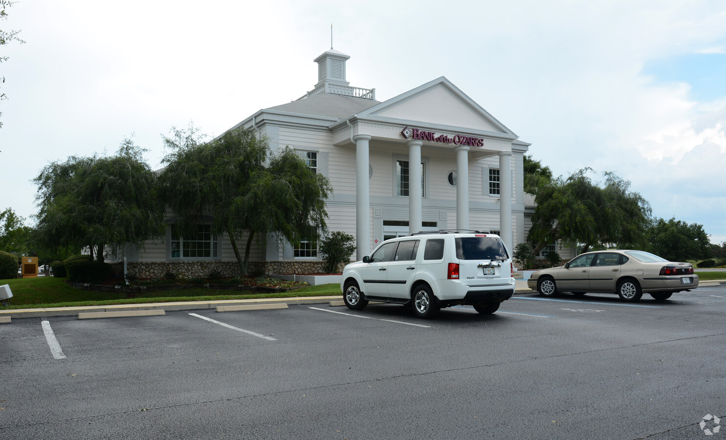
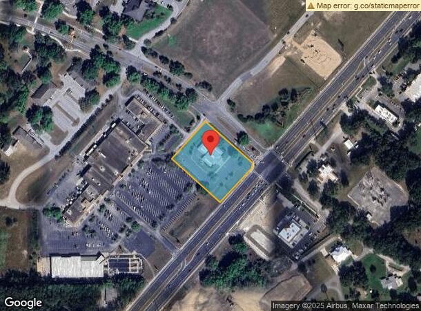
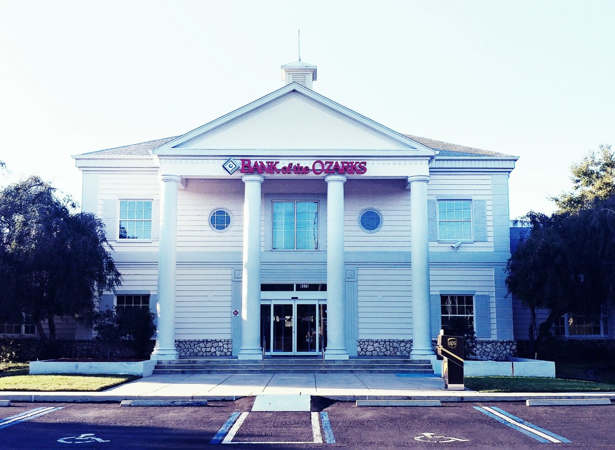
8375 Sw Highway 200, Ocala, FL 34481
NEARBY LISTINGS FOR SALE OR LEASE
Property Detail
8375 Sw Highway 200
3530-003-000
Circle Square Woods First
Financialbuilding
SEC 24 TWP 16 RGE 20 PLAT BOOK Y PAGE 088 CIRCLE SQUARE WOODS FIRST REPLAT COM AT SE COR OF SW 1/4 OF 24-16-20 N 88-51-28 E 429.11 FT TO NLY ROW LINE OF ST RD 200 TH N 41-38-27 E 510.80 FT FOR POB N 48-21-33 W 350.00 FT N 41-38-27 E 249.65 FT TO A PT
AE
Marion
12083C0684E
Florida
2023
2 AC
2023
Outlying Marion County
002610
Ocala
10,957 SF
Ocala, FL
DEMOGRAPHICS near 8375 Sw Highway 200
1 Mile
3 Mile
5 Mile
2024 Total Population
6,119
32,364
54,368
2029 Population
6,908
36,688
61,831
Pop Growth 2024-2029
+ 12.89%
+ 13.36%
+ 13.73%
Average Age
67
64
56
2024 Total Households
3,517
17,099
25,964
HH Growth 2024-2029
+ 12.91%
+ 13.26%
+ 13.55%
Median Household Inc
$46,953
$54,407
$59,207
Avg Household Size
1.70
1.90
2.10
2024 Avg HH Vehicles
1.00
1.00
2.00
Median Home Value
$152,480
$190,044
$204,667
Median Year Built
1990
1996
1999
Nearby Places
- Restaurants
- Banks
- Shops
- Fitness
- Groceries
SALE & LEASE HISTORY
LISTING DATE
SALE/LEASE

Nov 17, 2017
For Lease
Nearby Properties
Address
Land Use
TOTAL SIZE
Lot Size
Zoning
Address
Land Use
TOTAL SIZE
Lot Size
Zoning
62,253 SF
6.52 AC
PUD
Address
Land Use
TOTAL SIZE
Lot Size
Zoning
96,094 SF
13.66 AC
B2
Address
Land Use
TOTAL SIZE
Lot Size
Zoning
74,928 SF
7.80 AC
PUD
Address
Land Use
TOTAL SIZE
Lot Size
Zoning
203,356 SF
27.08 AC
B4
Address
Land Use
TOTAL SIZE
Lot Size
Zoning
28,813 SF
70.30 AC
B4
Address
Land Use
TOTAL SIZE
Lot Size
Zoning
18,035 SF
3.33 AC
B2
Address
Land Use
TOTAL SIZE
Lot Size
Zoning
88,777 SF
10.50 AC
B4
Address
Land Use
TOTAL SIZE
Lot Size
Zoning
101,312 SF
5,419.05 AC
A1
Address
Land Use
TOTAL SIZE
Lot Size
Zoning
139,728 SF
22.86 AC
B4
Address
Land Use
TOTAL SIZE
Lot Size
Zoning
43,619 SF
6.04 AC
R3
Address
Land Use
TOTAL SIZE
Lot Size
Zoning
7,677 SF
26.27 AC
B2
Address
Land Use
TOTAL SIZE
Lot Size
Zoning
98,205 SF
13.41 AC
B2
Address
Land Use
TOTAL SIZE
Lot Size
Zoning
65,060 SF
11.90 AC
B2
Address
Land Use
TOTAL SIZE
Lot Size
Zoning
69,278 SF
7.52 AC
B4
Address
Land Use
TOTAL SIZE
Lot Size
Zoning
42,159 SF
5.95 AC
B2
Address
Land Use
TOTAL SIZE
Lot Size
Zoning
42,673 SF
13.72 AC
A1
Address
Land Use
TOTAL SIZE
Lot Size
Zoning
58,381 SF
5.12 AC
R3
Address
Land Use
TOTAL SIZE
Lot Size
Zoning
68,180 SF
5.40 AC
B5
Address
Land Use
TOTAL SIZE
Lot Size
Zoning
27,563 SF
3.03 AC
B4
Address
Land Use
TOTAL SIZE
Lot Size
Zoning
47,378 SF
23.26 AC
A1
Address
Land Use
TOTAL SIZE
Lot Size
Zoning
13,943 SF
0.43 AC
B2
Address
Land Use
TOTAL SIZE
Lot Size
Zoning
286.80 AC
PUD
Address
Land Use
TOTAL SIZE
Lot Size
Zoning
27,862 SF
17.04 AC
A1
Address
Land Use
TOTAL SIZE
Lot Size
Zoning
37,213 SF
14.54 AC
A1
Address
Land Use
TOTAL SIZE
Lot Size
Zoning
41,642 SF
5.47 AC
B4
Address
Land Use
TOTAL SIZE
Lot Size
Zoning
17,428 SF
2.01 AC
B4
Address
Land Use
TOTAL SIZE
Lot Size
Zoning
20,288 SF
7.20 AC
B2
Address
Land Use
TOTAL SIZE
Lot Size
Zoning
45,364 SF
6.69 AC
B2
Address
Land Use
TOTAL SIZE
Lot Size
Zoning
16,308 SF
1.74 AC
B2
The World's #1 Commercial Real Estate Marketplace
Connect with us
© 2025 CoStar Group
The information above has been obtained from sources believed reliable. While we do not doubt its accuracy we have not verified it and make no guarantee, warranty or representation about it. It is your responsibility to independently confirm its accuracy and completeness. Any projections, opinions, assumptions, or estimates used are for example only and do not represent the current or future performance of the property. The value of this transaction to you depends on tax and other factors which should be evaluated by your tax, financial, and legal advisors. You and your advisors should conduct a careful, independent investigation of the property to determine to your satisfaction the suitability of the property for your needs.