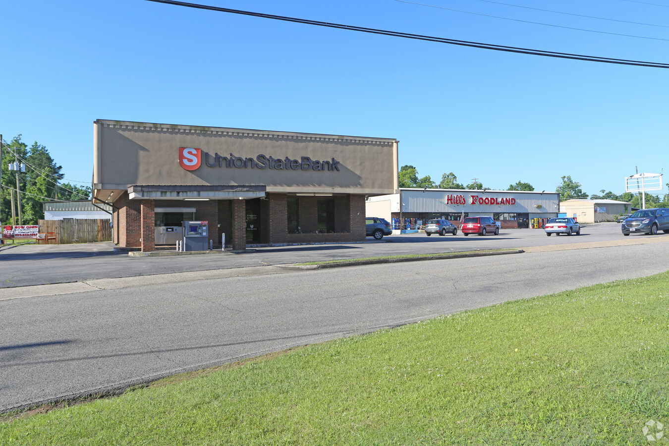
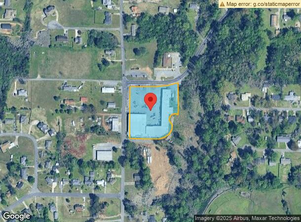
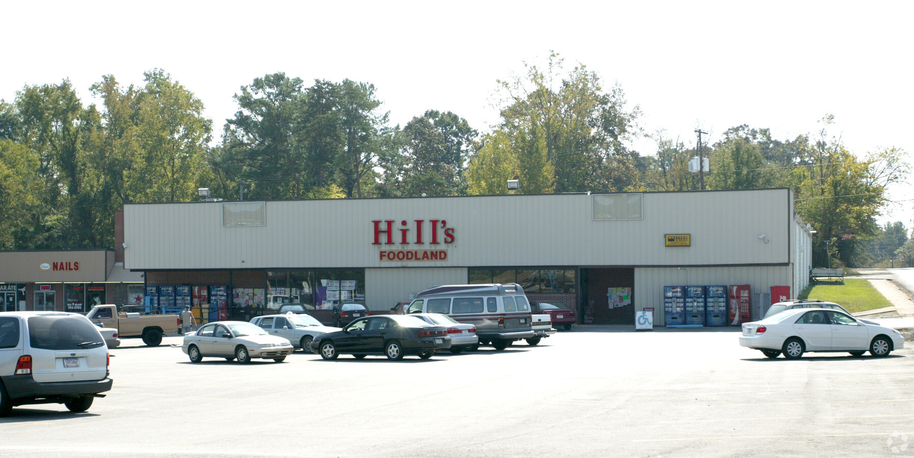
Property Record
839 Park Rd, Pleasant Grove, AL 35127
NEARBY LISTINGS FOR SALE OR LEASE
Property Detail
839 Park Rd
Birmingham-Hoover, AL
Fullers J P Res
30-00-08-1-006-007.000
LOTS 9 THRU 17 RESUR OF J P FULLERS 1ST ADD TO PLEASANT GROVE 11/38
Financialbuilding
Jefferson
X
Alabama
01073C0526G
9-17
2023
2.35 AC
2024
Bessemer
0123053013
Birmingham
41,462 SF
DEMOGRAPHICS near 839 Park Rd
1 Mile
3 Mile
5 Mile
2024 Total Population
3,959
18,077
63,565
2029 Population
3,876
17,673
62,922
Pop Growth 2024-2029
(2.10%)
(2.23%)
(1.01%)
Average Age
41
41
41
2024 Total Households
1,500
6,941
25,120
HH Growth 2024-2029
(2.07%)
(2.33%)
(1.11%)
Median Household Inc
$67,918
$60,211
$49,745
Avg Household Size
2.60
2.50
2.40
2024 Avg HH Vehicles
2.00
2.00
2.00
Median Home Value
$172,285
$156,893
$117,333
Median Year Built
1979
1978
1965
Nearby Places
- Restaurants
- Banks
- Shops
- Fitness
- Groceries
PUBLIC TRANSPORTATION
AIRPORT
Birmingham-Shuttlesworth International
DRIVE
WALK
Distance
Birmingham-Shuttlesworth International
27 min
16.2 mi
Freight Ports
Port of Mobile
DRIVE
WALK
Distance
Port of Mobile
293 min
245.8 mi
Nearby Properties
Address
Land Use
TOTAL SIZE
Lot Size
Zoning
Address
Land Use
TOTAL SIZE
Lot Size
Zoning
2,573,547 SF
112 AC
I2
Address
Land Use
TOTAL SIZE
Lot Size
Zoning
195,495 SF
28.97 AC
B3
Address
Land Use
TOTAL SIZE
Lot Size
Zoning
110,770 SF
7.20 AC
R3
Address
Land Use
TOTAL SIZE
Lot Size
Zoning
218,210 SF
11.24 AC
CM-2
Address
Land Use
TOTAL SIZE
Lot Size
Zoning
58,822 SF
7.80 AC
B3
Address
Land Use
TOTAL SIZE
Lot Size
Zoning
66,935 SF
1.99 AC
B2
Address
Land Use
TOTAL SIZE
Lot Size
Zoning
69,344 SF
2.30 AC
B-1
Address
Land Use
TOTAL SIZE
Lot Size
Zoning
1,437,077 SF
I2
Address
Land Use
TOTAL SIZE
Lot Size
Zoning
80,043 SF
10.89 AC
B3-C
Address
Land Use
TOTAL SIZE
Lot Size
Zoning
94,026 SF
4.90 AC
I2R2
Address
Land Use
TOTAL SIZE
Lot Size
Zoning
49,022 SF
5.50 AC
R2
Address
Land Use
TOTAL SIZE
Lot Size
Zoning
1,244,986 SF
I2
Address
Land Use
TOTAL SIZE
Lot Size
Zoning
52,810 SF
3.44 AC
B-3
Address
Land Use
TOTAL SIZE
Lot Size
Zoning
130,563 SF
I3
Address
Land Use
TOTAL SIZE
Lot Size
Zoning
62,918 SF
3.59 AC
R2-R
Address
Land Use
TOTAL SIZE
Lot Size
Zoning
26,234 SF
3.30 AC
B2
Address
Land Use
TOTAL SIZE
Lot Size
Zoning
36,546 SF
6.30 AC
R3
Address
Land Use
TOTAL SIZE
Lot Size
Zoning
114,890 SF
5.95 AC
M1
Address
Land Use
TOTAL SIZE
Lot Size
Zoning
10,578 SF
2.93 AC
B-3
Address
Land Use
TOTAL SIZE
Lot Size
Zoning
46,105 SF
1.83 AC
R-5
Address
Land Use
TOTAL SIZE
Lot Size
Zoning
38,636 SF
1.63 AC
R-5
Address
Land Use
TOTAL SIZE
Lot Size
Zoning
34,491 SF
5.75 AC
B2-M
Address
Land Use
TOTAL SIZE
Lot Size
Zoning
17,678 SF
5.72 AC
B-3
Address
Land Use
TOTAL SIZE
Lot Size
Zoning
30,332 SF
2.34 AC
B-2
Address
Land Use
TOTAL SIZE
Lot Size
Zoning
47,232 SF
1.09 AC
B2-R
Address
Land Use
TOTAL SIZE
Lot Size
Zoning
27,635 SF
3.70 AC
R1-R
Address
Land Use
TOTAL SIZE
Lot Size
Zoning
14,296 SF
2.67 AC
B-1
Address
Land Use
TOTAL SIZE
Lot Size
Zoning
21,468 SF
1.31 AC
R-5
Address
Land Use
TOTAL SIZE
Lot Size
Zoning
5,484 SF
148 AC
I2
Address
Land Use
TOTAL SIZE
Lot Size
Zoning
7,070 SF
0.74 AC
The World's #1 Commercial Real Estate Marketplace
Connect with us
© 2025 CoStar Group
The information above has been obtained from sources believed reliable. While we do not doubt its accuracy we have not verified it and make no guarantee, warranty or representation about it. It is your responsibility to independently confirm its accuracy and completeness. Any projections, opinions, assumptions, or estimates used are for example only and do not represent the current or future performance of the property. The value of this transaction to you depends on tax and other factors which should be evaluated by your tax, financial, and legal advisors. You and your advisors should conduct a careful, independent investigation of the property to determine to your satisfaction the suitability of the property for your needs.