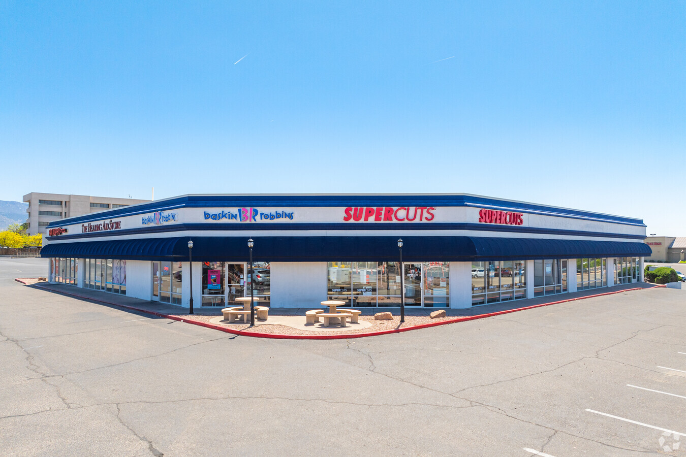
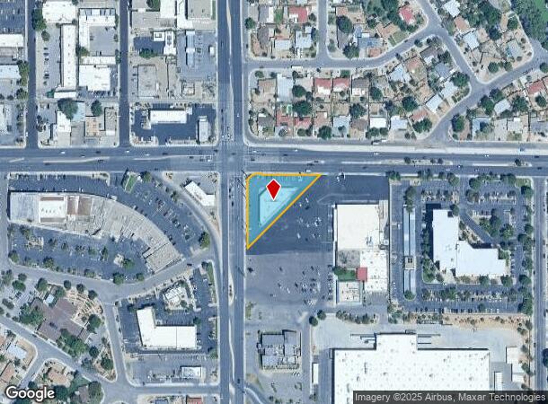
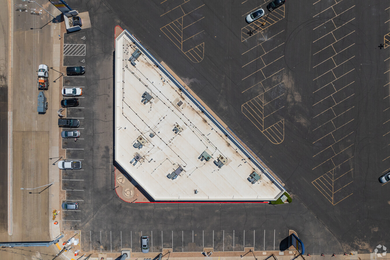
Property Record
8400 Menaul Blvd Ne, Albuquerque, NM 87112
NEARBY LISTINGS FOR SALE OR LEASE
Property Detail
8400 Menaul Blvd Ne
Albuquerque, NM
Land Division
1-020-059-013249-3-13-39
LT 1 LAND DIVISION PLAT OF TRACTS A AND B OF UNCLE DOC ADDITION NO 1 (EXC NW PORT OF LT 1 OUT TO R/W) CONT .6200 AC
Storebuilding
Bernalillo
X
New Mexico
35001C0356H
1
2024
0.62 AC
2024
Northeast Heights
000121
Albuquerque
8,676 SF
DEMOGRAPHICS near 8400 Menaul Blvd Ne
1 Mile
3 Mile
5 Mile
2024 Total Population
16,900
153,217
309,531
2029 Population
17,010
153,465
310,387
Pop Growth 2024-2029
+ 0.65%
+ 0.16%
+ 0.28%
Average Age
43
42
42
2024 Total Households
7,657
69,470
139,939
HH Growth 2024-2029
+ 0.64%
+ 0.15%
+ 0.25%
Median Household Inc
$52,573
$53,832
$56,807
Avg Household Size
2.10
2.10
2.10
2024 Avg HH Vehicles
2.00
2.00
2.00
Median Home Value
$238,327
$236,484
$268,148
Median Year Built
1964
1971
1975
Nearby Places
- Restaurants
- Banks
- Shops
- Fitness
- Groceries
PUBLIC TRANSPORTATION
COMMUTER RAIL
Montaño Station (NMRX - Rio Metro Regional Transit District)
DRIVE
WALK
Distance
Montaño Station (NMRX - Rio Metro Regional Transit District)
14 min
6.5 mi
Downtown Albuquerque (Rail Runner Express - New Mexico Rail Runner Express)
DRIVE
WALK
Distance
Downtown Albuquerque (Rail Runner Express - New Mexico Rail Runner Express)
14 min
7.7 mi
AIRPORT
Albuquerque International Sunport
DRIVE
WALK
Distance
Albuquerque International Sunport
21 min
8.2 mi
Freight Ports
Tulsa Port Of Catoosa
DRIVE
WALK
Distance
Tulsa Port Of Catoosa
684 min
658.0 mi
Nearby Properties
Address
Land Use
TOTAL SIZE
Lot Size
Zoning
Address
Land Use
TOTAL SIZE
Lot Size
Zoning
254,392 SF
40.71 AC
Address
Land Use
TOTAL SIZE
Lot Size
Zoning
264,043 SF
61.17 AC
Address
Land Use
TOTAL SIZE
Lot Size
Zoning
231,258 SF
18.90 AC
Address
Land Use
TOTAL SIZE
Lot Size
Zoning
7,100 SF
19 AC
Address
Land Use
TOTAL SIZE
Lot Size
Zoning
26.76 AC
Address
Land Use
TOTAL SIZE
Lot Size
Zoning
15,610 SF
17.67 AC
Address
Land Use
TOTAL SIZE
Lot Size
Zoning
249,387 SF
16.89 AC
Address
Land Use
TOTAL SIZE
Lot Size
Zoning
326,965 SF
51.32 AC
Address
Land Use
TOTAL SIZE
Lot Size
Zoning
424,854 SF
20.23 AC
Address
Land Use
TOTAL SIZE
Lot Size
Zoning
293,896 SF
52.96 AC
Address
Land Use
TOTAL SIZE
Lot Size
Zoning
47,232 SF
15.93 AC
Address
Land Use
TOTAL SIZE
Lot Size
Zoning
59,072 SF
17.86 AC
Address
Land Use
TOTAL SIZE
Lot Size
Zoning
37,771 SF
7.71 AC
Address
Land Use
TOTAL SIZE
Lot Size
Zoning
53,200 SF
21.77 AC
Address
Land Use
TOTAL SIZE
Lot Size
Zoning
315,942 SF
7.41 AC
Address
Land Use
TOTAL SIZE
Lot Size
Zoning
347,805 SF
4.17 AC
Address
Land Use
TOTAL SIZE
Lot Size
Zoning
100,000 SF
202.08 AC
Address
Land Use
TOTAL SIZE
Lot Size
Zoning
211,688 SF
5.68 AC
Address
Land Use
TOTAL SIZE
Lot Size
Zoning
200,652 SF
1.95 AC
Address
Land Use
TOTAL SIZE
Lot Size
Zoning
35,757 SF
10.16 AC
Address
Land Use
TOTAL SIZE
Lot Size
Zoning
182,490 SF
1.85 AC
Address
Land Use
TOTAL SIZE
Lot Size
Zoning
176,357 SF
10.02 AC
Address
Land Use
TOTAL SIZE
Lot Size
Zoning
20,999 SF
6.53 AC
Address
Land Use
TOTAL SIZE
Lot Size
Zoning
14.40 AC
Address
Land Use
TOTAL SIZE
Lot Size
Zoning
127,980 SF
17.72 AC
Address
Land Use
TOTAL SIZE
Lot Size
Zoning
31,022 SF
8.25 AC
Address
Land Use
TOTAL SIZE
Lot Size
Zoning
268,982 SF
16.77 AC
Address
Land Use
TOTAL SIZE
Lot Size
Zoning
34.62 AC
Address
Land Use
TOTAL SIZE
Lot Size
Zoning
219,132 SF
3.27 AC
Address
Land Use
TOTAL SIZE
Lot Size
Zoning
212,280 SF
14.79 AC
The World's #1 Commercial Real Estate Marketplace
Connect with us
© 2025 CoStar Group
The information above has been obtained from sources believed reliable. While we do not doubt its accuracy we have not verified it and make no guarantee, warranty or representation about it. It is your responsibility to independently confirm its accuracy and completeness. Any projections, opinions, assumptions, or estimates used are for example only and do not represent the current or future performance of the property. The value of this transaction to you depends on tax and other factors which should be evaluated by your tax, financial, and legal advisors. You and your advisors should conduct a careful, independent investigation of the property to determine to your satisfaction the suitability of the property for your needs.