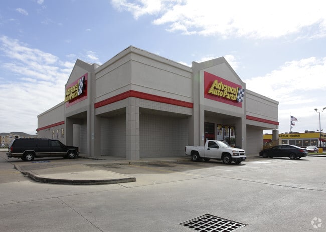
Property Record
8407 Highway 6 S, Houston, TX 77083


NEARBY LISTINGS FOR SALE OR LEASE
Property Detail
8407 Highway 6 S
1192050010001
Beechnut S E
Storebuilding
RES A BLK 1 BEECHNUT S E
X
Harris
48157C0135L
Texas
2024
1.10 AC
2025
Sugar Land
453901
Houston
11,200 SF
Houston-The Woodlands-Sugar Land, TX
DEMOGRAPHICS near 8407 Highway 6 S
1 Mile
3 Mile
5 Mile
2024 Total Population
19,773
173,061
390,064
2029 Population
21,320
187,800
423,937
Pop Growth 2024-2029
+ 7.82%
+ 8.52%
+ 8.68%
Average Age
39
37
37
2024 Total Households
6,089
54,280
132,259
HH Growth 2024-2029
+ 7.80%
+ 8.30%
+ 8.34%
Median Household Inc
$67,976
$58,369
$60,531
Avg Household Size
3.10
3.10
2.90
2024 Avg HH Vehicles
2.00
2.00
2.00
Median Home Value
$216,809
$190,221
$226,003
Median Year Built
1989
1988
1989
Nearby Places
Map Layers
Map Styles
 Street
 Aerial
- Restaurants
- Banks
- Shops
- Fitness
- Groceries
PUBLIC TRANSPORTATION
AIRPORT
William P Hobby
DRIVE
WALK
Distance
William P Hobby
45 min
28.6 mi
George Bush Intcntl/Houston
DRIVE
WALK
Distance
George Bush Intcntl/Houston
48 min
38.5 mi
SALE & LEASE HISTORY
LISTING DATE
SALE/LEASE

Oct 21, 2016
For Sale
Oct 21, 2016
For Sale
Mar 28, 2022
For Sale
Apr 01, 2019
For Sale
Nearby Properties
Address
Land Use
TOTAL SIZE
Lot Size
Zoning
Address
Land Use
TOTAL SIZE
Lot Size
Zoning
1,376,776 SF
113.43 AC
Address
Land Use
TOTAL SIZE
Lot Size
Zoning
403,080 SF
19.17 AC
Address
Land Use
TOTAL SIZE
Lot Size
Zoning
94,547 SF
13.59 AC
Address
Land Use
TOTAL SIZE
Lot Size
Zoning
14.01 AC
Address
Land Use
TOTAL SIZE
Lot Size
Zoning
104,287 SF
13.56 AC
M
Address
Land Use
TOTAL SIZE
Lot Size
Zoning
88,705 SF
17.04 AC
SY
Address
Land Use
TOTAL SIZE
Lot Size
Zoning
126,308 SF
16.95 AC
Address
Land Use
TOTAL SIZE
Lot Size
Zoning
12.38 AC
Address
Land Use
TOTAL SIZE
Lot Size
Zoning
526,945 SF
23.05 AC
Address
Land Use
TOTAL SIZE
Lot Size
Zoning
363,177 SF
36.37 AC
YOS
Address
Land Use
TOTAL SIZE
Lot Size
Zoning
690,119 SF
23 AC
Address
Land Use
TOTAL SIZE
Lot Size
Zoning
364,571 SF
19.23 AC
Address
Land Use
TOTAL SIZE
Lot Size
Zoning
286,285 SF
11.78 AC
Address
Land Use
TOTAL SIZE
Lot Size
Zoning
443,209 SF
25.13 AC
Address
Land Use
TOTAL SIZE
Lot Size
Zoning
332,872 SF
13 AC
Address
Land Use
TOTAL SIZE
Lot Size
Zoning
300,014 SF
14.13 AC
Address
Land Use
TOTAL SIZE
Lot Size
Zoning
396,100 SF
18.02 AC
Address
Land Use
TOTAL SIZE
Lot Size
Zoning
459,199 SF
15.74 AC
Address
Land Use
TOTAL SIZE
Lot Size
Zoning
351,177 SF
15.81 AC
Address
Land Use
TOTAL SIZE
Lot Size
Zoning
205,950 SF
8.50 AC
Address
Land Use
TOTAL SIZE
Lot Size
Zoning
158,975 SF
46.38 AC
YQ
Address
Land Use
TOTAL SIZE
Lot Size
Zoning
206,121 SF
23.28 AC
Address
Land Use
TOTAL SIZE
Lot Size
Zoning
311,010 SF
12.36 AC
Address
Land Use
TOTAL SIZE
Lot Size
Zoning
330,612 SF
13.41 AC
Address
Land Use
TOTAL SIZE
Lot Size
Zoning
181,840 SF
4.53 AC
Address
Land Use
TOTAL SIZE
Lot Size
Zoning
153,222 SF
15 AC
M
Address
Land Use
TOTAL SIZE
Lot Size
Zoning
11.73 AC
XT
Address
Land Use
TOTAL SIZE
Lot Size
Zoning
Address
Land Use
TOTAL SIZE
Lot Size
Zoning
185,225 SF
22.43 AC
Address
Land Use
TOTAL SIZE
Lot Size
Zoning
149,580 SF
12.81 AC
The World's #1 Commercial Real Estate Marketplace
Connect with us
© 2025 CoStar Group
The information above has been obtained from sources believed reliable. While we do not doubt its accuracy we have not verified it and make no guarantee, warranty or representation about it. It is your responsibility to independently confirm its accuracy and completeness. Any projections, opinions, assumptions, or estimates used are for example only and do not represent the current or future performance of the property. The value of this transaction to you depends on tax and other factors which should be evaluated by your tax, financial, and legal advisors. You and your advisors should conduct a careful, independent investigation of the property to determine to your satisfaction the suitability of the property for your needs.