Property Record
8411 Fm 1960 Rd W, Humble, TX 77338


NEARBY LISTINGS FOR SALE OR LEASE
Property Detail
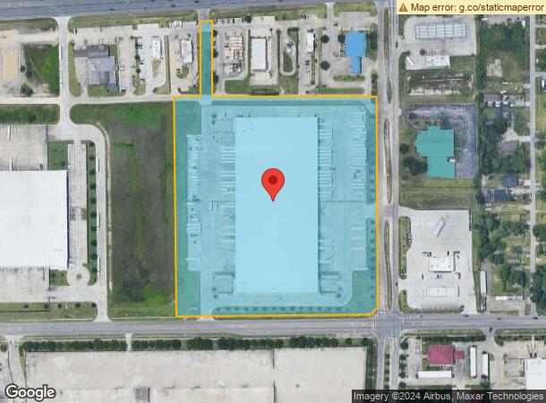
8411 Fm 1960 Rd W
1361170010004
Walhof Global Logisitics Center
Warehouse
RES A3 BLK 1 WALHOF GLOBAL LOGISITICS CENTER
X
Harris
48339C0725G
Texas
2023
14.79 AC
2023
North Hardy Toll Road
2415013023
Houston
205,400 SF
Houston-The Woodlands-Sugar Land, TX
DEMOGRAPHICS near 8411 Fm 1960 Rd W
1 Mile
3 Mile
5 Mile
2024 Total Population
8,619
40,383
101,959
2029 Population
8,816
41,158
105,008
Pop Growth 2024-2029
+ 2.29%
+ 1.92%
+ 2.99%
Average Age
36
35
35
2024 Total Households
2,946
13,534
34,313
HH Growth 2024-2029
+ 2.31%
+ 1.87%
+ 3.42%
Median Household Inc
$71,818
$63,588
$60,955
Avg Household Size
2.80
2.90
2.90
2024 Avg HH Vehicles
2.00
2.00
2.00
Median Home Value
$161,131
$169,210
$174,212
Median Year Built
2000
1996
1995
Nearby Places
- Restaurants
- Banks
- Shops
- Fitness
- Groceries
PUBLIC TRANSPORTATION
AIRPORT
George Bush Intcntl/Houston
DRIVE
WALK
Distance
George Bush Intcntl/Houston
13 min
6.6 mi
William P Hobby
DRIVE
WALK
Distance
William P Hobby
48 min
31.7 mi
Freight Ports
Port of Houston
DRIVE
WALK
Distance
Port of Houston
37 min
25.4 mi
SALE & LEASE HISTORY
LISTING DATE
SALE/LEASE

Sep 25, 2016
For Lease
Mar 30, 2023
For Lease
Feb 20, 2020
For Lease
Nearby Properties
Address
Land Use
TOTAL SIZE
Lot Size
Zoning
Address
Land Use
TOTAL SIZE
Lot Size
Zoning
687,195 SF
33.75 AC
Address
Land Use
TOTAL SIZE
Lot Size
Zoning
685,400 SF
38.82 AC
Address
Land Use
TOTAL SIZE
Lot Size
Zoning
514,500 SF
40.84 AC
Address
Land Use
TOTAL SIZE
Lot Size
Zoning
432,617 SF
19.41 AC
Address
Land Use
TOTAL SIZE
Lot Size
Zoning
429,750 SF
24.74 AC
Address
Land Use
TOTAL SIZE
Lot Size
Zoning
421,211 SF
32.42 AC
Address
Land Use
TOTAL SIZE
Lot Size
Zoning
235,236 SF
15.14 AC
Address
Land Use
TOTAL SIZE
Lot Size
Zoning
216,978 SF
10.99 AC
Address
Land Use
TOTAL SIZE
Lot Size
Zoning
205,040 SF
10.51 AC
Address
Land Use
TOTAL SIZE
Lot Size
Zoning
334,510 SF
23.54 AC
Address
Land Use
TOTAL SIZE
Lot Size
Zoning
320,200 SF
19.56 AC
Address
Land Use
TOTAL SIZE
Lot Size
Zoning
309,744 SF
21.50 AC
Address
Land Use
TOTAL SIZE
Lot Size
Zoning
276,464 SF
18.79 AC
Address
Land Use
TOTAL SIZE
Lot Size
Zoning
196,468 SF
9.51 AC
Address
Land Use
TOTAL SIZE
Lot Size
Zoning
252,320 SF
22.14 AC
Address
Land Use
TOTAL SIZE
Lot Size
Zoning
199,368 SF
8.16 AC
Address
Land Use
TOTAL SIZE
Lot Size
Zoning
242,788 SF
14.72 AC
Address
Land Use
TOTAL SIZE
Lot Size
Zoning
4,536 SF
0.41 AC
Address
Land Use
TOTAL SIZE
Lot Size
Zoning
213,292 SF
9.81 AC
Address
Land Use
TOTAL SIZE
Lot Size
Zoning
300,062 SF
14.77 AC
Address
Land Use
TOTAL SIZE
Lot Size
Zoning
165,737 SF
14 AC
Address
Land Use
TOTAL SIZE
Lot Size
Zoning
102,374 SF
13.48 AC
Address
Land Use
TOTAL SIZE
Lot Size
Zoning
56,344 SF
3.24 AC
Address
Land Use
TOTAL SIZE
Lot Size
Zoning
98,124 SF
7.58 AC
Address
Land Use
TOTAL SIZE
Lot Size
Zoning
133,700 SF
12.82 AC
Address
Land Use
TOTAL SIZE
Lot Size
Zoning
207,432 SF
15.12 AC
Address
Land Use
TOTAL SIZE
Lot Size
Zoning
64,980 SF
4.19 AC
Address
Land Use
TOTAL SIZE
Lot Size
Zoning
156,756 SF
17.05 AC
Address
Land Use
TOTAL SIZE
Lot Size
Zoning
198,376 SF
12.40 AC
The World's #1 Commercial Real Estate Marketplace
Connect with us
© 2025 CoStar Group
The information above has been obtained from sources believed reliable. While we do not doubt its accuracy we have not verified it and make no guarantee, warranty or representation about it. It is your responsibility to independently confirm its accuracy and completeness. Any projections, opinions, assumptions, or estimates used are for example only and do not represent the current or future performance of the property. The value of this transaction to you depends on tax and other factors which should be evaluated by your tax, financial, and legal advisors. You and your advisors should conduct a careful, independent investigation of the property to determine to your satisfaction the suitability of the property for your needs.