Property Record
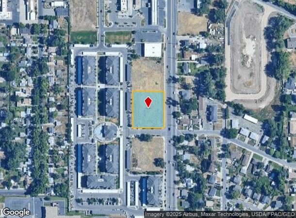
8426 W Washakie Ln W, Magna, UT 84044
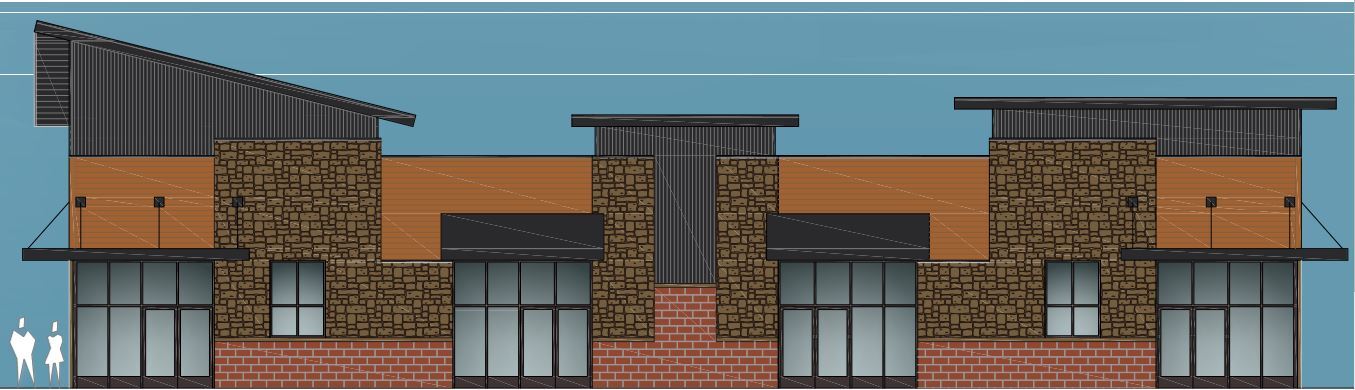
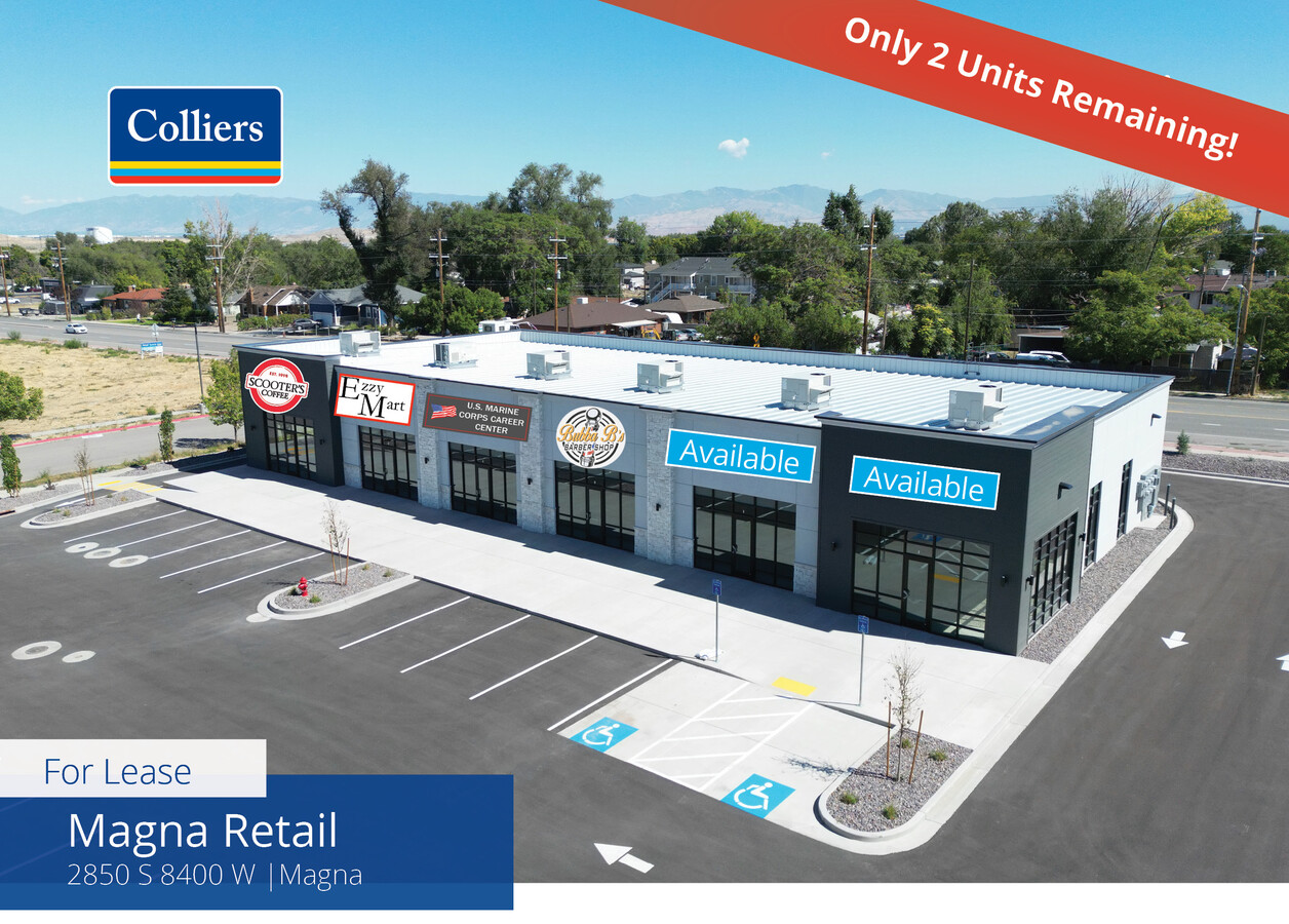
Current Lease Availabilities
NEARBY LISTINGS FOR SALE OR LEASE
Property Detail
8426 W Washakie Ln W
Salt Lake City, UT
Flangas Crossing Pud Sub
14-29-127-042-0000
LOT 3, FLANGAS CROSSING P.U.D. LESS & EXCEPT BEG S 01135 W 781.09 FT & N 894825 W 53 FT FR N 1/4 COR SEC 29, T1S, R2W, SLM; S 01135 W 73.92 FT; NWLY ALG A 9.50 FT RADIUS CURVE TO L 11.83 FT (CHD 540936 W); N 01135 E 61 FT; NLY ALG A 9.50 FT RADIUS CU
Commercialacreage
Salt Lake
X
Utah
49035C0275G
3
2023
0.99 AC
2023
West Valley/Lake Park
113906
Salt Lake City
DEMOGRAPHICS near 8426 W Washakie Ln W
1 Mile
3 Mile
5 Mile
2024 Total Population
14,656
45,646
81,935
2029 Population
14,815
45,880
82,311
Pop Growth 2024-2029
+ 1.08%
+ 0.51%
+ 0.46%
Average Age
34
34
35
2024 Total Households
4,459
12,785
22,492
HH Growth 2024-2029
+ 0.92%
+ 0.38%
+ 0.32%
Median Household Inc
$65,188
$77,492
$82,191
Avg Household Size
3.30
3.50
3.50
2024 Avg HH Vehicles
2.00
2.00
3.00
Median Home Value
$309,975
$332,442
$341,764
Median Year Built
1980
1987
1986
Nearby Places
- Restaurants
- Banks
- Shops
- Fitness
- Groceries
PUBLIC TRANSPORTATION
AIRPORT
Salt Lake City International
DRIVE
WALK
Distance
Salt Lake City International
15 min
10.4 mi
Freight Ports
Port of Stockton
DRIVE
WALK
Distance
Port of Stockton
700 min
685.7 mi
Nearby Properties
Address
Land Use
TOTAL SIZE
Lot Size
Zoning
Address
Land Use
TOTAL SIZE
Lot Size
Zoning
832,383 SF
19.61 AC
IP-M
Address
Land Use
TOTAL SIZE
Lot Size
Zoning
634,402 SF
32.29 AC
IP-M
Address
Land Use
TOTAL SIZE
Lot Size
Zoning
89,037 SF
11.79 AC
C-2
Address
Land Use
TOTAL SIZE
Lot Size
Zoning
404,800 SF
24.62 AC
M
Address
Land Use
TOTAL SIZE
Lot Size
Zoning
480,159 SF
56.52 AC
M-1
Address
Land Use
TOTAL SIZE
Lot Size
Zoning
496,431 SF
23.89 AC
IP-M
Address
Land Use
TOTAL SIZE
Lot Size
Zoning
231,694 SF
20.73 AC
1206
Address
Land Use
TOTAL SIZE
Lot Size
Zoning
159,381 SF
18.82 AC
1106
Address
Land Use
TOTAL SIZE
Lot Size
Zoning
374,120 SF
22.16 AC
IP-M
Address
Land Use
TOTAL SIZE
Lot Size
Zoning
418,984 SF
21.65 AC
IP-M
Address
Land Use
TOTAL SIZE
Lot Size
Zoning
746,986 SF
782.87 AC
A-20
Address
Land Use
TOTAL SIZE
Lot Size
Zoning
58,759 SF
9.82 AC
RM/ZC
Address
Land Use
TOTAL SIZE
Lot Size
Zoning
99,064 SF
5.65 AC
1P-M
Address
Land Use
TOTAL SIZE
Lot Size
Zoning
328,000 SF
18.04 AC
IP-M
Address
Land Use
TOTAL SIZE
Lot Size
Zoning
319,200 SF
18.64 AC
M
Address
Land Use
TOTAL SIZE
Lot Size
Zoning
183,638 SF
17.27 AC
1206
Address
Land Use
TOTAL SIZE
Lot Size
Zoning
158 AC
IP-M-1
Address
Land Use
TOTAL SIZE
Lot Size
Zoning
134,526 SF
622.03 AC
3000
Address
Land Use
TOTAL SIZE
Lot Size
Zoning
214,385 SF
20.58 AC
M
Address
Land Use
TOTAL SIZE
Lot Size
Zoning
143.12 AC
IP-M-1
Address
Land Use
TOTAL SIZE
Lot Size
Zoning
442,273 SF
13.13 AC
P-C
Address
Land Use
TOTAL SIZE
Lot Size
Zoning
640 AC
M-2
Address
Land Use
TOTAL SIZE
Lot Size
Zoning
640 AC
M-2
Address
Land Use
TOTAL SIZE
Lot Size
Zoning
640 AC
M-2
Address
Land Use
TOTAL SIZE
Lot Size
Zoning
379,627 SF
355 AC
3000
Address
Land Use
TOTAL SIZE
Lot Size
Zoning
126,060 SF
7.35 AC
1P-M
Address
Land Use
TOTAL SIZE
Lot Size
Zoning
126,060 SF
7.01 AC
1P-M
Address
Land Use
TOTAL SIZE
Lot Size
Zoning
565.36 AC
M-2
Address
Land Use
TOTAL SIZE
Lot Size
Zoning
120,163 SF
6.69 AC
IP-M
Address
Land Use
TOTAL SIZE
Lot Size
Zoning
80,373 SF
12.68 AC
1107
The World's #1 Commercial Real Estate Marketplace
Connect with us
© 2025 CoStar Group
The information above has been obtained from sources believed reliable. While we do not doubt its accuracy we have not verified it and make no guarantee, warranty or representation about it. It is your responsibility to independently confirm its accuracy and completeness. Any projections, opinions, assumptions, or estimates used are for example only and do not represent the current or future performance of the property. The value of this transaction to you depends on tax and other factors which should be evaluated by your tax, financial, and legal advisors. You and your advisors should conduct a careful, independent investigation of the property to determine to your satisfaction the suitability of the property for your needs.