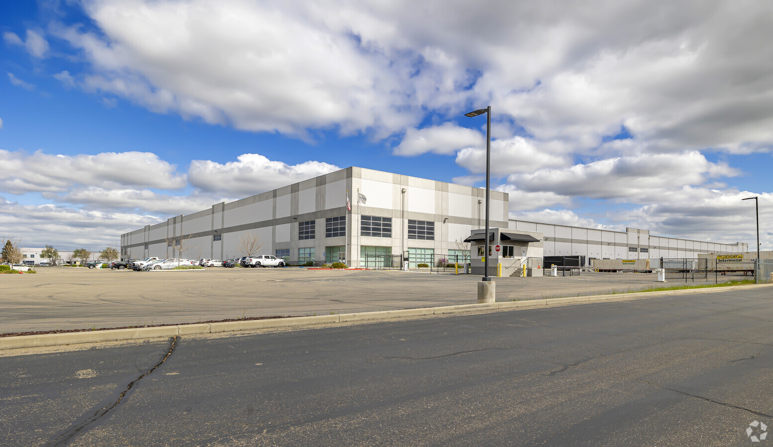
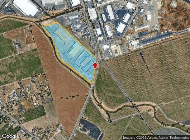
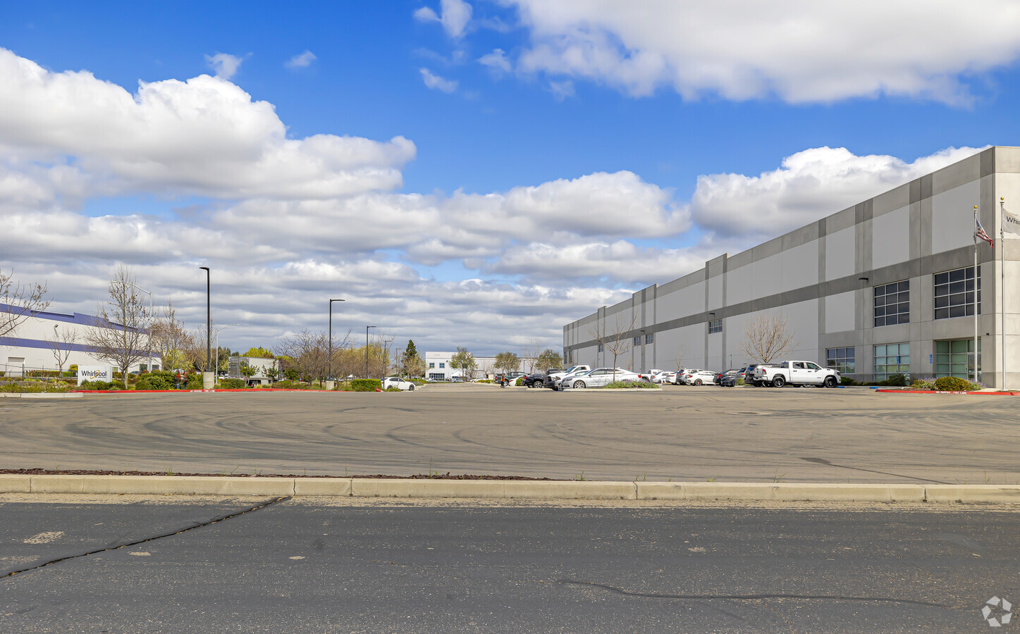
Property Record
8441 S Airport Way, Stockton, CA 95206
NEARBY LISTINGS FOR SALE OR LEASE
Property Detail
8441 S Airport Way
177-050-32
San Joaquin
Lightindustrial
California
AO
47.71 AC
06077C0470F
SE Stockton
2024
Stockton/Modesto
2024
Stockton-Lodi, CA
003803
DEMOGRAPHICS near 8441 S Airport Way
1 Mile
3 Mile
5 Mile
2024 Total Population
211
23,054
131,654
2029 Population
217
24,233
138,337
Pop Growth 2024-2029
+ 2.84%
+ 5.11%
+ 5.08%
Average Age
39
36
36
2024 Total Households
66
5,397
35,042
HH Growth 2024-2029
+ 3.03%
+ 5.45%
+ 5.21%
Median Household Inc
$96,874
$68,549
$67,538
Avg Household Size
3.10
3.70
3.50
2024 Avg HH Vehicles
3.00
2.00
2.00
Median Home Value
$761,363
$361,008
$382,761
Median Year Built
1974
1996
1989
Nearby Places
- Restaurants
- Banks
- Shops
- Fitness
- Groceries
PUBLIC TRANSPORTATION
COMMUTER RAIL
Stockton (San Joaquins - Amtrak)
DRIVE
WALK
Distance
Stockton (San Joaquins - Amtrak)
12 min
6.5 mi
Stockton (Altamont Corridor Express - Altamont Commuter Express (ACE))
DRIVE
WALK
Distance
Stockton (Altamont Corridor Express - Altamont Commuter Express (ACE))
13 min
7.0 mi
AIRPORT
Stockton Metro
DRIVE
WALK
Distance
Stockton Metro
5 min
2.5 mi
Freight Ports
Port of Stockton
DRIVE
WALK
Distance
Port of Stockton
14 min
9.1 mi
SALE & LEASE HISTORY
LISTING DATE
SALE/LEASE

Feb 17, 2022
For Lease
Nearby Properties
Address
Land Use
TOTAL SIZE
Lot Size
Zoning
Address
Land Use
TOTAL SIZE
Lot Size
Zoning
615,440 SF
76.23 AC
IG
Address
Land Use
TOTAL SIZE
Lot Size
Zoning
24,846 SF
66.15 AC
Address
Land Use
TOTAL SIZE
Lot Size
Zoning
600 SF
19.12 AC
Address
Land Use
TOTAL SIZE
Lot Size
Zoning
746,790 SF
39.23 AC
M2
Address
Land Use
TOTAL SIZE
Lot Size
Zoning
824,735 SF
52.87 AC
Address
Land Use
TOTAL SIZE
Lot Size
Zoning
Address
Land Use
TOTAL SIZE
Lot Size
Zoning
745,640 SF
41.63 AC
Address
Land Use
TOTAL SIZE
Lot Size
Zoning
326,934 SF
56.52 AC
IG
Address
Land Use
TOTAL SIZE
Lot Size
Zoning
545,832 SF
29.07 AC
Address
Land Use
TOTAL SIZE
Lot Size
Zoning
574,560 SF
32.34 AC
Address
Land Use
TOTAL SIZE
Lot Size
Zoning
511,718 SF
21.18 AC
Address
Land Use
TOTAL SIZE
Lot Size
Zoning
Address
Land Use
TOTAL SIZE
Lot Size
Zoning
434,900 SF
17.05 AC
Address
Land Use
TOTAL SIZE
Lot Size
Zoning
512,000 SF
20.16 AC
Address
Land Use
TOTAL SIZE
Lot Size
Zoning
521,500 SF
12.06 AC
Address
Land Use
TOTAL SIZE
Lot Size
Zoning
513,778 SF
11.88 AC
Address
Land Use
TOTAL SIZE
Lot Size
Zoning
436,800 SF
21.71 AC
Address
Land Use
TOTAL SIZE
Lot Size
Zoning
586,610 SF
27.36 AC
Address
Land Use
TOTAL SIZE
Lot Size
Zoning
522,400 SF
23.72 AC
Address
Land Use
TOTAL SIZE
Lot Size
Zoning
350,892 SF
20.34 AC
Address
Land Use
TOTAL SIZE
Lot Size
Zoning
452,000 SF
20.42 AC
Address
Land Use
TOTAL SIZE
Lot Size
Zoning
164,000 SF
7.62 AC
Address
Land Use
TOTAL SIZE
Lot Size
Zoning
24.30 AC
Address
Land Use
TOTAL SIZE
Lot Size
Zoning
171,900 SF
11.43 AC
Address
Land Use
TOTAL SIZE
Lot Size
Zoning
404,657 SF
24.89 AC
AG40
Address
Land Use
TOTAL SIZE
Lot Size
Zoning
42,267 SF
10.53 AC
Address
Land Use
TOTAL SIZE
Lot Size
Zoning
2,600 SF
129.97 AC
IG
Address
Land Use
TOTAL SIZE
Lot Size
Zoning
223,470 SF
21.05 AC
The World's #1 Commercial Real Estate Marketplace
Connect with us
© 2025 CoStar Group
The information above has been obtained from sources believed reliable. While we do not doubt its accuracy we have not verified it and make no guarantee, warranty or representation about it. It is your responsibility to independently confirm its accuracy and completeness. Any projections, opinions, assumptions, or estimates used are for example only and do not represent the current or future performance of the property. The value of this transaction to you depends on tax and other factors which should be evaluated by your tax, financial, and legal advisors. You and your advisors should conduct a careful, independent investigation of the property to determine to your satisfaction the suitability of the property for your needs.