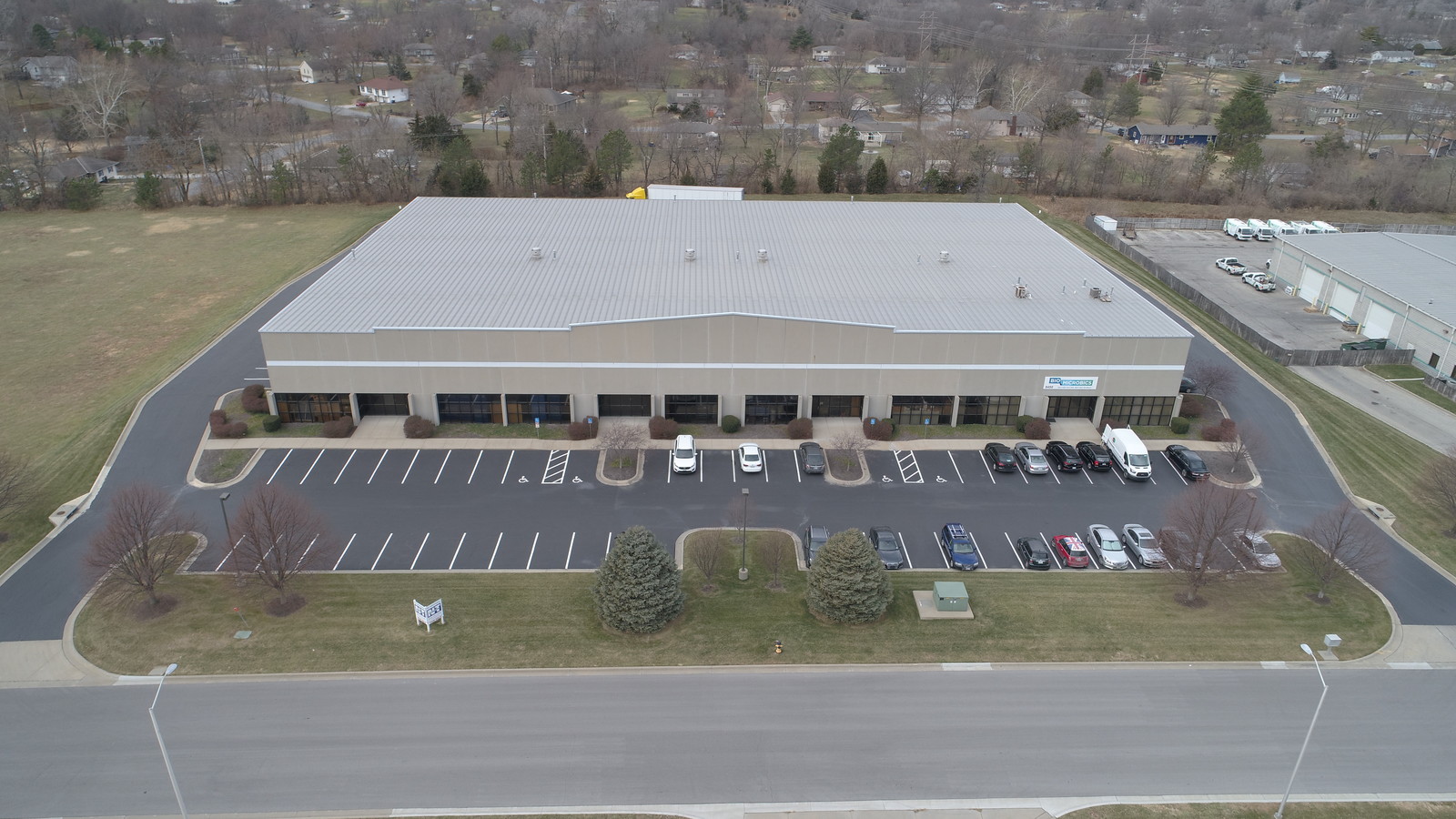
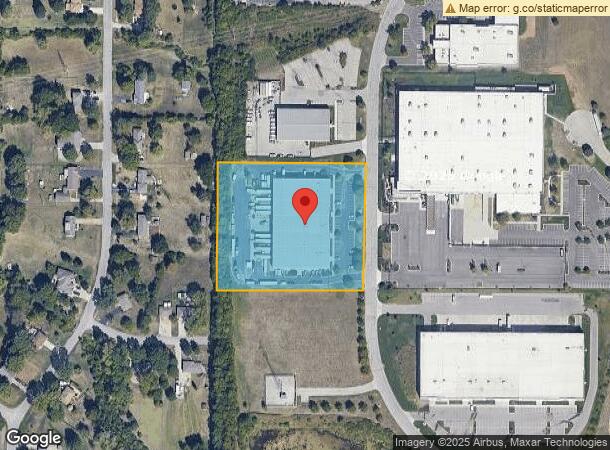
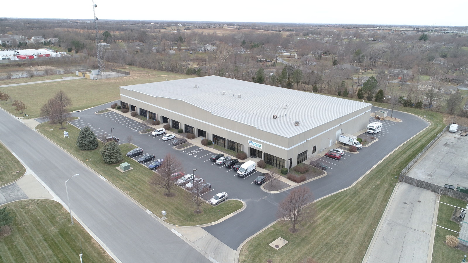
Property Record
8450 Cole Pkwy, Lenexa, KS 66227
NEARBY LISTINGS FOR SALE OR LEASE
Property Detail
8450 Cole Pkwy
Kansas City, MO-KS
Perimeter Park Sixth
QP53100000-0012
PERIMETER PARK SIXTH PLAT LT 12 SHC 486 1 12
Warehouse
Johnson
X
Kansas
20091C0032G
12
2023
4.01 AC
2023
Lenexa
052604
Kansas City
46,326 SF
DEMOGRAPHICS near 8450 Cole Pkwy
1 Mile
3 Mile
5 Mile
2024 Total Population
4,399
24,082
73,110
2029 Population
4,735
25,494
76,705
Pop Growth 2024-2029
+ 7.64%
+ 5.86%
+ 4.92%
Average Age
39
40
39
2024 Total Households
1,525
8,445
26,631
HH Growth 2024-2029
+ 7.80%
+ 6.03%
+ 4.98%
Median Household Inc
$134,086
$137,755
$129,440
Avg Household Size
2.80
2.80
2.70
2024 Avg HH Vehicles
2.00
2.00
2.00
Median Home Value
$402,055
$436,351
$406,084
Median Year Built
2009
2006
2004
Nearby Places
- Restaurants
- Banks
- Shops
- Fitness
- Groceries
PUBLIC TRANSPORTATION
AIRPORT
Kansas City International
DRIVE
WALK
Distance
Kansas City International
46 min
36.9 mi
Freight Ports
Tulsa Port Of Catoosa
DRIVE
WALK
Distance
Tulsa Port Of Catoosa
264 min
234.4 mi
SALE & LEASE HISTORY
LISTING DATE
SALE/LEASE

Sep 19, 2022
For Sale
Sep 14, 2022
For Sale
Sep 01, 2017
For Sale
Jan 17, 2025
For Lease
Nearby Properties
Address
Land Use
TOTAL SIZE
Lot Size
Zoning
Address
Land Use
TOTAL SIZE
Lot Size
Zoning
163,515 SF
70.39 AC
R1
Address
Land Use
TOTAL SIZE
Lot Size
Zoning
106,283 SF
11.79 AC
R1
Address
Land Use
TOTAL SIZE
Lot Size
Zoning
146,926 SF
29.23 AC
R-1
Address
Land Use
TOTAL SIZE
Lot Size
Zoning
192,548 SF
20.09 AC
BP
Address
Land Use
TOTAL SIZE
Lot Size
Zoning
91,639 SF
19.50 AC
R1
Address
Land Use
TOTAL SIZE
Lot Size
Zoning
69,675 SF
11.85 AC
R1
Address
Land Use
TOTAL SIZE
Lot Size
Zoning
32,186 SF
2.80 AC
CH
Address
Land Use
TOTAL SIZE
Lot Size
Zoning
67,336 SF
26.85 AC
AG
Address
Land Use
TOTAL SIZE
Lot Size
Zoning
138,758 SF
36.62 AC
BP
Address
Land Use
TOTAL SIZE
Lot Size
Zoning
99,600 SF
7.76 AC
PI
Address
Land Use
TOTAL SIZE
Lot Size
Zoning
42,261 SF
9.58 AC
R1
Address
Land Use
TOTAL SIZE
Lot Size
Zoning
75,626 SF
17.48 AC
AG
Address
Land Use
TOTAL SIZE
Lot Size
Zoning
73,003 SF
15.62 AC
R1
Address
Land Use
TOTAL SIZE
Lot Size
Zoning
69,025 SF
20.04 AC
AG
Address
Land Use
TOTAL SIZE
Lot Size
Zoning
30,751 SF
9.73 AC
R1
Address
Land Use
TOTAL SIZE
Lot Size
Zoning
515,334 SF
58.88 AC
BP
Address
Land Use
TOTAL SIZE
Lot Size
Zoning
24,208 SF
8.13 AC
CPO
Address
Land Use
TOTAL SIZE
Lot Size
Zoning
28,707 SF
11.92 AC
R1
Address
Land Use
TOTAL SIZE
Lot Size
Zoning
32,412 SF
19.93 AC
BP
Address
Land Use
TOTAL SIZE
Lot Size
Zoning
483,724 SF
50.52 AC
BP
Address
Land Use
TOTAL SIZE
Lot Size
Zoning
39,668 SF
6.02 AC
Address
Land Use
TOTAL SIZE
Lot Size
Zoning
24,478 SF
3.10 AC
R1
Address
Land Use
TOTAL SIZE
Lot Size
Zoning
20,832 SF
19.85 AC
AG
Address
Land Use
TOTAL SIZE
Lot Size
Zoning
28,390 SF
9.85 AC
AG
Address
Land Use
TOTAL SIZE
Lot Size
Zoning
12,746 SF
8.99 AC
AG
Address
Land Use
TOTAL SIZE
Lot Size
Zoning
19,003 SF
4.46 AC
CH
Address
Land Use
TOTAL SIZE
Lot Size
Zoning
16,078 SF
19.48 AC
PUDMR
Address
Land Use
TOTAL SIZE
Lot Size
Zoning
600 SF
91.25 AC
RUR
Address
Land Use
TOTAL SIZE
Lot Size
Zoning
241,418 SF
21.42 AC
PI
The World's #1 Commercial Real Estate Marketplace
Connect with us
© 2025 CoStar Group
The information above has been obtained from sources believed reliable. While we do not doubt its accuracy we have not verified it and make no guarantee, warranty or representation about it. It is your responsibility to independently confirm its accuracy and completeness. Any projections, opinions, assumptions, or estimates used are for example only and do not represent the current or future performance of the property. The value of this transaction to you depends on tax and other factors which should be evaluated by your tax, financial, and legal advisors. You and your advisors should conduct a careful, independent investigation of the property to determine to your satisfaction the suitability of the property for your needs.