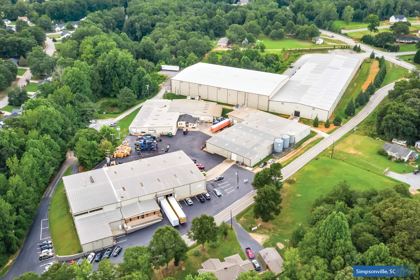
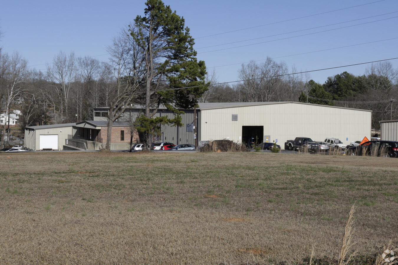
Property Record
849 Neely Ferry Rd, Simpsonville, SC 29680

NEARBY LISTINGS FOR SALE OR LEASE
-
-
View all Simpsonville listings for sale on LoopNet.com
Property Detail
849 Neely Ferry Rd
Greenville-Anderson-Mauldin, SC
Boundary Survey For Brothers Four Llp
0574.03-01-019.09
MAP 0574.03
Lightindustrial
Greenville
AE
South Carolina
45045C0481E
019.14
2024
4.58 AC
2024
I-385/Simpsonville
003017
Greenville/Spartanburg
DEMOGRAPHICS near 849 Neely Ferry Rd
1 Mile
3 Mile
5 Mile
2024 Total Population
7,893
49,560
97,329
2029 Population
8,647
54,883
107,683
Pop Growth 2024-2029
+ 9.55%
+ 10.74%
+ 10.64%
Average Age
39
39
40
2024 Total Households
2,955
18,811
37,270
HH Growth 2024-2029
+ 9.54%
+ 10.78%
+ 10.70%
Median Household Inc
$88,170
$86,983
$81,687
Avg Household Size
2.60
2.60
2.60
2024 Avg HH Vehicles
2.00
2.00
2.00
Median Home Value
$244,260
$249,706
$244,110
Median Year Built
1997
2000
1998
Nearby Places
- Restaurants
- Banks
- Shops
- Fitness
- Groceries
PUBLIC TRANSPORTATION
AIRPORT
Greenville Spartanburg International
DRIVE
WALK
Distance
Greenville Spartanburg International
25 min
16.1 mi
Freight Ports
North Charleston Terminal
DRIVE
WALK
Distance
North Charleston Terminal
216 min
192.7 mi
Nearby Properties
Address
Land Use
TOTAL SIZE
Lot Size
Zoning
Address
Land Use
TOTAL SIZE
Lot Size
Zoning
23.23 AC
Address
Land Use
TOTAL SIZE
Lot Size
Zoning
11.91 AC
RM20
Address
Land Use
TOTAL SIZE
Lot Size
Zoning
12.31 AC
Address
Land Use
TOTAL SIZE
Lot Size
Zoning
17.59 AC
Address
Land Use
TOTAL SIZE
Lot Size
Zoning
29.21 AC
I1
Address
Land Use
TOTAL SIZE
Lot Size
Zoning
47.12 AC
RRROW
Address
Land Use
TOTAL SIZE
Lot Size
Zoning
195.23 AC
RRROW
Address
Land Use
TOTAL SIZE
Lot Size
Zoning
9.46 AC
I1
Address
Land Use
TOTAL SIZE
Lot Size
Zoning
12.42 AC
RS
Address
Land Use
TOTAL SIZE
Lot Size
Zoning
5.30 AC
BI
Address
Land Use
TOTAL SIZE
Lot Size
Zoning
76.20 AC
R20
Address
Land Use
TOTAL SIZE
Lot Size
Zoning
10.04 AC
BG
Address
Land Use
TOTAL SIZE
Lot Size
Zoning
7.03 AC
I1
Address
Land Use
TOTAL SIZE
Lot Size
Zoning
1,176 SF
126.24 AC
RS
Address
Land Use
TOTAL SIZE
Lot Size
Zoning
26.30 AC
ROI
Address
Land Use
TOTAL SIZE
Lot Size
Zoning
10.50 AC
RRROW
Address
Land Use
TOTAL SIZE
Lot Size
Zoning
Address
Land Use
TOTAL SIZE
Lot Size
Zoning
9.89 AC
C2
Address
Land Use
TOTAL SIZE
Lot Size
Zoning
12.11 AC
BG
Address
Land Use
TOTAL SIZE
Lot Size
Zoning
51.30 AC
RS
Address
Land Use
TOTAL SIZE
Lot Size
Zoning
8.23 AC
S1
Address
Land Use
TOTAL SIZE
Lot Size
Zoning
1,528 SF
22.81 AC
RM14
Address
Land Use
TOTAL SIZE
Lot Size
Zoning
Address
Land Use
TOTAL SIZE
Lot Size
Zoning
17.65 AC
ID
Address
Land Use
TOTAL SIZE
Lot Size
Zoning
65.40 AC
RS
Address
Land Use
TOTAL SIZE
Lot Size
Zoning
17.02 AC
BG
Address
Land Use
TOTAL SIZE
Lot Size
Zoning
3.20 AC
I1
Address
Land Use
TOTAL SIZE
Lot Size
Zoning
31.90 AC
I1
The World's #1 Commercial Real Estate Marketplace
Connect with us
© 2025 CoStar Group
The information above has been obtained from sources believed reliable. While we do not doubt its accuracy we have not verified it and make no guarantee, warranty or representation about it. It is your responsibility to independently confirm its accuracy and completeness. Any projections, opinions, assumptions, or estimates used are for example only and do not represent the current or future performance of the property. The value of this transaction to you depends on tax and other factors which should be evaluated by your tax, financial, and legal advisors. You and your advisors should conduct a careful, independent investigation of the property to determine to your satisfaction the suitability of the property for your needs.