Property Record
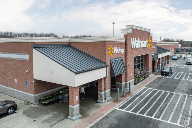
85 Crooked Hill Rd, Commack, NY 11725


NEARBY LISTINGS FOR SALE OR LEASE
Property Detail
85 Crooked Hill Rd
0800-173-00-03-00-054-001
173.-3-54.1 N-KOHLS/HOME DEPOT W-CROO S-ARTHUR ST, E-PJ VENTURE
Storebuilding
Suffolk
X
New York
36103C0645H
54
2024
16.90 AC
2024
Western Suffolk
135205
Long Island (New York)
142,732 SF
Nassau County-Suffolk County, NY
DEMOGRAPHICS near 85 Crooked Hill Rd
1 Mile
3 Mile
5 Mile
2024 Total Population
5,264
72,833
236,052
2029 Population
5,187
71,204
230,191
Pop Growth 2024-2029
(1.46%)
(2.24%)
(2.48%)
Average Age
42
40
40
2024 Total Households
1,571
20,434
67,973
HH Growth 2024-2029
(1.97%)
(2.36%)
(2.63%)
Median Household Inc
$163,968
$142,607
$129,448
Avg Household Size
3.00
3.30
3.30
2024 Avg HH Vehicles
3.00
2.00
2.00
Median Home Value
$691,331
$599,058
$546,515
Median Year Built
1967
1965
1965
Nearby Places
Map Layers
Map Styles
 Street
 Aerial
- Restaurants
- Banks
- Shops
- Fitness
- Groceries
PUBLIC TRANSPORTATION
COMMUTER RAIL
Brentwood Station (Ronkonkoma Branch - Long Island Rail Road)
DRIVE
WALK
Distance
Brentwood Station (Ronkonkoma Branch - Long Island Rail Road)
10 min
4.3 mi
Deer Park Station (Ronkonkoma Branch - Long Island Rail Road)
DRIVE
WALK
Distance
Deer Park Station (Ronkonkoma Branch - Long Island Rail Road)
9 min
4.9 mi
AIRPORT
Long Island MacArthur
DRIVE
WALK
Distance
Long Island MacArthur
21 min
12.4 mi
John F Kennedy International
DRIVE
WALK
Distance
John F Kennedy International
51 min
35.9 mi
Freight Ports
NY - Red Hook Container Terminal
DRIVE
WALK
Distance
NY - Red Hook Container Terminal
64 min
43.3 mi
SALE & LEASE HISTORY
LISTING DATE
SALE/LEASE

Sep 25, 2016
For Lease
Nearby Properties
Address
Land Use
TOTAL SIZE
Lot Size
Zoning
Address
Land Use
TOTAL SIZE
Lot Size
Zoning
4.81 AC
AAA
Address
Land Use
TOTAL SIZE
Lot Size
Zoning
371.18 AC
AAA
Address
Land Use
TOTAL SIZE
Lot Size
Zoning
4.39 AC
AAA
Address
Land Use
TOTAL SIZE
Lot Size
Zoning
196.07 AC
AAA
Address
Land Use
TOTAL SIZE
Lot Size
Zoning
23.91 AC
IND1
Address
Land Use
TOTAL SIZE
Lot Size
Zoning
117.66 AC
AAA
Address
Land Use
TOTAL SIZE
Lot Size
Zoning
109.45 AC
AAA
Address
Land Use
TOTAL SIZE
Lot Size
Zoning
19.70 AC
A
Address
Land Use
TOTAL SIZE
Lot Size
Zoning
30 AC
IND1
Address
Land Use
TOTAL SIZE
Lot Size
Zoning
30.50 AC
A
Address
Land Use
TOTAL SIZE
Lot Size
Zoning
18.37 AC
IND1
Address
Land Use
TOTAL SIZE
Lot Size
Zoning
10.20 AC
B
Address
Land Use
TOTAL SIZE
Lot Size
Zoning
10.90 AC
AAA
Address
Land Use
TOTAL SIZE
Lot Size
Zoning
20.13 AC
Address
Land Use
TOTAL SIZE
Lot Size
Zoning
8.83 AC
Address
Land Use
TOTAL SIZE
Lot Size
Zoning
14.63 AC
IND1
Address
Land Use
TOTAL SIZE
Lot Size
Zoning
79.78 AC
AAA
Address
Land Use
TOTAL SIZE
Lot Size
Zoning
52.32 AC
AAA
Address
Land Use
TOTAL SIZE
Lot Size
Zoning
13.28 AC
IND1
Address
Land Use
TOTAL SIZE
Lot Size
Zoning
11.20 AC
A
Address
Land Use
TOTAL SIZE
Lot Size
Zoning
102.58 AC
AAA
Address
Land Use
TOTAL SIZE
Lot Size
Zoning
9.20 AC
IND1
Address
Land Use
TOTAL SIZE
Lot Size
Zoning
10.95 AC
IND1
Address
Land Use
TOTAL SIZE
Lot Size
Zoning
13.81 AC
IND1
Address
Land Use
TOTAL SIZE
Lot Size
Zoning
512 SF
10.55 AC
IND1
Address
Land Use
TOTAL SIZE
Lot Size
Zoning
1.84 AC
A
Address
Land Use
TOTAL SIZE
Lot Size
Zoning
13.80 AC
IND1
Address
Land Use
TOTAL SIZE
Lot Size
Zoning
9.79 AC
IND1
Address
Land Use
TOTAL SIZE
Lot Size
Zoning
1.88 AC
AAA
Address
Land Use
TOTAL SIZE
Lot Size
Zoning
8 AC
IND1
The World's #1 Commercial Real Estate Marketplace
Connect with us
© 2026 CoStar Group
The information above has been obtained from sources believed reliable. While we do not doubt its accuracy we have not verified it and make no guarantee, warranty or representation about it. It is your responsibility to independently confirm its accuracy and completeness. Any projections, opinions, assumptions, or estimates used are for example only and do not represent the current or future performance of the property. The value of this transaction to you depends on tax and other factors which should be evaluated by your tax, financial, and legal advisors. You and your advisors should conduct a careful, independent investigation of the property to determine to your satisfaction the suitability of the property for your needs.