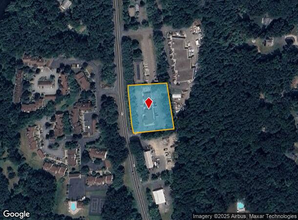
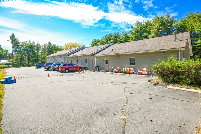
Property Record
85 River Rd, Collinsville, CT 06019
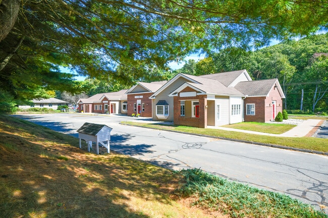
This Property Is For Sale
NEARBY LISTINGS FOR SALE OR LEASE
Property Detail
85 River Rd
CANT-000030-000449-000085
Hartford
Industrialgeneral
Connecticut
X
85
09003C0308F
1.61 AC
2024
Northwest Outlying
2025
Hartford
464102
Hartford-West Hartford-East Hartford, CT
7,944 SF
DEMOGRAPHICS near 85 River Rd
1 Mile
3 Mile
5 Mile
2024 Total Population
2,812
12,870
39,296
2029 Population
2,782
12,849
39,184
Pop Growth 2024-2029
(1.07%)
(0.16%)
(0.29%)
Average Age
43
43
43
2024 Total Households
1,194
5,055
15,266
HH Growth 2024-2029
(1.34%)
(0.24%)
(0.32%)
Median Household Inc
$89,983
$132,015
$132,197
Avg Household Size
2.20
2.50
2.50
2024 Avg HH Vehicles
2.00
2.00
2.00
Median Home Value
$303,889
$372,478
$384,047
Median Year Built
1967
1977
1976
Nearby Places
- Restaurants
- Banks
- Shops
- Fitness
- Groceries
PUBLIC TRANSPORTATION
AIRPORT
Bradley International
DRIVE
WALK
Distance
Bradley International
44 min
22.6 mi
Freight Ports
Port of New Haven
DRIVE
WALK
Distance
Port of New Haven
61 min
45.8 mi
Nearby Properties
Address
Land Use
TOTAL SIZE
Lot Size
Zoning
Address
Land Use
TOTAL SIZE
Lot Size
Zoning
124 AC
B
Address
Land Use
TOTAL SIZE
Lot Size
Zoning
172,502 SF
28.04 AC
MCPF
Address
Land Use
TOTAL SIZE
Lot Size
Zoning
20 AC
R30
Address
Land Use
TOTAL SIZE
Lot Size
Zoning
21.06 AC
B-3
Address
Land Use
TOTAL SIZE
Lot Size
Zoning
87,133 SF
9.25 AC
HCDVD
Address
Land Use
TOTAL SIZE
Lot Size
Zoning
64,974 SF
B
Address
Land Use
TOTAL SIZE
Lot Size
Zoning
70,929 SF
12.47 AC
MCPF
Address
Land Use
TOTAL SIZE
Lot Size
Zoning
57,510 SF
14 AC
MCPF
Address
Land Use
TOTAL SIZE
Lot Size
Zoning
14,299 SF
6.64 AC
MCPF
Address
Land Use
TOTAL SIZE
Lot Size
Zoning
57,104 SF
7.71 AC
MCPF
Address
Land Use
TOTAL SIZE
Lot Size
Zoning
98,764 SF
B
Address
Land Use
TOTAL SIZE
Lot Size
Zoning
8.47 AC
B-3
Address
Land Use
TOTAL SIZE
Lot Size
Zoning
13,530 SF
4.83 AC
EGDVD
Address
Land Use
TOTAL SIZE
Lot Size
Zoning
1,079.49 AC
PS/UD
Address
Land Use
TOTAL SIZE
Lot Size
Zoning
33,414 SF
3.36 AC
B-3
Address
Land Use
TOTAL SIZE
Lot Size
Zoning
50,076 SF
11.20 AC
AAH
Address
Land Use
TOTAL SIZE
Lot Size
Zoning
52,187 SF
6.27 AC
HCDVD
Address
Land Use
TOTAL SIZE
Lot Size
Zoning
33,924 SF
4.74 AC
EGDVD
Address
Land Use
TOTAL SIZE
Lot Size
Zoning
44,985 SF
1.49 AC
HCDVD
Address
Land Use
TOTAL SIZE
Lot Size
Zoning
17,801 SF
1.49 AC
EGDVD
Address
Land Use
TOTAL SIZE
Lot Size
Zoning
15,377 SF
1.57 AC
EGDVD
Address
Land Use
TOTAL SIZE
Lot Size
Zoning
16,112 SF
5 AC
MCPF
Address
Land Use
TOTAL SIZE
Lot Size
Zoning
36.93 AC
ROS
Address
Land Use
TOTAL SIZE
Lot Size
Zoning
23,790 SF
0.34 AC
CVDD
Address
Land Use
TOTAL SIZE
Lot Size
Zoning
52,025 SF
9.59 AC
CVDVD
Address
Land Use
TOTAL SIZE
Lot Size
Zoning
19,125 SF
4.20 AC
EGDVD
Address
Land Use
TOTAL SIZE
Lot Size
Zoning
10,424 SF
2.25 AC
CVDVD
Address
Land Use
TOTAL SIZE
Lot Size
Zoning
18,740 SF
2.70 AC
EGDVD
Address
Land Use
TOTAL SIZE
Lot Size
Zoning
5.24 AC
R30
Address
Land Use
TOTAL SIZE
Lot Size
Zoning
36,393 SF
6.87 AC
HCDVD
The World's #1 Commercial Real Estate Marketplace
Connect with us
© 2025 CoStar Group
The information above has been obtained from sources believed reliable. While we do not doubt its accuracy we have not verified it and make no guarantee, warranty or representation about it. It is your responsibility to independently confirm its accuracy and completeness. Any projections, opinions, assumptions, or estimates used are for example only and do not represent the current or future performance of the property. The value of this transaction to you depends on tax and other factors which should be evaluated by your tax, financial, and legal advisors. You and your advisors should conduct a careful, independent investigation of the property to determine to your satisfaction the suitability of the property for your needs.