Property Record
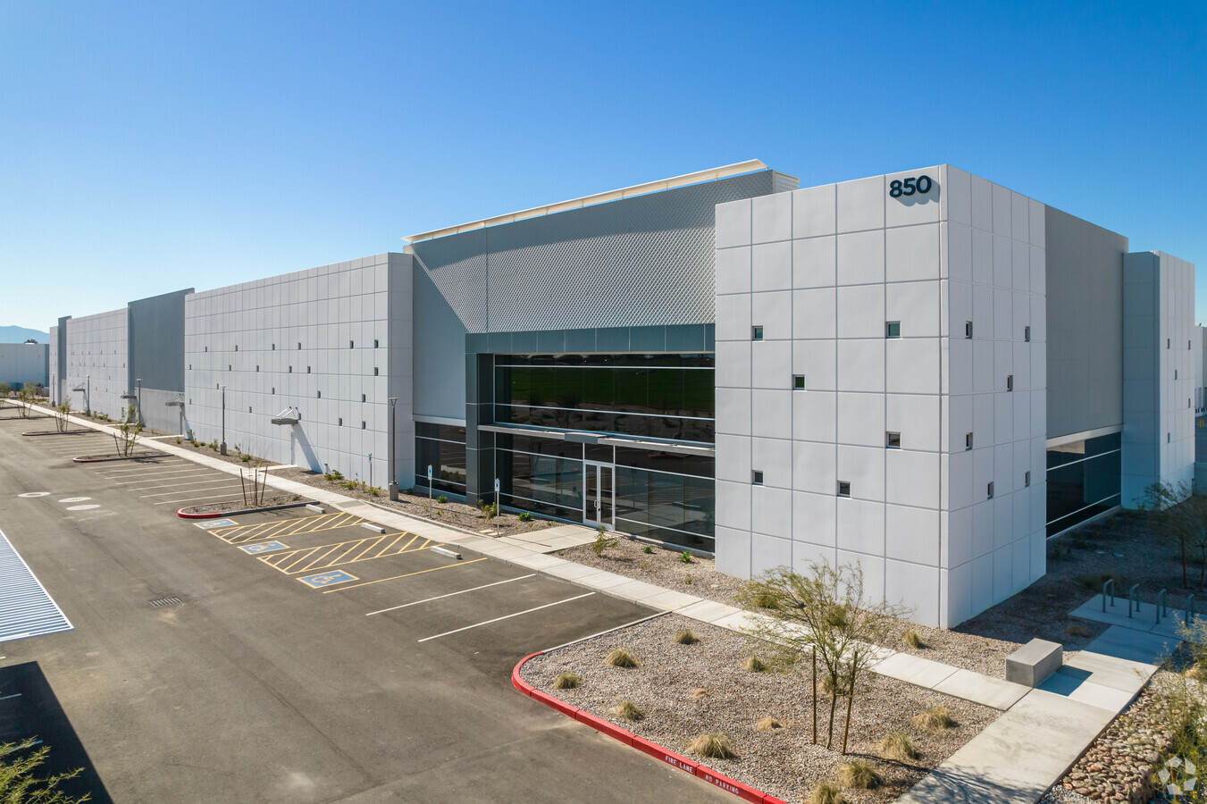
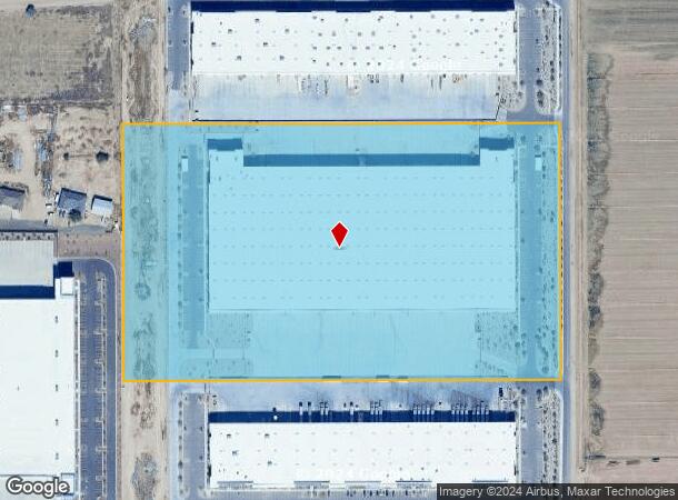
850 N 119Th Ave, Avondale, AZ 85323

NEARBY LISTINGS FOR SALE OR LEASE
Property Detail
850 N 119Th Ave
Phoenix-Mesa-Scottsdale, AZ
Avondale 50
500-01-595
AVONDALE 50 MCR 1548-17
Warehouse
Maricopa
X
Arizona
04013C2155M
2
2024
22.15 AC
2025
Goodyear
082025
Phoenix
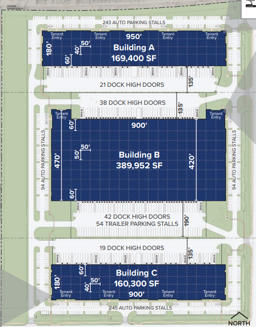
389,952 SF
DEMOGRAPHICS near 850 N 119Th Ave
1 Mile
3 Mile
5 Mile
2024 Total Population
8,617
102,710
248,498
2029 Population
9,352
110,728
270,588
Pop Growth 2024-2029
+ 8.53%
+ 7.81%
+ 8.89%
Average Age
33
34
35
2024 Total Households
3,004
31,661
76,104
HH Growth 2024-2029
+ 8.59%
+ 7.92%
+ 9.06%
Median Household Inc
$63,036
$73,025
$78,103
Avg Household Size
2.90
3.20
3.20
2024 Avg HH Vehicles
2.00
2.00
2.00
Median Home Value
$291,680
$313,982
$332,464
Median Year Built
2004
2001
2002
Nearby Places
- Restaurants
- Banks
- Shops
- Fitness
- Groceries
PUBLIC TRANSPORTATION
AIRPORT
Phoenix Sky Harbor International
DRIVE
WALK
Distance
Phoenix Sky Harbor International
30 min
20.8 mi
Freight Ports
Port of San Diego
DRIVE
WALK
Distance
Port of San Diego
381 min
341.5 mi
SALE & LEASE HISTORY
LISTING DATE
SALE/LEASE

Sep 05, 2023
For Lease
Jun 23, 2020
For Lease
Nearby Properties
Address
Land Use
TOTAL SIZE
Lot Size
Zoning
Address
Land Use
TOTAL SIZE
Lot Size
Zoning
370,726 SF
23.40 AC
PAD
Address
Land Use
TOTAL SIZE
Lot Size
Zoning
90,008 SF
20.42 AC
M-H
Address
Land Use
TOTAL SIZE
Lot Size
Zoning
324,374 SF
18.26 AC
PAD
Address
Land Use
TOTAL SIZE
Lot Size
Zoning
889,089 SF
83.11 AC
I-1
Address
Land Use
TOTAL SIZE
Lot Size
Zoning
401,714 SF
100.01 AC
PAD
Address
Land Use
TOTAL SIZE
Lot Size
Zoning
901,699 SF
49.92 AC
I1
Address
Land Use
TOTAL SIZE
Lot Size
Zoning
287,294 SF
67.46 AC
PAD
Address
Land Use
TOTAL SIZE
Lot Size
Zoning
301,329 SF
50.60 AC
AG
Address
Land Use
TOTAL SIZE
Lot Size
Zoning
296,791 SF
35 AC
PAD
Address
Land Use
TOTAL SIZE
Lot Size
Zoning
369,413 SF
16.39 AC
THEBLVDD
Address
Land Use
TOTAL SIZE
Lot Size
Zoning
432,022 SF
19.33 AC
PAD
Address
Land Use
TOTAL SIZE
Lot Size
Zoning
797,310 SF
36.82 AC
I-1
Address
Land Use
TOTAL SIZE
Lot Size
Zoning
628,480 SF
34.45 AC
PAD
Address
Land Use
TOTAL SIZE
Lot Size
Zoning
397,132 SF
27.52 AC
I1
Address
Land Use
TOTAL SIZE
Lot Size
Zoning
409,088 SF
21.34 AC
PAD
Address
Land Use
TOTAL SIZE
Lot Size
Zoning
353,155 SF
16.80 AC
M-H
Address
Land Use
TOTAL SIZE
Lot Size
Zoning
340,061 SF
15.50 AC
M-H
Address
Land Use
TOTAL SIZE
Lot Size
Zoning
332,075 SF
19.15 AC
C2
Address
Land Use
TOTAL SIZE
Lot Size
Zoning
274,700 SF
23.23 AC
PAD
Address
Land Use
TOTAL SIZE
Lot Size
Zoning
191,303 SF
37.42 AC
R-6
Address
Land Use
TOTAL SIZE
Lot Size
Zoning
232,797 SF
25.43 AC
PAD
Address
Land Use
TOTAL SIZE
Lot Size
Zoning
1,038,407 SF
59.54 AC
R-43
Address
Land Use
TOTAL SIZE
Lot Size
Zoning
177,052 SF
15.81 AC
THEBLVDD
Address
Land Use
TOTAL SIZE
Lot Size
Zoning
291,805 SF
16.48 AC
PAD
Address
Land Use
TOTAL SIZE
Lot Size
Zoning
382,419 SF
18.41 AC
PAD
Address
Land Use
TOTAL SIZE
Lot Size
Zoning
291,119 SF
15.38 AC
PAD
Address
Land Use
TOTAL SIZE
Lot Size
Zoning
450,240 SF
25.56 AC
Address
Land Use
TOTAL SIZE
Lot Size
Zoning
285,131 SF
16.11 AC
I-1
Address
Land Use
TOTAL SIZE
Lot Size
Zoning
242,320 SF
13.36 AC
PAD
The World's #1 Commercial Real Estate Marketplace
Connect with us
© 2025 CoStar Group
The information above has been obtained from sources believed reliable. While we do not doubt its accuracy we have not verified it and make no guarantee, warranty or representation about it. It is your responsibility to independently confirm its accuracy and completeness. Any projections, opinions, assumptions, or estimates used are for example only and do not represent the current or future performance of the property. The value of this transaction to you depends on tax and other factors which should be evaluated by your tax, financial, and legal advisors. You and your advisors should conduct a careful, independent investigation of the property to determine to your satisfaction the suitability of the property for your needs.