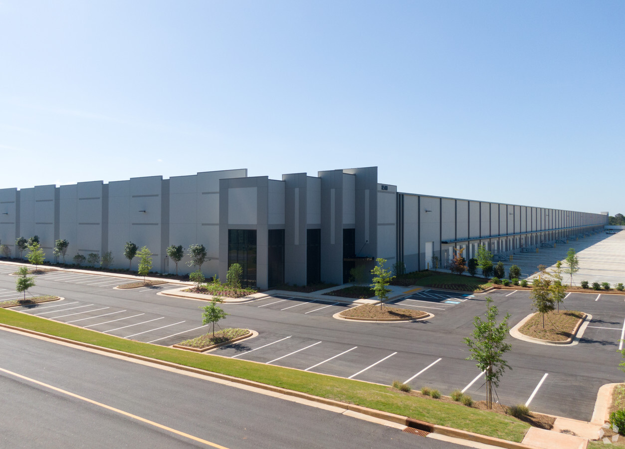
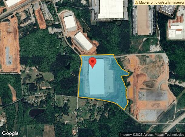
Property Record
8500 Tatum Rd, Palmetto, GA 30268


NEARBY LISTINGS FOR SALE OR LEASE
Property Detail
8500 Tatum Rd
Atlanta-Sandy Springs-Roswell, GA
Covenant 031-7 051-5 093-7 Land Split Fo
07-3700-0125-095-2
4/18: LND PKG - W/F: 2018-0394
Stripcommercialcenter
Fulton
X
Georgia
13121C0445F
125
2023
83.45 AC
2023
Airport/North Clayton
010401
Atlanta
981,874 SF
DEMOGRAPHICS near 8500 Tatum Rd
1 Mile
3 Mile
5 Mile
2024 Total Population
165
12,087
49,589
2029 Population
170
12,731
52,206
Pop Growth 2024-2029
+ 3.03%
+ 5.33%
+ 5.28%
Average Age
36
38
38
2024 Total Households
58
4,391
17,886
HH Growth 2024-2029
+ 1.72%
+ 5.35%
+ 5.23%
Median Household Inc
$55,454
$56,867
$71,935
Avg Household Size
2.80
2.70
2.70
2024 Avg HH Vehicles
2.00
2.00
2.00
Median Home Value
$136,538
$209,036
$260,336
Median Year Built
2000
1997
2001
Nearby Places
- Restaurants
- Banks
- Shops
- Fitness
- Groceries
PUBLIC TRANSPORTATION
AIRPORT
Hartsfield - Jackson Atlanta International
DRIVE
WALK
Distance
Hartsfield - Jackson Atlanta International
32 min
19.9 mi
Freight Ports
Georgia Ports - Savannah
DRIVE
WALK
Distance
Georgia Ports - Savannah
294 min
257.2 mi
SALE & LEASE HISTORY
LISTING DATE
SALE/LEASE

May 25, 2017
For Lease
Nearby Properties
Address
Land Use
TOTAL SIZE
Lot Size
Zoning
Address
Land Use
TOTAL SIZE
Lot Size
Zoning
938,714 SF
103.25 AC
AG1
Address
Land Use
TOTAL SIZE
Lot Size
Zoning
1,000,200 SF
78.26 AC
R1
Address
Land Use
TOTAL SIZE
Lot Size
Zoning
374,881 SF
91.05 AC
M1
Address
Land Use
TOTAL SIZE
Lot Size
Zoning
1,160,240 SF
71.94 AC
AG1
Address
Land Use
TOTAL SIZE
Lot Size
Zoning
873,600 SF
65.24 AC
C2
Address
Land Use
TOTAL SIZE
Lot Size
Zoning
1,351,440 SF
86.29 AC
M1
Address
Land Use
TOTAL SIZE
Lot Size
Zoning
1,054,500 SF
101.73 AC
M1
Address
Land Use
TOTAL SIZE
Lot Size
Zoning
491,992 SF
48.25 AC
M1
Address
Land Use
TOTAL SIZE
Lot Size
Zoning
556,800 SF
32.69 AC
M1
Address
Land Use
TOTAL SIZE
Lot Size
Zoning
510,180 SF
41.23 AC
M1
Address
Land Use
TOTAL SIZE
Lot Size
Zoning
715,114 SF
135.23 AC
M2
Address
Land Use
TOTAL SIZE
Lot Size
Zoning
350,000 SF
17.54 AC
M1
Address
Land Use
TOTAL SIZE
Lot Size
Zoning
139,164 SF
48.66 AC
R2
Address
Land Use
TOTAL SIZE
Lot Size
Zoning
74.16 AC
R1
Address
Land Use
TOTAL SIZE
Lot Size
Zoning
242,550 SF
15.82 AC
AG1
Address
Land Use
TOTAL SIZE
Lot Size
Zoning
82,508 SF
7.30 AC
M2
Address
Land Use
TOTAL SIZE
Lot Size
Zoning
149,600 SF
17.58 AC
M1
Address
Land Use
TOTAL SIZE
Lot Size
Zoning
45,256 SF
20.15 AC
M
Address
Land Use
TOTAL SIZE
Lot Size
Zoning
Address
Land Use
TOTAL SIZE
Lot Size
Zoning
103,800 SF
6.50 AC
M2
Address
Land Use
TOTAL SIZE
Lot Size
Zoning
40,360 SF
12.29 AC
R2
Address
Land Use
TOTAL SIZE
Lot Size
Zoning
21,824 SF
0.64 AC
R2
Address
Land Use
TOTAL SIZE
Lot Size
Zoning
29,800 SF
16.70 AC
R2
Address
Land Use
TOTAL SIZE
Lot Size
Zoning
2,979 SF
132 AC
C3
Address
Land Use
TOTAL SIZE
Lot Size
Zoning
6,974 SF
2 AC
M1
Address
Land Use
TOTAL SIZE
Lot Size
Zoning
218,254 SF
16.03 AC
R7
Address
Land Use
TOTAL SIZE
Lot Size
Zoning
720 SF
14.23 AC
AG1
Address
Land Use
TOTAL SIZE
Lot Size
Zoning
685,260 SF
56.60 AC
M1
Address
Land Use
TOTAL SIZE
Lot Size
Zoning
26,132 SF
8.84 AC
The World's #1 Commercial Real Estate Marketplace
Connect with us
© 2025 CoStar Group
The information above has been obtained from sources believed reliable. While we do not doubt its accuracy we have not verified it and make no guarantee, warranty or representation about it. It is your responsibility to independently confirm its accuracy and completeness. Any projections, opinions, assumptions, or estimates used are for example only and do not represent the current or future performance of the property. The value of this transaction to you depends on tax and other factors which should be evaluated by your tax, financial, and legal advisors. You and your advisors should conduct a careful, independent investigation of the property to determine to your satisfaction the suitability of the property for your needs.