Property Record
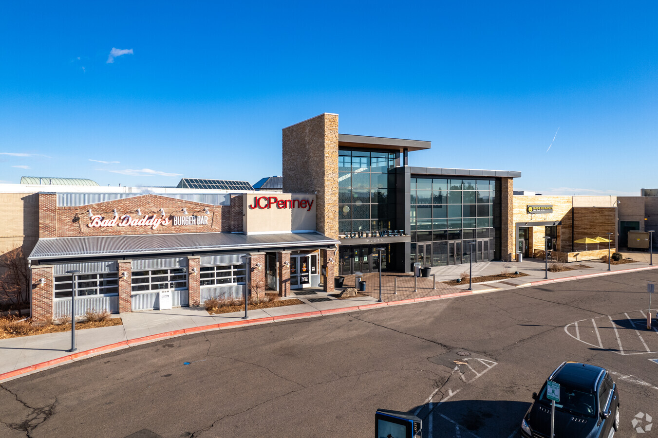
8501 W Bowles Ave, Littleton, CO 80123

Current Lease Availabilities
NEARBY LISTINGS FOR SALE OR LEASE
Property Detail
8501 W Bowles Ave
Denver-Aurora-Lakewood, CO
Southwest Plaza Regional Shopping Ctr Fl
59-154-02-013
Jefferson
Commercialnec
Colorado
X
35.87 AC
0800460251H
Southwest
600,847 SF
Denver
DEMOGRAPHICS near 8501 W Bowles Ave
1 Mile
3 Mile
5 Mile
2024 Total Population
11,384
100,585
215,540
2029 Population
11,296
99,349
213,715
Pop Growth 2024-2029
(0.77%)
(1.23%)
(0.85%)
Average Age
43
42
42
2024 Total Households
4,660
39,067
86,789
HH Growth 2024-2029
(0.90%)
(1.25%)
(0.84%)
Median Household Inc
$107,188
$106,909
$97,268
Avg Household Size
2.40
2.50
2.40
2024 Avg HH Vehicles
2.00
2.00
2.00
Median Home Value
$509,194
$555,548
$550,517
Median Year Built
1988
1985
1983
Nearby Places
- Restaurants
- Banks
- Shops
- Fitness
- Groceries
PUBLIC TRANSPORTATION
AIRPORT
Denver International
DRIVE
WALK
Distance
Denver International
52 min
37.3 mi
Freight Ports
Tulsa Port Of Catoosa
DRIVE
WALK
Distance
Tulsa Port Of Catoosa
749 min
720.1 mi
Nearby Properties
Address
Land Use
TOTAL SIZE
Lot Size
Zoning
Address
Land Use
TOTAL SIZE
Lot Size
Zoning
665,722 SF
615.84 AC
OS-B
Address
Land Use
TOTAL SIZE
Lot Size
Zoning
272,246 SF
31.76 AC
PD
Address
Land Use
TOTAL SIZE
Lot Size
Zoning
381,135 SF
35.02 AC
Address
Land Use
TOTAL SIZE
Lot Size
Zoning
298,752 SF
73.96 AC
Address
Land Use
TOTAL SIZE
Lot Size
Zoning
600,847 SF
32.41 AC
PD
Address
Land Use
TOTAL SIZE
Lot Size
Zoning
452,193 SF
12.56 AC
Address
Land Use
TOTAL SIZE
Lot Size
Zoning
391,595 SF
27.94 AC
Address
Land Use
TOTAL SIZE
Lot Size
Zoning
446,582 SF
19.24 AC
Address
Land Use
TOTAL SIZE
Lot Size
Zoning
178,421 SF
12.31 AC
PD
Address
Land Use
TOTAL SIZE
Lot Size
Zoning
293,292 SF
13.78 AC
PUD
Address
Land Use
TOTAL SIZE
Lot Size
Zoning
63,347 SF
20.70 AC
Address
Land Use
TOTAL SIZE
Lot Size
Zoning
123,843 SF
6.03 AC
Address
Land Use
TOTAL SIZE
Lot Size
Zoning
329,538 SF
14.64 AC
B-4
Address
Land Use
TOTAL SIZE
Lot Size
Zoning
296,034 SF
14.26 AC
R-2-A
Address
Land Use
TOTAL SIZE
Lot Size
Zoning
189,672 SF
16.74 AC
PD
Address
Land Use
TOTAL SIZE
Lot Size
Zoning
224,595 SF
14.66 AC
Address
Land Use
TOTAL SIZE
Lot Size
Zoning
94,367 SF
10.02 AC
R-2
Address
Land Use
TOTAL SIZE
Lot Size
Zoning
294,876 SF
12.25 AC
Address
Land Use
TOTAL SIZE
Lot Size
Zoning
85,580 SF
12.54 AC
Address
Land Use
TOTAL SIZE
Lot Size
Zoning
150,951 SF
17.90 AC
PD
Address
Land Use
TOTAL SIZE
Lot Size
Zoning
151,602 SF
38.93 AC
Address
Land Use
TOTAL SIZE
Lot Size
Zoning
101,795 SF
12.61 AC
PD
Address
Land Use
TOTAL SIZE
Lot Size
Zoning
105,093 SF
9.32 AC
B-2
Address
Land Use
TOTAL SIZE
Lot Size
Zoning
80,798 SF
12.27 AC
PD
Address
Land Use
TOTAL SIZE
Lot Size
Zoning
175,000 SF
36.25 AC
PD
Address
Land Use
TOTAL SIZE
Lot Size
Zoning
218,158 SF
20.16 AC
A2
Address
Land Use
TOTAL SIZE
Lot Size
Zoning
297,003 SF
26.77 AC
PD
Address
Land Use
TOTAL SIZE
Lot Size
Zoning
221,123 SF
14.82 AC
PD
Address
Land Use
TOTAL SIZE
Lot Size
Zoning
52,493 SF
12.69 AC
Address
Land Use
TOTAL SIZE
Lot Size
Zoning
119,540 SF
10.67 AC
C1
The World's #1 Commercial Real Estate Marketplace
Connect with us
© 2025 CoStar Group
The information above has been obtained from sources believed reliable. While we do not doubt its accuracy we have not verified it and make no guarantee, warranty or representation about it. It is your responsibility to independently confirm its accuracy and completeness. Any projections, opinions, assumptions, or estimates used are for example only and do not represent the current or future performance of the property. The value of this transaction to you depends on tax and other factors which should be evaluated by your tax, financial, and legal advisors. You and your advisors should conduct a careful, independent investigation of the property to determine to your satisfaction the suitability of the property for your needs.