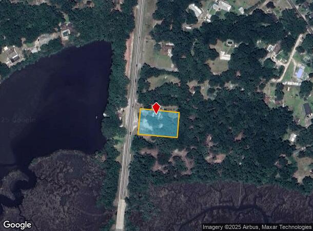
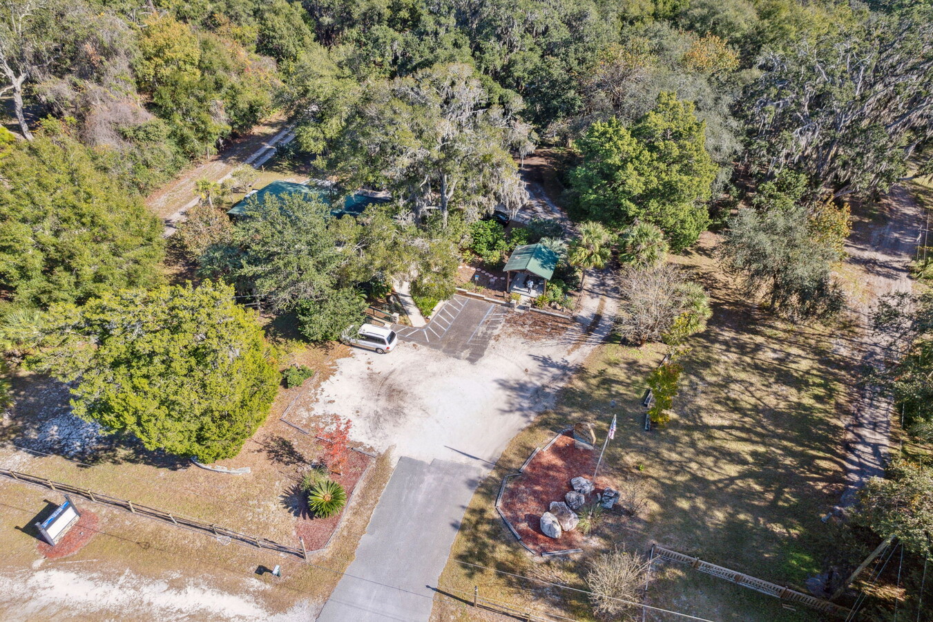
Property Record
850310 Us Highway 17, Yulee, FL 32097
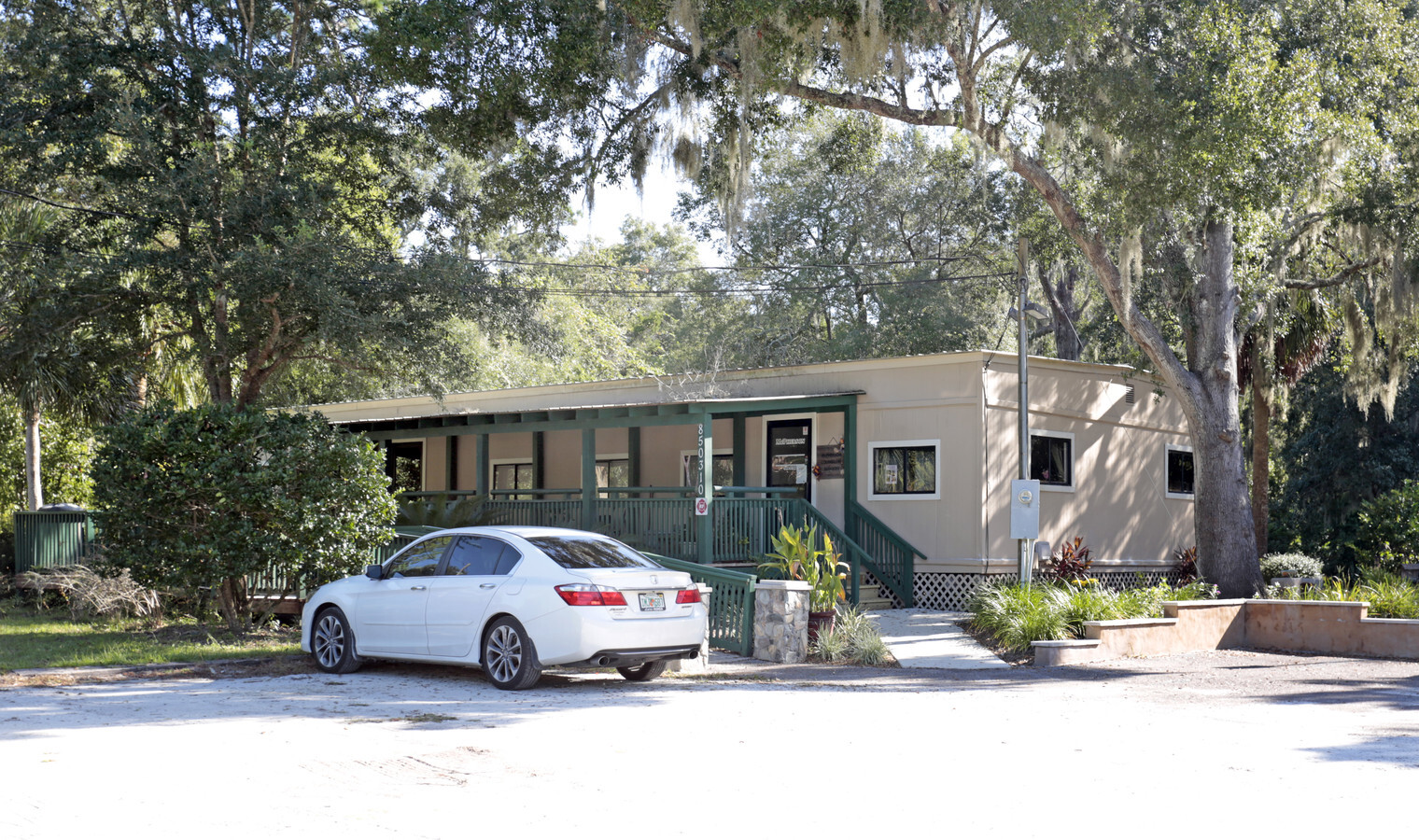
This Property Is For Sale
NEARBY LISTINGS FOR SALE OR LEASE
-
-
View all Yulee listings for sale on LoopNet.com
Property Detail
850310 Us Highway 17
Jacksonville, FL
John Love Grant
42-2N-27-0000-0075-0010
IN OR 1408/344 & OR 1413/1251 & OR 1514/1416 FPL ESMT OR 901/366 EX 75-3
Officebuilding
Nassau
X
Florida
12031C0055J
75
2023
1 AC
2023
Nassau County
050304
Jacksonville (Florida)
1,848 SF
DEMOGRAPHICS near 850310 Us Highway 17
1 Mile
3 Mile
5 Mile
2024 Total Population
1,663
13,200
36,920
2029 Population
1,992
15,929
44,012
Pop Growth 2024-2029
+ 19.78%
+ 20.67%
+ 19.21%
Average Age
41
41
41
2024 Total Households
616
4,939
13,676
HH Growth 2024-2029
+ 21.10%
+ 21.89%
+ 20.42%
Median Household Inc
$65,152
$74,874
$81,581
Avg Household Size
2.60
2.60
2.60
2024 Avg HH Vehicles
2.00
2.00
2.00
Median Home Value
$185,624
$268,404
$279,803
Median Year Built
1996
2004
2007
Nearby Places
- Restaurants
- Banks
- Shops
- Fitness
- Groceries
PUBLIC TRANSPORTATION
AIRPORT
Jacksonville International
DRIVE
WALK
Distance
Jacksonville International
19 min
11.0 mi
Freight Ports
Jacksonville Port
DRIVE
WALK
Distance
Jacksonville Port
29 min
21.3 mi
Nearby Properties
Address
Land Use
TOTAL SIZE
Lot Size
Zoning
Address
Land Use
TOTAL SIZE
Lot Size
Zoning
249,913 SF
160.04 AC
Address
Land Use
TOTAL SIZE
Lot Size
Zoning
297,748 SF
92.23 AC
OR
Address
Land Use
TOTAL SIZE
Lot Size
Zoning
91,196 SF
86.52 AC
GU
Address
Land Use
TOTAL SIZE
Lot Size
Zoning
112,634 SF
16 AC
GU
Address
Land Use
TOTAL SIZE
Lot Size
Zoning
80,138 SF
16.02 AC
PUD
Address
Land Use
TOTAL SIZE
Lot Size
Zoning
42,189 SF
7.69 AC
Address
Land Use
TOTAL SIZE
Lot Size
Zoning
121.57 AC
PUD
Address
Land Use
TOTAL SIZE
Lot Size
Zoning
59,703 SF
11.12 AC
CG
Address
Land Use
TOTAL SIZE
Lot Size
Zoning
25,920 SF
14.69 AC
GU
Address
Land Use
TOTAL SIZE
Lot Size
Zoning
18,750 SF
4.58 AC
CI
Address
Land Use
TOTAL SIZE
Lot Size
Zoning
35,463 SF
9.08 AC
PUD
Address
Land Use
TOTAL SIZE
Lot Size
Zoning
21.65 AC
PD-ENC
Address
Land Use
TOTAL SIZE
Lot Size
Zoning
19,000 SF
21.27 AC
PUD
Address
Land Use
TOTAL SIZE
Lot Size
Zoning
19,952 SF
3.67 AC
PUD
Address
Land Use
TOTAL SIZE
Lot Size
Zoning
5.78 AC
CHT
Address
Land Use
TOTAL SIZE
Lot Size
Zoning
23,277 SF
2.97 AC
PUD
Address
Land Use
TOTAL SIZE
Lot Size
Zoning
15,545 SF
5.02 AC
OR
Address
Land Use
TOTAL SIZE
Lot Size
Zoning
31.08 AC
PD-ENC
Address
Land Use
TOTAL SIZE
Lot Size
Zoning
25,635 SF
5.05 AC
CI
Address
Land Use
TOTAL SIZE
Lot Size
Zoning
43.12 AC
PD-ENC
Address
Land Use
TOTAL SIZE
Lot Size
Zoning
26,450 SF
6.60 AC
RS-2
Address
Land Use
TOTAL SIZE
Lot Size
Zoning
62.88 AC
PD-ENC
Address
Land Use
TOTAL SIZE
Lot Size
Zoning
38.48 AC
PD-ENC
Address
Land Use
TOTAL SIZE
Lot Size
Zoning
3,768 SF
11.95 AC
CHT
Address
Land Use
TOTAL SIZE
Lot Size
Zoning
7,961 SF
12.88 AC
RG-2
Address
Land Use
TOTAL SIZE
Lot Size
Zoning
15,635 SF
3.03 AC
Address
Land Use
TOTAL SIZE
Lot Size
Zoning
15,635 SF
3 AC
OR
Address
Land Use
TOTAL SIZE
Lot Size
Zoning
1,576 SF
9.36 AC
CG
Address
Land Use
TOTAL SIZE
Lot Size
Zoning
15.76 AC
PD-ENC
Address
Land Use
TOTAL SIZE
Lot Size
Zoning
31.82 AC
PD-ENC
The World's #1 Commercial Real Estate Marketplace
Connect with us
© 2025 CoStar Group
The information above has been obtained from sources believed reliable. While we do not doubt its accuracy we have not verified it and make no guarantee, warranty or representation about it. It is your responsibility to independently confirm its accuracy and completeness. Any projections, opinions, assumptions, or estimates used are for example only and do not represent the current or future performance of the property. The value of this transaction to you depends on tax and other factors which should be evaluated by your tax, financial, and legal advisors. You and your advisors should conduct a careful, independent investigation of the property to determine to your satisfaction the suitability of the property for your needs.