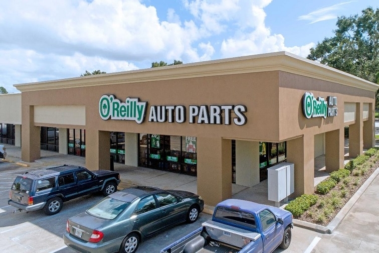
Property Record
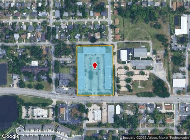
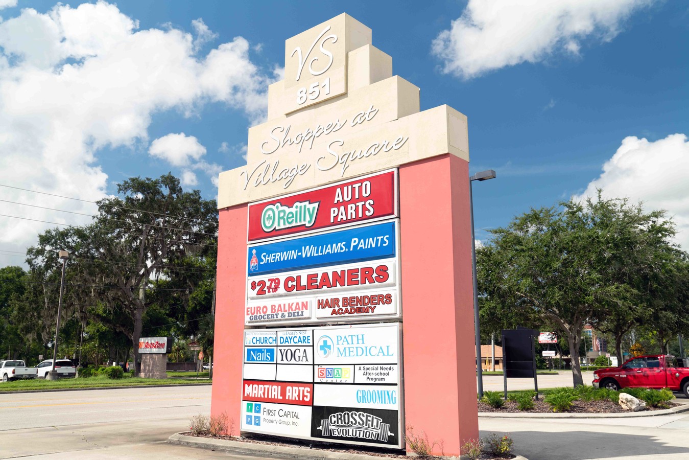
851 E State Road 434, Longwood, FL 32750

NEARBY LISTINGS FOR SALE OR LEASE
Property Detail
851 E State Road 434
32-20-30-510-0200-0000
Wildmere
Storebuilding
ALL BLK 2 (LESS W 225 FT & RD) WILDMERE PB 1 PG 111
X
Seminole
12117C0155F
Florida
2023
4.95 AC
2023
Longwood
021507
Orlando
23,400 SF
Orlando-Kissimmee-Sanford, FL
DEMOGRAPHICS near 851 E State Road 434
1 Mile
3 Mile
5 Mile
2024 Total Population
11,828
70,842
207,004
2029 Population
12,308
73,700
215,697
Pop Growth 2024-2029
+ 4.06%
+ 4.03%
+ 4.20%
Average Age
41
42
42
2024 Total Households
4,739
27,638
84,395
HH Growth 2024-2029
+ 4.16%
+ 4.12%
+ 4.39%
Median Household Inc
$55,628
$64,841
$67,399
Avg Household Size
2.40
2.50
2.40
2024 Avg HH Vehicles
2.00
2.00
2.00
Median Home Value
$248,089
$280,649
$307,436
Median Year Built
1980
1981
1983
Nearby Places
- Restaurants
- Banks
- Shops
- Fitness
- Groceries
PUBLIC TRANSPORTATION
COMMUTER RAIL
Longwood (SunRail - Florida Department of Transportation)
DRIVE
WALK
Distance
Longwood (SunRail - Florida Department of Transportation)
3 min
20 min
1.1 mi
Altamonte Springs (SunRail - Florida Department of Transportation)
DRIVE
WALK
Distance
Altamonte Springs (SunRail - Florida Department of Transportation)
7 min
3.8 mi
AIRPORT
Orlando Sanford International
DRIVE
WALK
Distance
Orlando Sanford International
17 min
9.5 mi
Orlando International
DRIVE
WALK
Distance
Orlando International
34 min
19.9 mi
Freight Ports
Port Canaveral
DRIVE
WALK
Distance
Port Canaveral
79 min
61.5 mi
SALE & LEASE HISTORY
LISTING DATE
SALE/LEASE

Sep 25, 2016
For Lease
Sep 13, 2018
For Sale
Mar 23, 2022
For Lease
Mar 16, 2021
For Lease
Nearby Properties
Address
Land Use
TOTAL SIZE
Lot Size
Zoning
Address
Land Use
TOTAL SIZE
Lot Size
Zoning
21.25 AC
GC
Address
Land Use
TOTAL SIZE
Lot Size
Zoning
1,158 SF
17.22 AC
Address
Land Use
TOTAL SIZE
Lot Size
Zoning
206 SF
1.43 AC
VMU
Address
Land Use
TOTAL SIZE
Lot Size
Zoning
629,182 SF
1.81 AC
R1A
Address
Land Use
TOTAL SIZE
Lot Size
Zoning
456 SF
9.56 AC
Address
Land Use
TOTAL SIZE
Lot Size
Zoning
17,728 SF
14.64 AC
GC
Address
Land Use
TOTAL SIZE
Lot Size
Zoning
97,888 SF
3.72 AC
IND
Address
Land Use
TOTAL SIZE
Lot Size
Zoning
147,310 SF
16.71 AC
GC
Address
Land Use
TOTAL SIZE
Lot Size
Zoning
560,170 SF
32.59 AC
M1A
Address
Land Use
TOTAL SIZE
Lot Size
Zoning
390,293 SF
47.33 AC
PI
Address
Land Use
TOTAL SIZE
Lot Size
Zoning
1,696 SF
0.16 AC
A1
Address
Land Use
TOTAL SIZE
Lot Size
Zoning
1,518 SF
12.08 AC
PUD
Address
Land Use
TOTAL SIZE
Lot Size
Zoning
365,430 SF
2.70 AC
RMF13
Address
Land Use
TOTAL SIZE
Lot Size
Zoning
212,638 SF
28.72 AC
M1
Address
Land Use
TOTAL SIZE
Lot Size
Zoning
5,935 SF
2.27 AC
RMF13
Address
Land Use
TOTAL SIZE
Lot Size
Zoning
195,936 SF
58.50 AC
PUD
Address
Land Use
TOTAL SIZE
Lot Size
Zoning
136,532 SF
12.13 AC
GC
Address
Land Use
TOTAL SIZE
Lot Size
Zoning
140,456 SF
8.45 AC
R1
Address
Land Use
TOTAL SIZE
Lot Size
Zoning
35.82 AC
Address
Land Use
TOTAL SIZE
Lot Size
Zoning
98,202 SF
9.03 AC
CG
Address
Land Use
TOTAL SIZE
Lot Size
Zoning
126,252 SF
10.49 AC
CG
Address
Land Use
TOTAL SIZE
Lot Size
Zoning
2,940 SF
13.83 AC
PMXH
Address
Land Use
TOTAL SIZE
Lot Size
Zoning
80,000 SF
5.35 AC
IND
Address
Land Use
TOTAL SIZE
Lot Size
Zoning
96,858 SF
4.88 AC
M1
Address
Land Use
TOTAL SIZE
Lot Size
Zoning
111,921 SF
5.22 AC
M1
Address
Land Use
TOTAL SIZE
Lot Size
Zoning
67,499 SF
3.74 AC
IND
Address
Land Use
TOTAL SIZE
Lot Size
Zoning
121,520 SF
5.82 AC
IND
Address
Land Use
TOTAL SIZE
Lot Size
Zoning
112,526 SF
8.23 AC
GC
Address
Land Use
TOTAL SIZE
Lot Size
Zoning
102,600 SF
10.48 AC
CG
Address
Land Use
TOTAL SIZE
Lot Size
Zoning
91,706 SF
4.38 AC
GC
The World's #1 Commercial Real Estate Marketplace
Connect with us
© 2025 CoStar Group
The information above has been obtained from sources believed reliable. While we do not doubt its accuracy we have not verified it and make no guarantee, warranty or representation about it. It is your responsibility to independently confirm its accuracy and completeness. Any projections, opinions, assumptions, or estimates used are for example only and do not represent the current or future performance of the property. The value of this transaction to you depends on tax and other factors which should be evaluated by your tax, financial, and legal advisors. You and your advisors should conduct a careful, independent investigation of the property to determine to your satisfaction the suitability of the property for your needs.