Property Record
8520 Scarborough Dr, Colorado Springs, CO 80920


NEARBY LISTINGS FOR SALE OR LEASE
Property Detail
8520 Scarborough Dr
Colorado Springs, CO
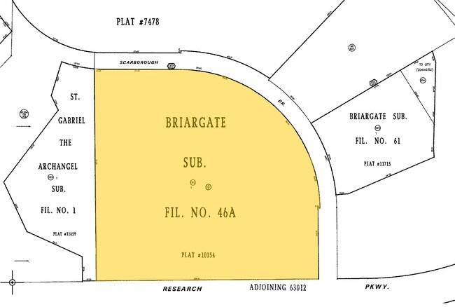
Briargate Sub Fil No 46A
62363-02-004
LOT 1 BLK 1 BRIARGATE SUB FIL NO 46A, EX THAT PT CONV BY REC 210131377
Commercialacreage
El Paso
X
Colorado
08041C0528G
1
2024
15.40 AC
2025
Northeast
003906
Colorado Springs
DEMOGRAPHICS near 8520 Scarborough Dr
1 Mile
3 Mile
5 Mile
2024 Total Population
16,290
96,878
198,588
2029 Population
16,942
101,916
208,644
Pop Growth 2024-2029
+ 4.00%
+ 5.20%
+ 5.06%
Average Age
36
37
37
2024 Total Households
5,239
34,321
73,216
HH Growth 2024-2029
+ 4.18%
+ 5.34%
+ 5.19%
Median Household Inc
$124,775
$106,653
$97,740
Avg Household Size
3.00
2.80
2.70
2024 Avg HH Vehicles
2.00
2.00
2.00
Median Home Value
$440,303
$441,724
$425,216
Median Year Built
1998
2001
1999
Nearby Places
Map Layers
Map Styles
 Street
 Aerial
- Restaurants
- Banks
- Shops
- Fitness
- Groceries
PUBLIC TRANSPORTATION
AIRPORT
City of Colorado Springs Municipal
DRIVE
WALK
Distance
City of Colorado Springs Municipal
22 min
12.6 mi
Freight Ports
Tulsa Port Of Catoosa
DRIVE
WALK
Distance
Tulsa Port Of Catoosa
731 min
687.6 mi
Nearby Properties
Address
Land Use
TOTAL SIZE
Lot Size
Zoning
Address
Land Use
TOTAL SIZE
Lot Size
Zoning
1,129,761 SF
32.88 AC
MX-M HR AO
Address
Land Use
TOTAL SIZE
Lot Size
Zoning
361,165 SF
59.11 AC
PDZ
Address
Land Use
TOTAL SIZE
Lot Size
Zoning
356,093 SF
16.27 AC
R-5 AO SS
Address
Land Use
TOTAL SIZE
Lot Size
Zoning
262,950 SF
13.23 AC
PDZ AO
Address
Land Use
TOTAL SIZE
Lot Size
Zoning
32,792 SF
7 AC
MX-M AO
Address
Land Use
TOTAL SIZE
Lot Size
Zoning
187,841 SF
40.33 AC
A
Address
Land Use
TOTAL SIZE
Lot Size
Zoning
82,316 SF
4.08 AC
R-5/CR SS
Address
Land Use
TOTAL SIZE
Lot Size
Zoning
43,033 SF
17 AC
MX-M AO
Address
Land Use
TOTAL SIZE
Lot Size
Zoning
480 SF
11 AC
A UV
Address
Land Use
TOTAL SIZE
Lot Size
Zoning
15,559 SF
6 AC
MX-M CU AO
Address
Land Use
TOTAL SIZE
Lot Size
Zoning
15,559 SF
6 AC
MX-M CU AO
Address
Land Use
TOTAL SIZE
Lot Size
Zoning
15,559 SF
6 AC
MX-M CU AO
Address
Land Use
TOTAL SIZE
Lot Size
Zoning
14,257 SF
6 AC
MX-M CU AO
Address
Land Use
TOTAL SIZE
Lot Size
Zoning
14,257 SF
6 AC
MX-M CU AO
Address
Land Use
TOTAL SIZE
Lot Size
Zoning
14,257 SF
6 AC
MX-M CU AO
Address
Land Use
TOTAL SIZE
Lot Size
Zoning
13,882 SF
6 AC
MX-M CU AO
Address
Land Use
TOTAL SIZE
Lot Size
Zoning
12,827 SF
6 AC
MX-M CU AO
Address
Land Use
TOTAL SIZE
Lot Size
Zoning
41,117 SF
5.04 AC
MX-M
Address
Land Use
TOTAL SIZE
Lot Size
Zoning
64,928 SF
31.47 AC
A
Address
Land Use
TOTAL SIZE
Lot Size
Zoning
8,830 SF
6 AC
MX-M CU AO
Address
Land Use
TOTAL SIZE
Lot Size
Zoning
8,830 SF
6 AC
MX-M CU AO
Address
Land Use
TOTAL SIZE
Lot Size
Zoning
58,630 SF
17.84 AC
A-5 CAD-O
Address
Land Use
TOTAL SIZE
Lot Size
Zoning
35,862 SF
5.95 AC
MX-N
Address
Land Use
TOTAL SIZE
Lot Size
Zoning
5,934 SF
6 AC
MX-M CU AO
Address
Land Use
TOTAL SIZE
Lot Size
Zoning
4,752 SF
6 AC
MX-M CU AO
Address
Land Use
TOTAL SIZE
Lot Size
Zoning
53,103 SF
8.93 AC
RR-5
Address
Land Use
TOTAL SIZE
Lot Size
Zoning
76,138 SF
4.84 AC
BP
Address
Land Use
TOTAL SIZE
Lot Size
Zoning
48,673 SF
5.51 AC
R-5 P
Address
Land Use
TOTAL SIZE
Lot Size
Zoning
45,141 SF
6.97 AC
R-5/CR
Address
Land Use
TOTAL SIZE
Lot Size
Zoning
44,844 SF
21.84 AC
PDZ AO
The World's #1 Commercial Real Estate Marketplace
Connect with us
© 2026 CoStar Group
The information above has been obtained from sources believed reliable. While we do not doubt its accuracy we have not verified it and make no guarantee, warranty or representation about it. It is your responsibility to independently confirm its accuracy and completeness. Any projections, opinions, assumptions, or estimates used are for example only and do not represent the current or future performance of the property. The value of this transaction to you depends on tax and other factors which should be evaluated by your tax, financial, and legal advisors. You and your advisors should conduct a careful, independent investigation of the property to determine to your satisfaction the suitability of the property for your needs.