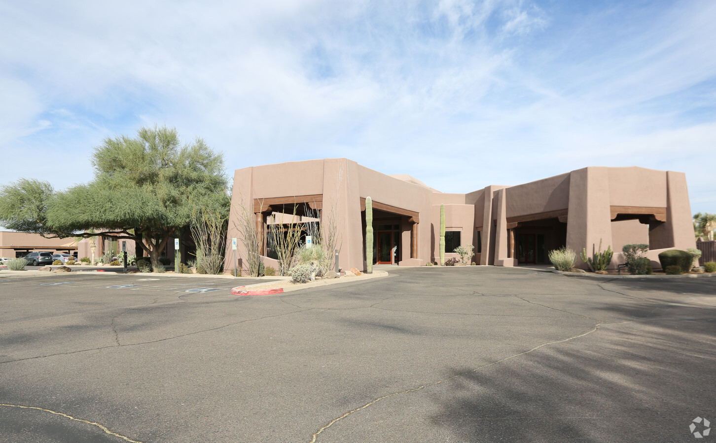
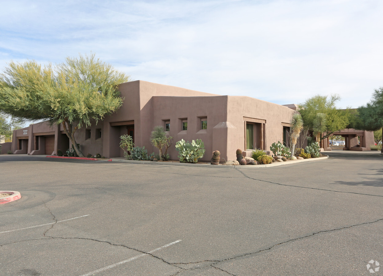
Property Record
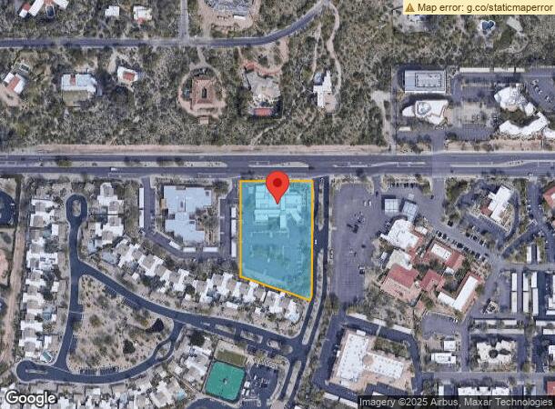
8555 E Pinnacle Peak Rd, Scottsdale, AZ 85255
NEARBY LISTINGS FOR SALE OR LEASE
Property Detail
8555 E Pinnacle Peak Rd
212-01-566E
La Vista Bonita
Cemetery
LA VISTA BONITA MCR 45/46 & A POR OF NE4 SEC 13 DAF COM AT NE COR SD SEC 13 TH W 1039.80F TH S 55F TO POB TH S 417.57F TH S 18D 34M W 9F TO PT ON NLY LN OF FINAL PLAT OF THE PINNACLE MCR 268/33 TH N 7 1D 26M W ALG SD NLY LN 272.47F TH N 339.34F TO PT
X
Maricopa
04013C1310M
Arizona
2024
2.30 AC
2025
North Scottsdale
216841
Phoenix
18,326 SF
Phoenix-Mesa-Scottsdale, AZ
DEMOGRAPHICS near 8555 E Pinnacle Peak Rd
1 Mile
3 Mile
5 Mile
2024 Total Population
3,724
31,239
80,408
2029 Population
4,081
34,558
89,069
Pop Growth 2024-2029
+ 9.59%
+ 10.62%
+ 10.77%
Average Age
50
49
47
2024 Total Households
1,524
13,820
36,478
HH Growth 2024-2029
+ 9.71%
+ 10.93%
+ 11.11%
Median Household Inc
$152,586
$139,127
$124,799
Avg Household Size
2.40
2.20
2.20
2024 Avg HH Vehicles
2.00
2.00
2.00
Median Home Value
$850,478
$860,377
$813,746
Median Year Built
1992
1999
2000
Nearby Places
- Restaurants
- Banks
- Shops
- Fitness
- Groceries
PUBLIC TRANSPORTATION
AIRPORT
Phoenix Sky Harbor International
DRIVE
WALK
Distance
Phoenix Sky Harbor International
36 min
25.8 mi
Freight Ports
Port of San Diego
DRIVE
WALK
Distance
Port of San Diego
426 min
379.1 mi
Nearby Properties
Address
Land Use
TOTAL SIZE
Lot Size
Zoning
Address
Land Use
TOTAL SIZE
Lot Size
Zoning
1,479,005 SF
12.55 AC
PC
Address
Land Use
TOTAL SIZE
Lot Size
Zoning
229,856 SF
7.71 AC
C-T
Address
Land Use
TOTAL SIZE
Lot Size
Zoning
734,840 SF
33.12 AC
M-H
Address
Land Use
TOTAL SIZE
Lot Size
Zoning
90.73 AC
O-S
Address
Land Use
TOTAL SIZE
Lot Size
Zoning
67.59 AC
C-C
Address
Land Use
TOTAL SIZE
Lot Size
Zoning
255,313 SF
22.54 AC
PNC
Address
Land Use
TOTAL SIZE
Lot Size
Zoning
385,376 SF
13.65 AC
PAD
Address
Land Use
TOTAL SIZE
Lot Size
Zoning
41.63 AC
I-1
Address
Land Use
TOTAL SIZE
Lot Size
Zoning
731,843 SF
29.85 AC
M-H
Address
Land Use
TOTAL SIZE
Lot Size
Zoning
328,616 SF
10.56 AC
PAD
Address
Land Use
TOTAL SIZE
Lot Size
Zoning
397,568 SF
16.71 AC
PAD
Address
Land Use
TOTAL SIZE
Lot Size
Zoning
191,639 SF
31.94 AC
O-S
Address
Land Use
TOTAL SIZE
Lot Size
Zoning
58.66 AC
R-43AG
Address
Land Use
TOTAL SIZE
Lot Size
Zoning
570.07 AC
R-43
Address
Land Use
TOTAL SIZE
Lot Size
Zoning
286,776 SF
5.86 AC
C-T
Address
Land Use
TOTAL SIZE
Lot Size
Zoning
270,264 SF
5.84 AC
C-C
Address
Land Use
TOTAL SIZE
Lot Size
Zoning
201,308 SF
3.44 AC
PC
Address
Land Use
TOTAL SIZE
Lot Size
Zoning
66,317 SF
20.82 AC
R-190
Address
Land Use
TOTAL SIZE
Lot Size
Zoning
115,275 SF
12.16 AC
C-C
Address
Land Use
TOTAL SIZE
Lot Size
Zoning
100,378 SF
12.29 AC
C-C
Address
Land Use
TOTAL SIZE
Lot Size
Zoning
80,105 SF
12.35 AC
PAD
Address
Land Use
TOTAL SIZE
Lot Size
Zoning
77,580 SF
9.84 AC
R-7
Address
Land Use
TOTAL SIZE
Lot Size
Zoning
153,809 SF
4.50 AC
C2
Address
Land Use
TOTAL SIZE
Lot Size
Zoning
31.40 AC
R-43AG
Address
Land Use
TOTAL SIZE
Lot Size
Zoning
92,548 SF
16.81 AC
Address
Land Use
TOTAL SIZE
Lot Size
Zoning
78,375 SF
9.28 AC
R-43
Address
Land Use
TOTAL SIZE
Lot Size
Zoning
181,428 SF
12 AC
Address
Land Use
TOTAL SIZE
Lot Size
Zoning
21.96 AC
C-R
Address
Land Use
TOTAL SIZE
Lot Size
Zoning
1,350 SF
20.41 AC
R-43AG
The World's #1 Commercial Real Estate Marketplace
Connect with us
© 2025 CoStar Group
The information above has been obtained from sources believed reliable. While we do not doubt its accuracy we have not verified it and make no guarantee, warranty or representation about it. It is your responsibility to independently confirm its accuracy and completeness. Any projections, opinions, assumptions, or estimates used are for example only and do not represent the current or future performance of the property. The value of this transaction to you depends on tax and other factors which should be evaluated by your tax, financial, and legal advisors. You and your advisors should conduct a careful, independent investigation of the property to determine to your satisfaction the suitability of the property for your needs.