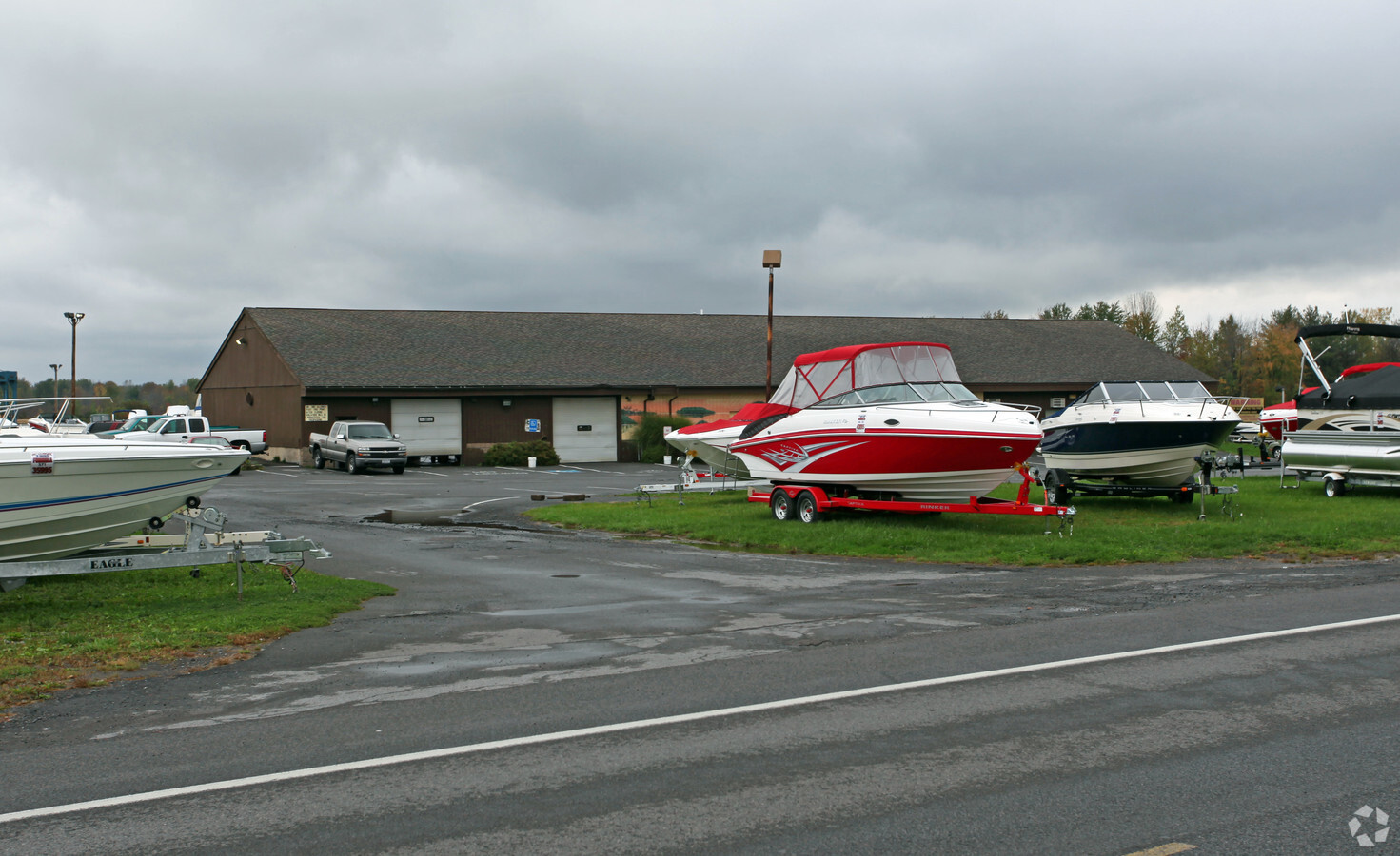
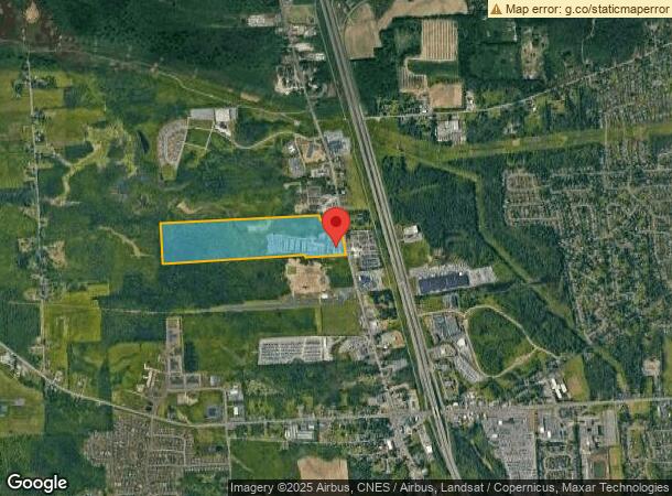
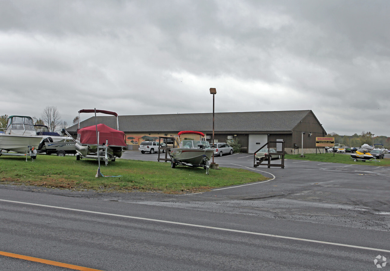
Property Record
8575 Brewerton Rd, Cicero, NY 13039
NEARBY LISTINGS FOR SALE OR LEASE
Property Detail
8575 Brewerton Rd
312289-092-000-0001-010-001-0000
FL 41 (SUBDIVISIONS 1 & 2 1160744
Vehiclerentalsvehiclesales
Onondaga
X
New York
36067C0111F
10.001
2024
71.08 AC
2023
NE Outer Onondaga County
010200
Syracuse
7,200 SF
Syracuse, NY
DEMOGRAPHICS near 8575 Brewerton Rd
1 Mile
3 Mile
5 Mile
2024 Total Population
1,645
26,108
60,849
2029 Population
1,594
25,320
59,123
Pop Growth 2024-2029
(3.10%)
(3.02%)
(2.84%)
Average Age
44
42
43
2024 Total Households
691
10,193
25,156
HH Growth 2024-2029
(3.47%)
(3.26%)
(3.01%)
Median Household Inc
$99,038
$101,453
$85,022
Avg Household Size
2.30
2.50
2.40
2024 Avg HH Vehicles
2.00
2.00
2.00
Median Home Value
$167,617
$188,020
$179,239
Median Year Built
1975
1981
1974
Nearby Places
- Restaurants
- Banks
- Shops
- Fitness
- Groceries
PUBLIC TRANSPORTATION
AIRPORT
Syracuse Hancock International
DRIVE
WALK
Distance
Syracuse Hancock International
12 min
7.3 mi
Freight Ports
Albany, NY Port
DRIVE
WALK
Distance
Albany, NY Port
176 min
147.7 mi
Nearby Properties
Address
Land Use
TOTAL SIZE
Lot Size
Zoning
Address
Land Use
TOTAL SIZE
Lot Size
Zoning
256,727 SF
70.21 AC
Address
Land Use
TOTAL SIZE
Lot Size
Zoning
439,670 SF
74.73 AC
C-G
Address
Land Use
TOTAL SIZE
Lot Size
Zoning
157,010 SF
36.98 AC
Address
Land Use
TOTAL SIZE
Lot Size
Zoning
203,345 SF
18.17 AC
Address
Land Use
TOTAL SIZE
Lot Size
Zoning
8,417 SF
13.95 AC
Address
Land Use
TOTAL SIZE
Lot Size
Zoning
125,400 SF
18.11 AC
GC
Address
Land Use
TOTAL SIZE
Lot Size
Zoning
141,472 SF
12.38 AC
C-G
Address
Land Use
TOTAL SIZE
Lot Size
Zoning
24,556 SF
16.52 AC
Address
Land Use
TOTAL SIZE
Lot Size
Zoning
92,844 SF
14.26 AC
C-G
Address
Land Use
TOTAL SIZE
Lot Size
Zoning
1,568 SF
330.36 AC
Address
Land Use
TOTAL SIZE
Lot Size
Zoning
103,005 SF
12.58 AC
Address
Land Use
TOTAL SIZE
Lot Size
Zoning
86,269 SF
25.20 AC
C-G
Address
Land Use
TOTAL SIZE
Lot Size
Zoning
66,538 SF
18.24 AC
Address
Land Use
TOTAL SIZE
Lot Size
Zoning
81,439 SF
15.48 AC
Address
Land Use
TOTAL SIZE
Lot Size
Zoning
57,052 SF
16.82 AC
Address
Land Use
TOTAL SIZE
Lot Size
Zoning
67,143 SF
3.91 AC
Address
Land Use
TOTAL SIZE
Lot Size
Zoning
2,404 SF
9.73 AC
Address
Land Use
TOTAL SIZE
Lot Size
Zoning
42,698 SF
13.85 AC
Address
Land Use
TOTAL SIZE
Lot Size
Zoning
68,021 SF
9.94 AC
C-G
Address
Land Use
TOTAL SIZE
Lot Size
Zoning
17,436 SF
98.89 AC
06000
Address
Land Use
TOTAL SIZE
Lot Size
Zoning
139,279 SF
12.14 AC
Address
Land Use
TOTAL SIZE
Lot Size
Zoning
8,224 SF
8.45 AC
PUD-R
Address
Land Use
TOTAL SIZE
Lot Size
Zoning
271,263 SF
27.93 AC
Address
Land Use
TOTAL SIZE
Lot Size
Zoning
29,745 SF
22.69 AC
Address
Land Use
TOTAL SIZE
Lot Size
Zoning
8,224 SF
9.86 AC
PUD-R
Address
Land Use
TOTAL SIZE
Lot Size
Zoning
16,630 SF
10.16 AC
Address
Land Use
TOTAL SIZE
Lot Size
Zoning
58,598 SF
4.21 AC
Address
Land Use
TOTAL SIZE
Lot Size
Zoning
35,504 SF
26.92 AC
PUD-R
Address
Land Use
TOTAL SIZE
Lot Size
Zoning
900 SF
0.44 AC
R-10
Address
Land Use
TOTAL SIZE
Lot Size
Zoning
43,968 SF
1.95 AC
The World's #1 Commercial Real Estate Marketplace
Connect with us
© 2025 CoStar Group
The information above has been obtained from sources believed reliable. While we do not doubt its accuracy we have not verified it and make no guarantee, warranty or representation about it. It is your responsibility to independently confirm its accuracy and completeness. Any projections, opinions, assumptions, or estimates used are for example only and do not represent the current or future performance of the property. The value of this transaction to you depends on tax and other factors which should be evaluated by your tax, financial, and legal advisors. You and your advisors should conduct a careful, independent investigation of the property to determine to your satisfaction the suitability of the property for your needs.