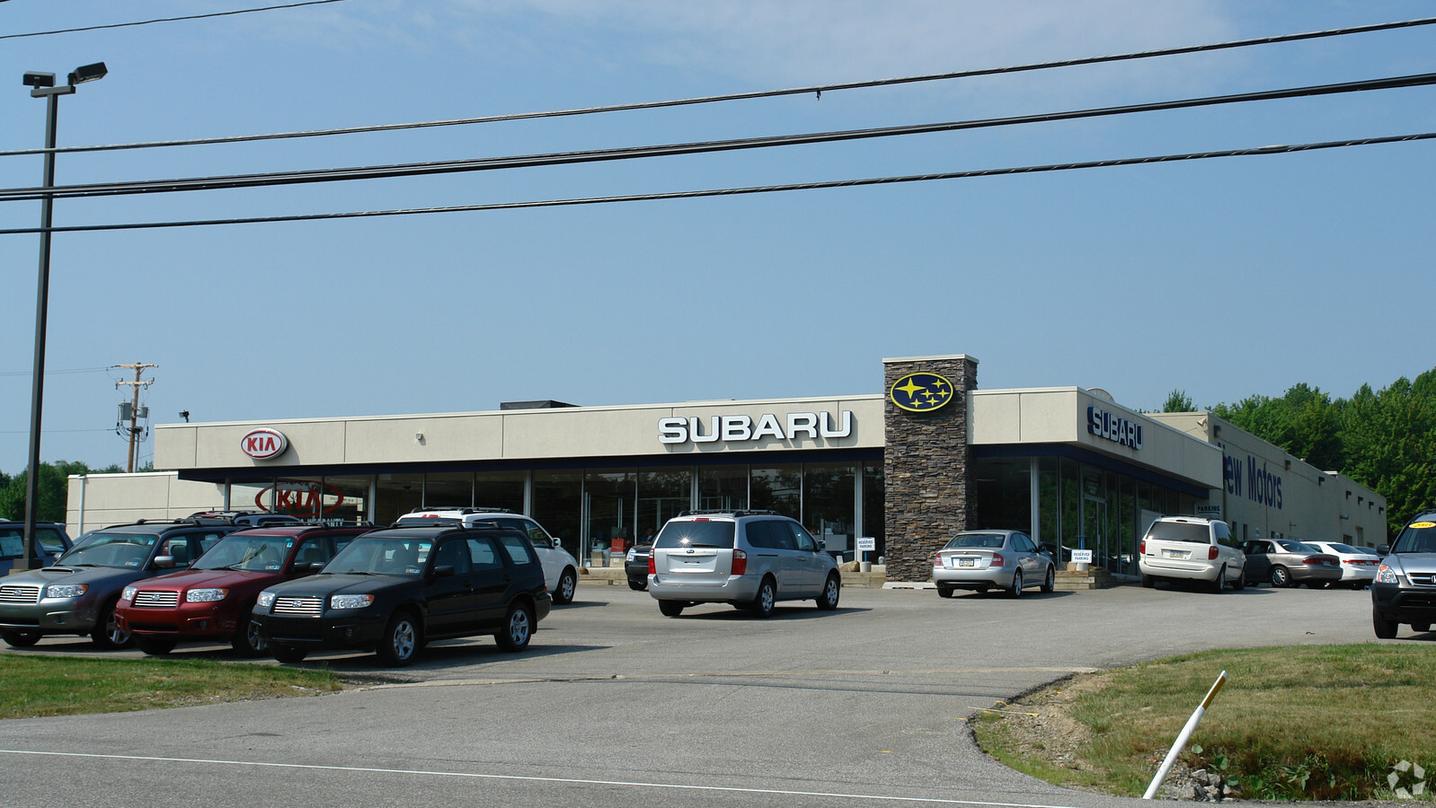
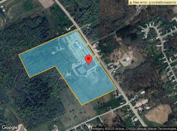
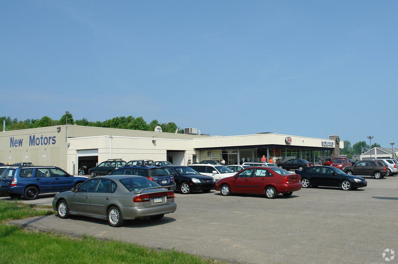
Property Record
8670 Peach St, Erie, PA 16509
NEARBY LISTINGS FOR SALE OR LEASE
Property Detail
8670 Peach St
Erie, PA
Subidivsion Of Land For Gertruse Moedzel
40-016-072.0-038.01
8630, 8670 & 8680 PEACH ST 31.5461 AC REF L2004-209, S1993-175 & L2015-20898
Vehiclerentalsvehiclesales
Erie
X
Pennsylvania
42049C0212D
3801
2024
31.55 AC
2024
Outlying Erie County
011202
Erie
26,770 SF
DEMOGRAPHICS near 8670 Peach St
1 Mile
3 Mile
5 Mile
2024 Total Population
1,162
12,333
61,618
2029 Population
1,137
12,159
60,739
Pop Growth 2024-2029
(2.15%)
(1.41%)
(1.43%)
Average Age
49
45
42
2024 Total Households
513
5,382
26,013
HH Growth 2024-2029
(2.53%)
(1.41%)
(1.52%)
Median Household Inc
$63,816
$68,509
$67,348
Avg Household Size
2.20
2.20
2.20
2024 Avg HH Vehicles
2.00
2.00
2.00
Median Home Value
$152,592
$210,558
$170,845
Median Year Built
1990
1978
1970
Nearby Places
- Restaurants
- Banks
- Shops
- Fitness
- Groceries
PUBLIC TRANSPORTATION
COMMUTER RAIL
Erie Amtrak Station (Lake Shore Limited - Amtrak)
DRIVE
WALK
Distance
Erie Amtrak Station (Lake Shore Limited - Amtrak)
14 min
6.9 mi
AIRPORT
Erie International/Tom Ridge Field
DRIVE
WALK
Distance
Erie International/Tom Ridge Field
17 min
9.3 mi
Freight Ports
Port of Toledo
DRIVE
WALK
Distance
Port of Toledo
247 min
211.0 mi
Nearby Properties
Address
Land Use
TOTAL SIZE
Lot Size
Zoning
Address
Land Use
TOTAL SIZE
Lot Size
Zoning
104,159 SF
255.72 AC
B1
Address
Land Use
TOTAL SIZE
Lot Size
Zoning
35,529 SF
84.04 AC
BB
Address
Land Use
TOTAL SIZE
Lot Size
Zoning
1,121,950 SF
80.70 AC
I1
Address
Land Use
TOTAL SIZE
Lot Size
Zoning
8,337 SF
13.31 AC
B1
Address
Land Use
TOTAL SIZE
Lot Size
Zoning
14,688 SF
39.53 AC
AR
Address
Land Use
TOTAL SIZE
Lot Size
Zoning
151,500 SF
6.75 AC
Address
Land Use
TOTAL SIZE
Lot Size
Zoning
198,102 SF
27.63 AC
B1
Address
Land Use
TOTAL SIZE
Lot Size
Zoning
80,390 SF
69.53 AC
B1
Address
Land Use
TOTAL SIZE
Lot Size
Zoning
3,340 SF
37.04 AC
AR
Address
Land Use
TOTAL SIZE
Lot Size
Zoning
73,078 SF
13.80 AC
B1
Address
Land Use
TOTAL SIZE
Lot Size
Zoning
176,811 SF
26.71 AC
B1
Address
Land Use
TOTAL SIZE
Lot Size
Zoning
100,443 SF
6 AC
B1
Address
Land Use
TOTAL SIZE
Lot Size
Zoning
146.02 AC
R2
Address
Land Use
TOTAL SIZE
Lot Size
Zoning
36,406 SF
20 AC
Address
Land Use
TOTAL SIZE
Lot Size
Zoning
125,399 SF
10.93 AC
BB
Address
Land Use
TOTAL SIZE
Lot Size
Zoning
89,004 SF
2.80 AC
Address
Land Use
TOTAL SIZE
Lot Size
Zoning
18,460 SF
18.84 AC
B1
Address
Land Use
TOTAL SIZE
Lot Size
Zoning
4,476 SF
70.28 AC
B1
Address
Land Use
TOTAL SIZE
Lot Size
Zoning
37,032 SF
23.84 AC
Address
Land Use
TOTAL SIZE
Lot Size
Zoning
62,234 SF
12.79 AC
DR
Address
Land Use
TOTAL SIZE
Lot Size
Zoning
109,814 SF
9.66 AC
BB
Address
Land Use
TOTAL SIZE
Lot Size
Zoning
69,560 SF
3.36 AC
Address
Land Use
TOTAL SIZE
Lot Size
Zoning
147,556 SF
12.96 AC
B1
Address
Land Use
TOTAL SIZE
Lot Size
Zoning
73,670 SF
7.60 AC
AR
Address
Land Use
TOTAL SIZE
Lot Size
Zoning
27.90 AC
R2
Address
Land Use
TOTAL SIZE
Lot Size
Zoning
90,475 SF
3.42 AC
Address
Land Use
TOTAL SIZE
Lot Size
Zoning
119,900 SF
10.52 AC
B1
Address
Land Use
TOTAL SIZE
Lot Size
Zoning
54,668 SF
2.51 AC
B1
Address
Land Use
TOTAL SIZE
Lot Size
Zoning
20.82 AC
B1
Address
Land Use
TOTAL SIZE
Lot Size
Zoning
3,188 SF
8.87 AC
R2
The World's #1 Commercial Real Estate Marketplace
Connect with us
© 2025 CoStar Group
The information above has been obtained from sources believed reliable. While we do not doubt its accuracy we have not verified it and make no guarantee, warranty or representation about it. It is your responsibility to independently confirm its accuracy and completeness. Any projections, opinions, assumptions, or estimates used are for example only and do not represent the current or future performance of the property. The value of this transaction to you depends on tax and other factors which should be evaluated by your tax, financial, and legal advisors. You and your advisors should conduct a careful, independent investigation of the property to determine to your satisfaction the suitability of the property for your needs.