Property Record
8671 W Charleston Blvd, Las Vegas, NV 89117
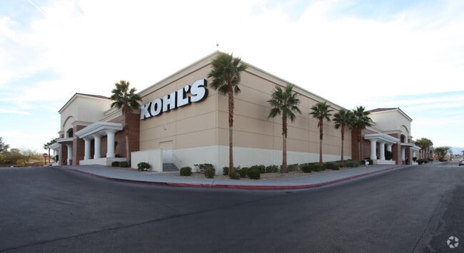


This Property Is For Sale
NEARBY LISTINGS FOR SALE OR LEASE
Property Detail
8671 W Charleston Blvd
Las Vegas-Henderson-Paradise, NV
Charlston-Durango Coml Center
163-05-517-005
CHARLSTON-DURANGO COML CENTER PLAT BOOK 72 PAGE 90 PT LOT 1 BLOCK 1
Storebuilding
Clark
X
Nevada
32003C2145F
1
2025
8.06 AC
2025
West Las Vegas
005805
Las Vegas
103,122 SF
DEMOGRAPHICS near 8671 W Charleston Blvd
1 Mile
3 Mile
5 Mile
2024 Total Population
18,170
163,244
456,675
2029 Population
19,591
174,818
491,595
Pop Growth 2024-2029
+ 7.82%
+ 7.09%
+ 7.65%
Average Age
43
42
41
2024 Total Households
7,816
66,932
180,903
HH Growth 2024-2029
+ 7.79%
+ 7.07%
+ 7.61%
Median Household Inc
$61,205
$64,139
$63,554
Avg Household Size
2.30
2.40
2.50
2024 Avg HH Vehicles
2.00
2.00
2.00
Median Home Value
$415,823
$389,019
$383,873
Median Year Built
1994
1993
1993
Nearby Places
Map Layers
Map Styles
 Street
 Aerial
- Restaurants
- Banks
- Shops
- Fitness
- Groceries
PUBLIC TRANSPORTATION
AIRPORT
Harry Reid International
DRIVE
WALK
Distance
Harry Reid International
24 min
12.5 mi
Boulder City Municipal
DRIVE
WALK
Distance
Boulder City Municipal
47 min
35.4 mi
Nearby Properties
Address
Land Use
TOTAL SIZE
Lot Size
Zoning
Address
Land Use
TOTAL SIZE
Lot Size
Zoning
421,874 SF
59.43 AC
H1
Address
Land Use
TOTAL SIZE
Lot Size
Zoning
336,142 SF
39.99 AC
PC
Address
Land Use
TOTAL SIZE
Lot Size
Zoning
338,051 SF
49.13 AC
C1
Address
Land Use
TOTAL SIZE
Lot Size
Zoning
157,011 SF
31.41 AC
Address
Land Use
TOTAL SIZE
Lot Size
Zoning
974,131 SF
19.93 AC
Address
Land Use
TOTAL SIZE
Lot Size
Zoning
29,374 SF
7.06 AC
Address
Land Use
TOTAL SIZE
Lot Size
Zoning
40.55 AC
PC
Address
Land Use
TOTAL SIZE
Lot Size
Zoning
40 AC
PF
Address
Land Use
TOTAL SIZE
Lot Size
Zoning
38.56 AC
PF
Address
Land Use
TOTAL SIZE
Lot Size
Zoning
157.50 AC
Address
Land Use
TOTAL SIZE
Lot Size
Zoning
408,908 SF
15.60 AC
Address
Land Use
TOTAL SIZE
Lot Size
Zoning
Address
Land Use
TOTAL SIZE
Lot Size
Zoning
52,690 SF
17.65 AC
RU
Address
Land Use
TOTAL SIZE
Lot Size
Zoning
280,968 SF
1.45 AC
Address
Land Use
TOTAL SIZE
Lot Size
Zoning
Address
Land Use
TOTAL SIZE
Lot Size
Zoning
41,331 SF
1.59 AC
Address
Land Use
TOTAL SIZE
Lot Size
Zoning
Address
Land Use
TOTAL SIZE
Lot Size
Zoning
7,292 SF
24.24 AC
R3
Address
Land Use
TOTAL SIZE
Lot Size
Zoning
3,520 SF
28.42 AC
R3
Address
Land Use
TOTAL SIZE
Lot Size
Zoning
6,825 SF
9.11 AC
Address
Land Use
TOTAL SIZE
Lot Size
Zoning
5,427 SF
17.57 AC
Address
Land Use
TOTAL SIZE
Lot Size
Zoning
259,832 SF
3.79 AC
Address
Land Use
TOTAL SIZE
Lot Size
Zoning
2,754 SF
17.17 AC
RPD20
Address
Land Use
TOTAL SIZE
Lot Size
Zoning
223,030 SF
18.11 AC
C1
Address
Land Use
TOTAL SIZE
Lot Size
Zoning
246,947 SF
6.56 AC
RU
Address
Land Use
TOTAL SIZE
Lot Size
Zoning
28,956 SF
75.82 AC
CV
Address
Land Use
TOTAL SIZE
Lot Size
Zoning
3,895 SF
15.40 AC
PC
Address
Land Use
TOTAL SIZE
Lot Size
Zoning
4,872 SF
18.22 AC
R3
Address
Land Use
TOTAL SIZE
Lot Size
Zoning
12,031 SF
17.45 AC
PC
Address
Land Use
TOTAL SIZE
Lot Size
Zoning
7,408 SF
10.99 AC
R4
The World's #1 Commercial Real Estate Marketplace
Connect with us
© 2025 CoStar Group
The information above has been obtained from sources believed reliable. While we do not doubt its accuracy we have not verified it and make no guarantee, warranty or representation about it. It is your responsibility to independently confirm its accuracy and completeness. Any projections, opinions, assumptions, or estimates used are for example only and do not represent the current or future performance of the property. The value of this transaction to you depends on tax and other factors which should be evaluated by your tax, financial, and legal advisors. You and your advisors should conduct a careful, independent investigation of the property to determine to your satisfaction the suitability of the property for your needs.