Property Record
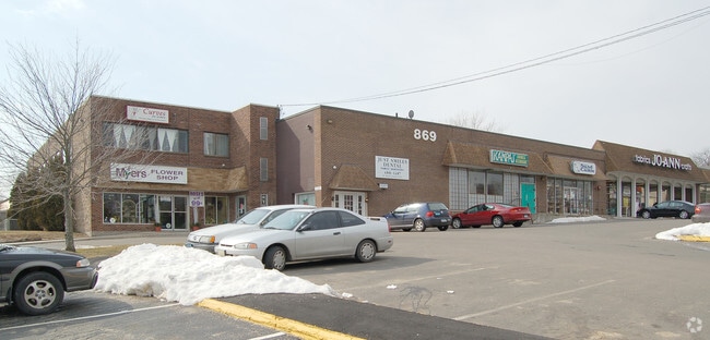
869 W Main St, Branford, CT 06405


NEARBY LISTINGS FOR SALE OR LEASE
Property Detail
869 W Main St
BRAN-000008C-000010-000001
New Haven
Commercialnec
Connecticut
X
1
09009C0464J
2.30 AC
2025
Branford
2025
Westchester/So Connecticut
184200
New Haven-Milford, CT
DEMOGRAPHICS near 869 W Main St
1 Mile
3 Mile
5 Mile
2024 Total Population
7,245
51,629
118,503
2029 Population
7,278
51,683
117,745
Pop Growth 2024-2029
+ 0.46%
+ 0.10%
(0.64%)
Average Age
45
44
41
2024 Total Households
3,320
22,506
51,237
HH Growth 2024-2029
+ 0.36%
+ 0.08%
(0.51%)
Median Household Inc
$79,450
$76,501
$67,930
Avg Household Size
2.10
2.20
2.20
2024 Avg HH Vehicles
2.00
2.00
2.00
Median Home Value
$267,453
$276,002
$277,722
Median Year Built
1975
1968
1964
Nearby Places
Map Layers
Map Styles
 Street
 Aerial
- Restaurants
- Banks
- Shops
- Fitness
- Groceries
PUBLIC TRANSPORTATION
COMMUTER RAIL
Branford (Commuter Rail - Shore Line East, Shore Line East - Shore Line East)
DRIVE
WALK
Distance
Branford (Commuter Rail - Shore Line East, Shore Line East - Shore Line East)
3 min
1.5 mi
New Haven-State Street Station (Hartford Line - CONN DOT, New Haven Line - CONN DOT, Shore Line East - CONN DOT)
DRIVE
WALK
Distance
New Haven-State Street Station (Hartford Line - CONN DOT, New Haven Line - CONN DOT, Shore Line East - CONN DOT)
9 min
5.3 mi
AIRPORT
Tweed/New Haven
DRIVE
WALK
Distance
Tweed/New Haven
7 min
3.1 mi
Freight Ports
Port of New Haven
DRIVE
WALK
Distance
Port of New Haven
8 min
4.2 mi
SALE & LEASE HISTORY
LISTING DATE
SALE/LEASE

Oct 09, 2019
For Lease
Nearby Properties
Address
Land Use
TOTAL SIZE
Lot Size
Zoning
Address
Land Use
TOTAL SIZE
Lot Size
Zoning
227,335 SF
38.50 AC
Address
Land Use
TOTAL SIZE
Lot Size
Zoning
8,655 SF
107.61 AC
AIRPOR
Address
Land Use
TOTAL SIZE
Lot Size
Zoning
85,679 SF
14.23 AC
RM1
Address
Land Use
TOTAL SIZE
Lot Size
Zoning
197.78 AC
LI-3
Address
Land Use
TOTAL SIZE
Lot Size
Zoning
7.72 AC
RA-1
Address
Land Use
TOTAL SIZE
Lot Size
Zoning
16.50 AC
Address
Land Use
TOTAL SIZE
Lot Size
Zoning
5.50 AC
Address
Land Use
TOTAL SIZE
Lot Size
Zoning
35 AC
RA-1
Address
Land Use
TOTAL SIZE
Lot Size
Zoning
44,676 SF
7 AC
Address
Land Use
TOTAL SIZE
Lot Size
Zoning
2,299 SF
14.94 AC
RA-1
Address
Land Use
TOTAL SIZE
Lot Size
Zoning
48,726 SF
9.46 AC
Address
Land Use
TOTAL SIZE
Lot Size
Zoning
19.26 AC
R-2
Address
Land Use
TOTAL SIZE
Lot Size
Zoning
9.34 AC
CA-1
Address
Land Use
TOTAL SIZE
Lot Size
Zoning
105,998 SF
13.68 AC
PDD
Address
Land Use
TOTAL SIZE
Lot Size
Zoning
10,892 SF
5.05 AC
Address
Land Use
TOTAL SIZE
Lot Size
Zoning
2,816 SF
PDD 11
Address
Land Use
TOTAL SIZE
Lot Size
Zoning
19.50 AC
Address
Land Use
TOTAL SIZE
Lot Size
Zoning
34,341 SF
5.65 AC
Address
Land Use
TOTAL SIZE
Lot Size
Zoning
109,119 SF
CA-1
Address
Land Use
TOTAL SIZE
Lot Size
Zoning
14,508 SF
14 AC
Address
Land Use
TOTAL SIZE
Lot Size
Zoning
5,089 SF
25.20 AC
R18
Address
Land Use
TOTAL SIZE
Lot Size
Zoning
66,116 SF
2.05 AC
CB-1
Address
Land Use
TOTAL SIZE
Lot Size
Zoning
4.87 AC
Address
Land Use
TOTAL SIZE
Lot Size
Zoning
124,472 SF
16.60 AC
Address
Land Use
TOTAL SIZE
Lot Size
Zoning
94,311 SF
6.80 AC
Address
Land Use
TOTAL SIZE
Lot Size
Zoning
6,480 SF
15.94 AC
Address
Land Use
TOTAL SIZE
Lot Size
Zoning
14,030 SF
13.20 AC
Address
Land Use
TOTAL SIZE
Lot Size
Zoning
3.63 AC
RA-1
Address
Land Use
TOTAL SIZE
Lot Size
Zoning
3,588 SF
15.80 AC
Address
Land Use
TOTAL SIZE
Lot Size
Zoning
7.10 AC
CA-1
The World's #1 Commercial Real Estate Marketplace
Connect with us
© 2025 CoStar Group
The information above has been obtained from sources believed reliable. While we do not doubt its accuracy we have not verified it and make no guarantee, warranty or representation about it. It is your responsibility to independently confirm its accuracy and completeness. Any projections, opinions, assumptions, or estimates used are for example only and do not represent the current or future performance of the property. The value of this transaction to you depends on tax and other factors which should be evaluated by your tax, financial, and legal advisors. You and your advisors should conduct a careful, independent investigation of the property to determine to your satisfaction the suitability of the property for your needs.