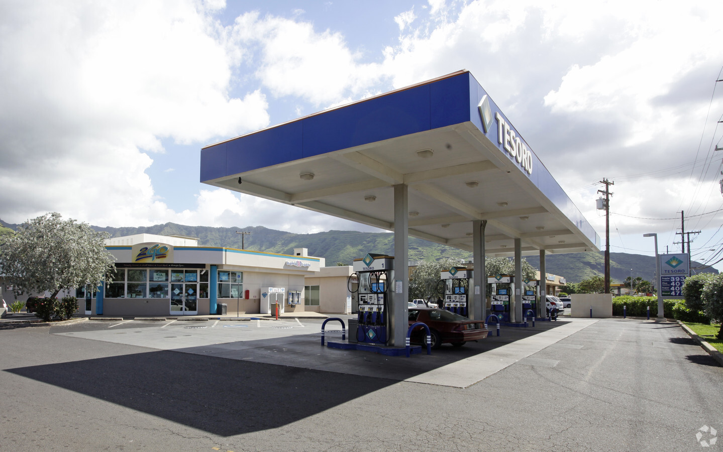
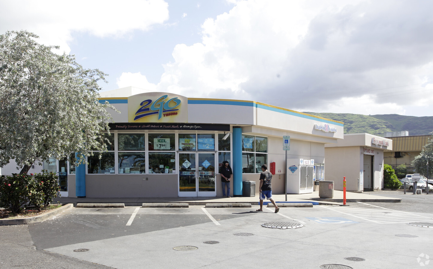
Property Record
87 Farrington Hwy, Waianae, HI 96792

NEARBY LISTINGS FOR SALE OR LEASE
-
-
View all Waianae listings for sale on LoopNet.com
Property Detail
87 Farrington Hwy
1-8-7-008-012-0000
LOT A-2 POR LP GR 9274, LP GR 9323 246,363 SF
Commercialnec
Honolulu
VE
Hawaii
15003C0194H
a-2
2024
5.66 AC
2024
Waianae
940007
Hawaii
76,085 SF
Urban Honolulu, HI
DEMOGRAPHICS near 87 Farrington Hwy
1 Mile
3 Mile
5 Mile
2024 Total Population
7,965
20,318
48,010
2029 Population
7,658
19,238
45,621
Pop Growth 2024-2029
(3.85%)
(5.32%)
(4.98%)
Average Age
35
36
37
2024 Total Households
1,779
4,654
12,495
HH Growth 2024-2029
(4.61%)
(6.38%)
(5.70%)
Median Household Inc
$69,871
$91,466
$100,913
Avg Household Size
4.10
3.90
3.50
2024 Avg HH Vehicles
2.00
2.00
2.00
Median Home Value
$462,028
$501,582
$638,382
Median Year Built
1975
1981
1988
Nearby Places
- Restaurants
- Banks
- Shops
- Fitness
- Groceries
PUBLIC TRANSPORTATION
AIRPORT
Daniel K Inouye International
DRIVE
WALK
Distance
Daniel K Inouye International
34 min
23.1 mi
Freight Ports
Honolulu Harbor, Oahu
DRIVE
WALK
Distance
Honolulu Harbor, Oahu
43 min
27.2 mi
Nearby Properties
Address
Land Use
TOTAL SIZE
Lot Size
Zoning
Address
Land Use
TOTAL SIZE
Lot Size
Zoning
35,020 SF
454.39 AC
U/42/70
Address
Land Use
TOTAL SIZE
Lot Size
Zoning
19.54 AC
U/42/60
Address
Land Use
TOTAL SIZE
Lot Size
Zoning
38,282 SF
25 AC
U/42/40
Address
Land Use
TOTAL SIZE
Lot Size
Zoning
26,311 SF
4.26 AC
U/05/70
Address
Land Use
TOTAL SIZE
Lot Size
Zoning
448.48 AC
A/52/50
Address
Land Use
TOTAL SIZE
Lot Size
Zoning
38,236 SF
2.52 AC
U/05/00
Address
Land Use
TOTAL SIZE
Lot Size
Zoning
12,036 SF
0.38 AC
U/32/30
Address
Land Use
TOTAL SIZE
Lot Size
Zoning
179.11 AC
A/52/50
Address
Land Use
TOTAL SIZE
Lot Size
Zoning
15,210 SF
1.44 AC
U/32/30
Address
Land Use
TOTAL SIZE
Lot Size
Zoning
18,198 SF
1.69 AC
U/05/70
Address
Land Use
TOTAL SIZE
Lot Size
Zoning
12,417 SF
0.48 AC
U/05/70
Address
Land Use
TOTAL SIZE
Lot Size
Zoning
4,168 SF
113.07 AC
A/52/50
Address
Land Use
TOTAL SIZE
Lot Size
Zoning
198.04 AC
A/52/50
Address
Land Use
TOTAL SIZE
Lot Size
Zoning
236.15 AC
A/62/60
Address
Land Use
TOTAL SIZE
Lot Size
Zoning
75.33 AC
A/52/50
Address
Land Use
TOTAL SIZE
Lot Size
Zoning
1,380 SF
14.32 AC
A/52/50
Address
Land Use
TOTAL SIZE
Lot Size
Zoning
3,680 SF
1.31 AC
U/31/30
Address
Land Use
TOTAL SIZE
Lot Size
Zoning
1,302 SF
1.99 AC
U/32/30
Address
Land Use
TOTAL SIZE
Lot Size
Zoning
22,787 SF
23.65 AC
A/51/50
Address
Land Use
TOTAL SIZE
Lot Size
Zoning
21.14 AC
A/62/60
Address
Land Use
TOTAL SIZE
Lot Size
Zoning
9,396 SF
8 AC
A/51/50
Address
Land Use
TOTAL SIZE
Lot Size
Zoning
1,968 SF
207.68 AC
A/52/50
Address
Land Use
TOTAL SIZE
Lot Size
Zoning
7,534 SF
8.40 AC
A/52/50
Address
Land Use
TOTAL SIZE
Lot Size
Zoning
14,844 SF
0.80 AC
U/31/30
Address
Land Use
TOTAL SIZE
Lot Size
Zoning
4,368 SF
0.59 AC
U/32/30
Address
Land Use
TOTAL SIZE
Lot Size
Zoning
10,460 SF
0.83 AC
U/32/30
Address
Land Use
TOTAL SIZE
Lot Size
Zoning
4,416 SF
7.74 AC
A/52/50
Address
Land Use
TOTAL SIZE
Lot Size
Zoning
1,887 SF
10 AC
A/51/50
Address
Land Use
TOTAL SIZE
Lot Size
Zoning
5,440 SF
1 AC
A/52/50
The World's #1 Commercial Real Estate Marketplace
Connect with us
© 2025 CoStar Group
The information above has been obtained from sources believed reliable. While we do not doubt its accuracy we have not verified it and make no guarantee, warranty or representation about it. It is your responsibility to independently confirm its accuracy and completeness. Any projections, opinions, assumptions, or estimates used are for example only and do not represent the current or future performance of the property. The value of this transaction to you depends on tax and other factors which should be evaluated by your tax, financial, and legal advisors. You and your advisors should conduct a careful, independent investigation of the property to determine to your satisfaction the suitability of the property for your needs.