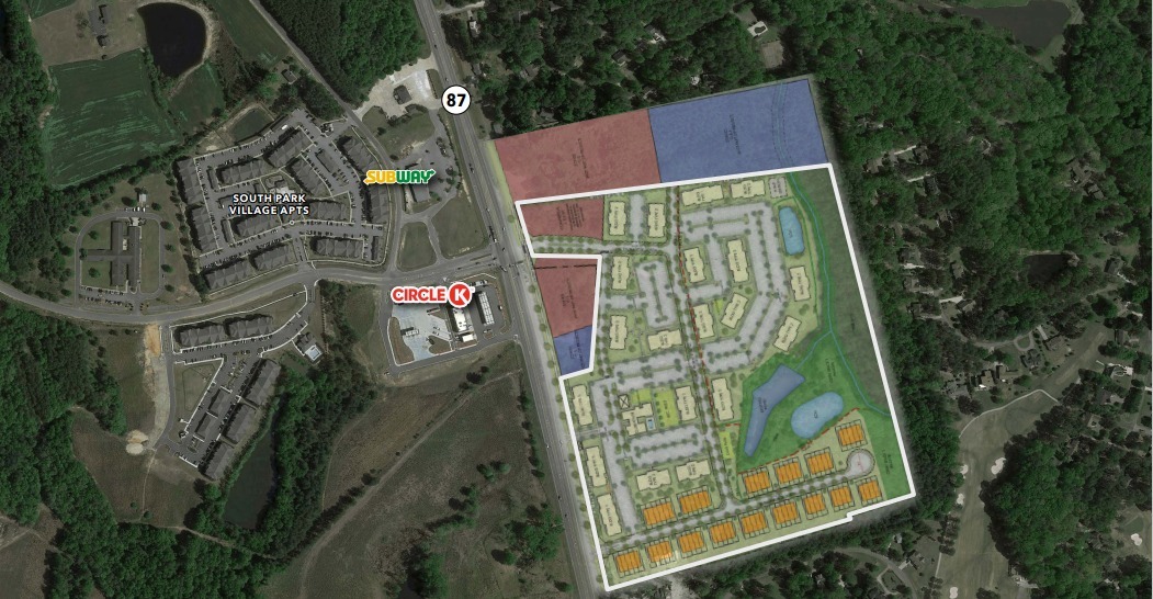
Property Record
87 S Nc Hwy, Sanford, NC 27332
NEARBY LISTINGS FOR SALE OR LEASE
Property Detail
87 S Nc Hwy
Sanford, NC
TRACT 3 PC 9/31F & 2023/147
9660-57-4827-00
Lee
Apartment
North Carolina
2024
38.78 AC
2024
North Carolina Southeast Area
030101
Other Market Areas
DEMOGRAPHICS near 87 S Nc Hwy
1 Mile
3 Mile
5 Mile
2024 Total Population
2,491
12,418
29,522
2029 Population
2,706
13,529
32,156
Pop Growth 2024-2029
+ 8.63%
+ 8.95%
+ 8.92%
Average Age
44
40
39
2024 Total Households
1,075
4,972
11,238
HH Growth 2024-2029
+ 8.74%
+ 8.97%
+ 8.97%
Median Household Inc
$67,048
$60,657
$51,117
Avg Household Size
2.30
2.50
2.50
2024 Avg HH Vehicles
2.00
2.00
2.00
Median Home Value
$238,911
$183,505
$161,850
Median Year Built
1991
1987
1986
Nearby Places
- Restaurants
- Banks
- Shops
- Fitness
- Groceries
PUBLIC TRANSPORTATION
AIRPORT
Fayetteville Regional/Grannis Field
DRIVE
WALK
Distance
Fayetteville Regional/Grannis Field
51 min
33.4 mi
Freight Ports
Port of Wilmington
DRIVE
WALK
Distance
Port of Wilmington
168 min
119.1 mi
SALE & LEASE HISTORY
LISTING DATE
SALE/LEASE

Sep 24, 2016
For Sale
Jan 25, 2024
For Sale
Nearby Properties
Address
Land Use
TOTAL SIZE
Lot Size
Zoning
Address
Land Use
TOTAL SIZE
Lot Size
Zoning
121.09 AC
LIGHT INDU
Address
Land Use
TOTAL SIZE
Lot Size
Zoning
45.70 AC
IND
Address
Land Use
TOTAL SIZE
Lot Size
Zoning
22,969 SF
72.18 AC
RESIDENTIA
Address
Land Use
TOTAL SIZE
Lot Size
Zoning
7.22 AC
CZ
Address
Land Use
TOTAL SIZE
Lot Size
Zoning
5,085 SF
3.50 AC
CZ
Address
Land Use
TOTAL SIZE
Lot Size
Zoning
10,675 SF
2.62 AC
C2
Address
Land Use
TOTAL SIZE
Lot Size
Zoning
4,644 SF
17.30 AC
RA20R
Address
Land Use
TOTAL SIZE
Lot Size
Zoning
135 AC
Address
Land Use
TOTAL SIZE
Lot Size
Zoning
9,100 SF
1.29 AC
COMM
Address
Land Use
TOTAL SIZE
Lot Size
Zoning
18.66 AC
LIGHT INDU
Address
Land Use
TOTAL SIZE
Lot Size
Zoning
3,202 SF
1.75 AC
COMM
Address
Land Use
TOTAL SIZE
Lot Size
Zoning
4,920 SF
0.85 AC
OFFICE & I
Address
Land Use
TOTAL SIZE
Lot Size
Zoning
4.90 AC
SSCZD
Address
Land Use
TOTAL SIZE
Lot Size
Zoning
231.88 AC
RESIDENTIA
Address
Land Use
TOTAL SIZE
Lot Size
Zoning
7.60 AC
C2
Address
Land Use
TOTAL SIZE
Lot Size
Zoning
9,000 SF
2.65 AC
LIGHT INDU
Address
Land Use
TOTAL SIZE
Lot Size
Zoning
53.99 AC
RA20R
Address
Land Use
TOTAL SIZE
Lot Size
Zoning
2.54 AC
Address
Land Use
TOTAL SIZE
Lot Size
Zoning
9,916 SF
5.71 AC
RESIDENTIA
Address
Land Use
TOTAL SIZE
Lot Size
Zoning
1,057 SF
138.48 AC
RESIDENTIA
Address
Land Use
TOTAL SIZE
Lot Size
Zoning
9.86 AC
Address
Land Use
TOTAL SIZE
Lot Size
Zoning
192.40 AC
RESIDENTIA
Address
Land Use
TOTAL SIZE
Lot Size
Zoning
1,350 SF
14.87 AC
RAMH
Address
Land Use
TOTAL SIZE
Lot Size
Zoning
918 SF
168.55 AC
RESIDENTIA
Address
Land Use
TOTAL SIZE
Lot Size
Zoning
141 AC
RA20R
Address
Land Use
TOTAL SIZE
Lot Size
Zoning
110.81 AC
RA20R
Address
Land Use
TOTAL SIZE
Lot Size
Zoning
1,864 SF
49.28 AC
RESIDENTIA
Address
Land Use
TOTAL SIZE
Lot Size
Zoning
2,155 SF
77.48 AC
RESIDENTIA
Address
Land Use
TOTAL SIZE
Lot Size
Zoning
129.87 AC
RESIDENTIA
The World's #1 Commercial Real Estate Marketplace
Connect with us
© 2025 CoStar Group
The information above has been obtained from sources believed reliable. While we do not doubt its accuracy we have not verified it and make no guarantee, warranty or representation about it. It is your responsibility to independently confirm its accuracy and completeness. Any projections, opinions, assumptions, or estimates used are for example only and do not represent the current or future performance of the property. The value of this transaction to you depends on tax and other factors which should be evaluated by your tax, financial, and legal advisors. You and your advisors should conduct a careful, independent investigation of the property to determine to your satisfaction the suitability of the property for your needs.