Property Record
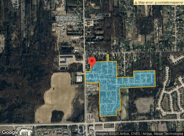
8701 Belleville Rd, Van Buren Township, MI 48111
NEARBY LISTINGS FOR SALE OR LEASE
-
-
View all Van Buren Township listings for sale on LoopNet.com
Property Detail
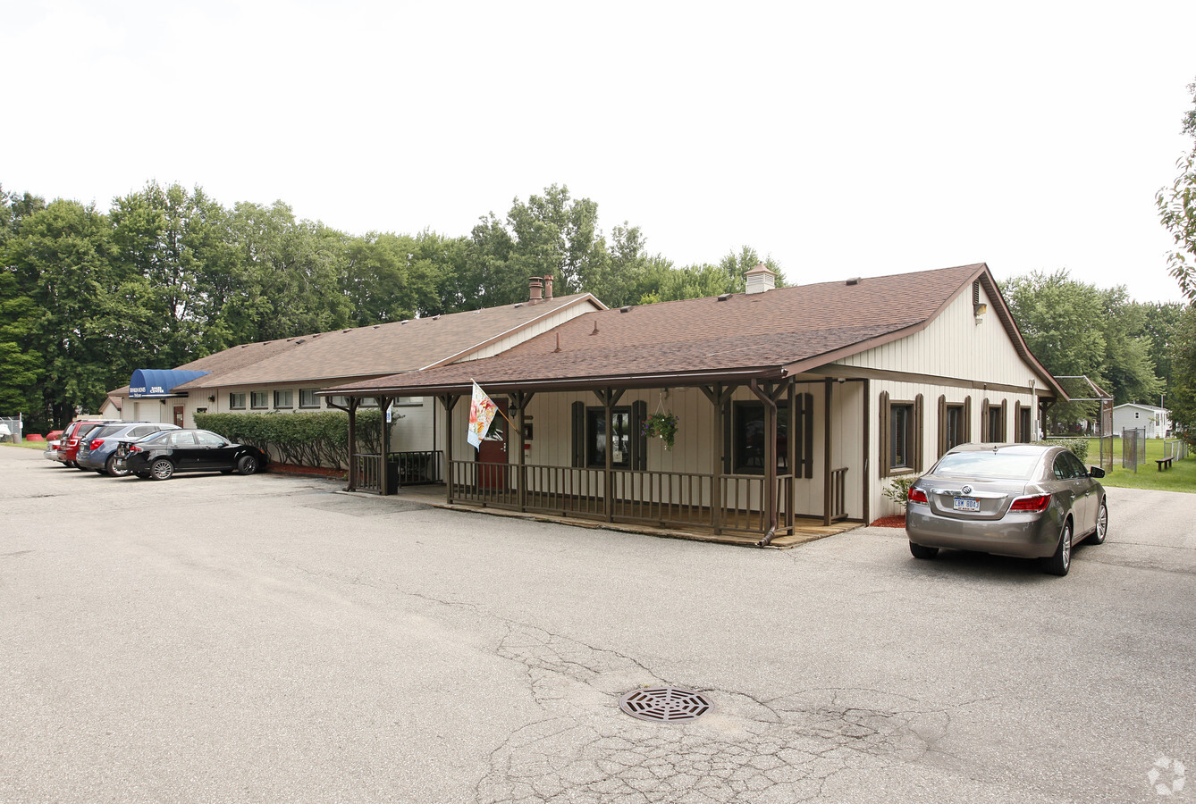
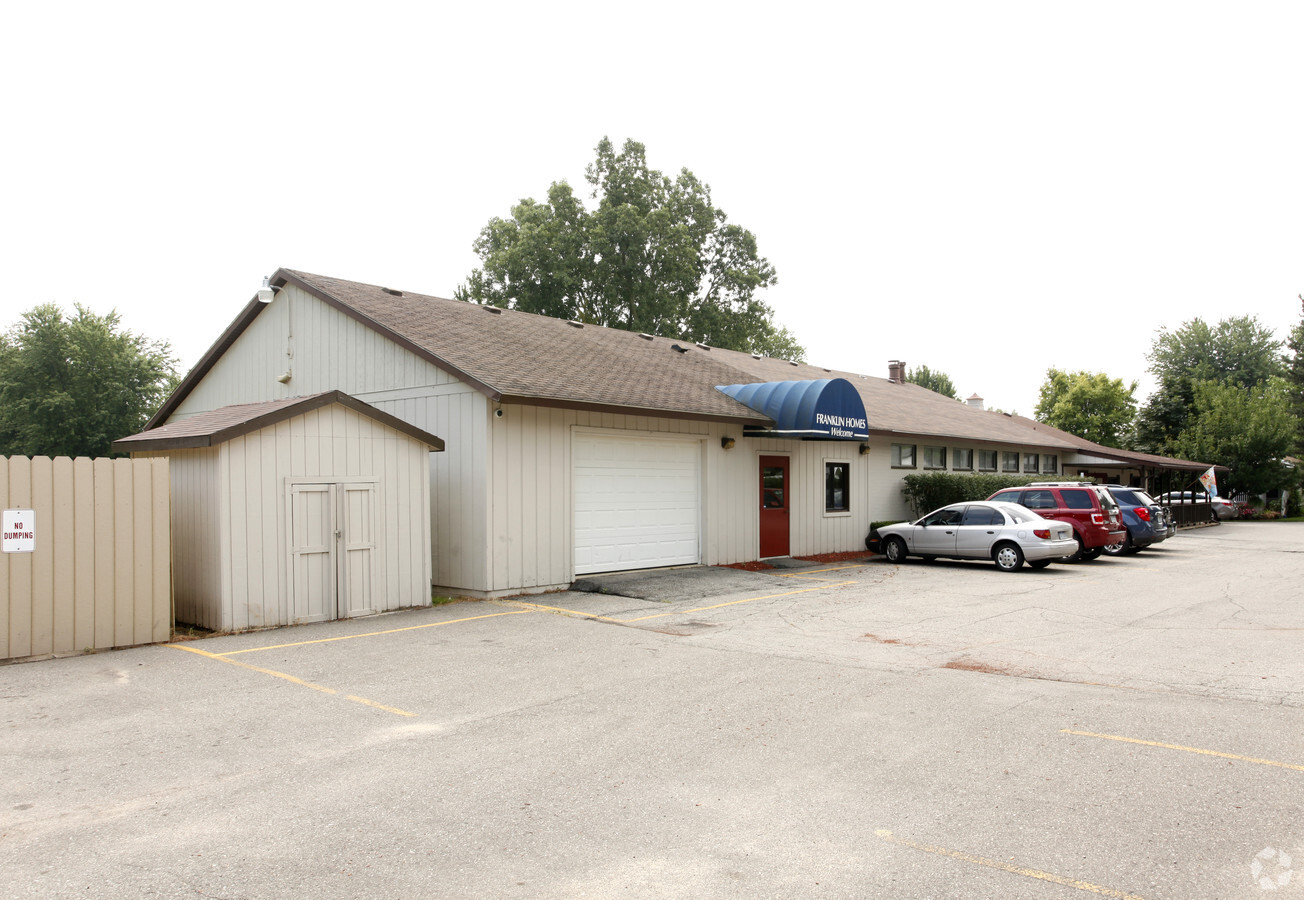
8701 Belleville Rd
Detroit-Warren-Dearborn, MI
Walden Woods Sub
83-039-99-0007-701
10R1E2B S1 S2B1--T1A3B COLA PT OF SW 1/4 SEC 10 T3S R8E BEG S00DEG 36M 05S W 658.58FT TH S 90D 00M 00S E 60 FT TO THE POB; TH S00DEG 36M 05S W 436.79FT; TH S88DEG 25M 38S E 475.81FT; TH S 00D 36M 05S W 1291.46FT; TH N 88D 50M 02S E 650.95FT TH N 00D
Clubslodgesprofessionalassociations
Wayne
X
Michigan
26163C0351E
a
2024
60.01 AC
2024
Outlying Wayne County
587900
Detroit
3,640 SF
DEMOGRAPHICS near 8701 Belleville Rd
1 Mile
3 Mile
5 Mile
2024 Total Population
4,426
28,318
98,615
2029 Population
4,227
27,321
95,568
Pop Growth 2024-2029
(4.50%)
(3.52%)
(3.09%)
Average Age
40
41
40
2024 Total Households
1,818
12,649
39,446
HH Growth 2024-2029
(4.57%)
(3.50%)
(3.11%)
Median Household Inc
$85,503
$70,031
$77,463
Avg Household Size
2.40
2.20
2.40
2024 Avg HH Vehicles
2.00
2.00
2.00
Median Home Value
$251,219
$240,792
$243,010
Median Year Built
1995
1985
1987
Nearby Places
- Restaurants
- Banks
- Shops
- Fitness
- Groceries
PUBLIC TRANSPORTATION
AIRPORT
Detroit Metro Wayne County
DRIVE
WALK
Distance
Detroit Metro Wayne County
16 min
11.1 mi
Windsor International
DRIVE
WALK
Distance
Windsor International
57 min
38.4 mi
Freight Ports
Port of Toledo
DRIVE
WALK
Distance
Port of Toledo
66 min
52.7 mi
Nearby Properties
Address
Land Use
TOTAL SIZE
Lot Size
Zoning
Address
Land Use
TOTAL SIZE
Lot Size
Zoning
238.69 AC
AG
Address
Land Use
TOTAL SIZE
Lot Size
Zoning
347,606 SF
71.56 AC
M2 GEN
Address
Land Use
TOTAL SIZE
Lot Size
Zoning
461,566 SF
50.13 AC
RM MULT
Address
Land Use
TOTAL SIZE
Lot Size
Zoning
Address
Land Use
TOTAL SIZE
Lot Size
Zoning
484,788 SF
52.40 AC
M1 LIG
Address
Land Use
TOTAL SIZE
Lot Size
Zoning
71.56 AC
M2 GEN
Address
Land Use
TOTAL SIZE
Lot Size
Zoning
357,286 SF
36.79 AC
RM MULT
Address
Land Use
TOTAL SIZE
Lot Size
Zoning
1,182 SF
25.21 AC
G-1
Address
Land Use
TOTAL SIZE
Lot Size
Zoning
85.27 AC
M1 LIG
Address
Land Use
TOTAL SIZE
Lot Size
Zoning
182,952 SF
82.77 AC
Address
Land Use
TOTAL SIZE
Lot Size
Zoning
685,506 SF
44.25 AC
M1 LIG
Address
Land Use
TOTAL SIZE
Lot Size
Zoning
524,579 SF
42.18 AC
M2 GEN
Address
Land Use
TOTAL SIZE
Lot Size
Zoning
137,143 SF
15.54 AC
C-3
Address
Land Use
TOTAL SIZE
Lot Size
Zoning
455,367 SF
32.59 AC
Address
Land Use
TOTAL SIZE
Lot Size
Zoning
443,082 SF
30.01 AC
LI-2
Address
Land Use
TOTAL SIZE
Lot Size
Zoning
198,549 SF
13.43 AC
RM MULT
Address
Land Use
TOTAL SIZE
Lot Size
Zoning
211,345 SF
18.67 AC
RM MULT
Address
Land Use
TOTAL SIZE
Lot Size
Zoning
135,430 SF
8.33 AC
AP
Address
Land Use
TOTAL SIZE
Lot Size
Zoning
Address
Land Use
TOTAL SIZE
Lot Size
Zoning
437,835 SF
28.75 AC
M1 LIG
Address
Land Use
TOTAL SIZE
Lot Size
Zoning
432.42 AC
M2 GEN
Address
Land Use
TOTAL SIZE
Lot Size
Zoning
161,794 SF
17.73 AC
RM MULT
Address
Land Use
TOTAL SIZE
Lot Size
Zoning
132,528 SF
5.91 AC
C2 EXT
Address
Land Use
TOTAL SIZE
Lot Size
Zoning
Address
Land Use
TOTAL SIZE
Lot Size
Zoning
85,612 SF
17.66 AC
R-1
Address
Land Use
TOTAL SIZE
Lot Size
Zoning
965,985 SF
75.26 AC
M2 GEN
Address
Land Use
TOTAL SIZE
Lot Size
Zoning
405,592 SF
28.40 AC
M1 LIG
Address
Land Use
TOTAL SIZE
Lot Size
Zoning
25,000 SF
7.91 AC
C1GEN
Address
Land Use
TOTAL SIZE
Lot Size
Zoning
Address
Land Use
TOTAL SIZE
Lot Size
Zoning
191,446 SF
22.76 AC
C2EXT
The World's #1 Commercial Real Estate Marketplace
Connect with us
© 2025 CoStar Group
The information above has been obtained from sources believed reliable. While we do not doubt its accuracy we have not verified it and make no guarantee, warranty or representation about it. It is your responsibility to independently confirm its accuracy and completeness. Any projections, opinions, assumptions, or estimates used are for example only and do not represent the current or future performance of the property. The value of this transaction to you depends on tax and other factors which should be evaluated by your tax, financial, and legal advisors. You and your advisors should conduct a careful, independent investigation of the property to determine to your satisfaction the suitability of the property for your needs.