Property Record
8701 W 32Nd St, Sioux Falls, SD 57106
NEARBY LISTINGS FOR SALE OR LEASE
-
-
View all Sioux Falls listings for sale on LoopNet.com
Property Detail
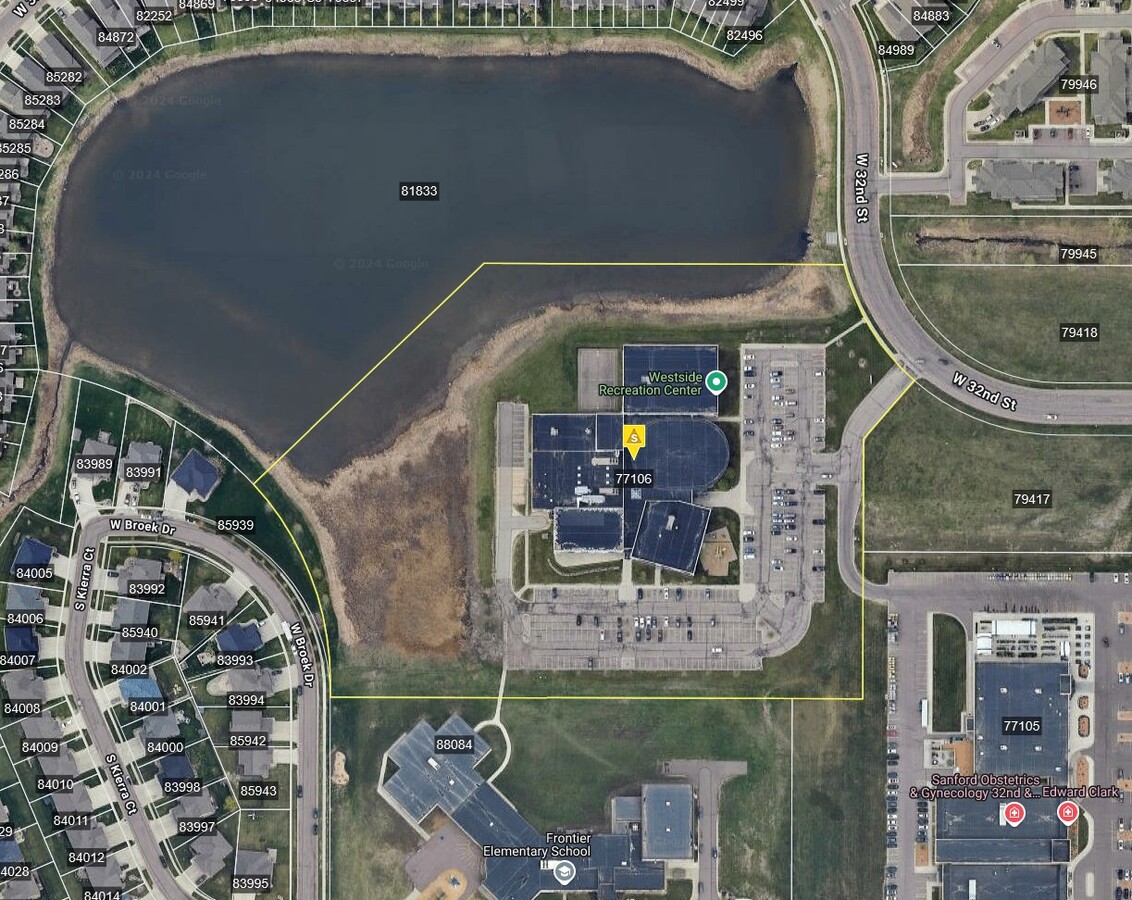
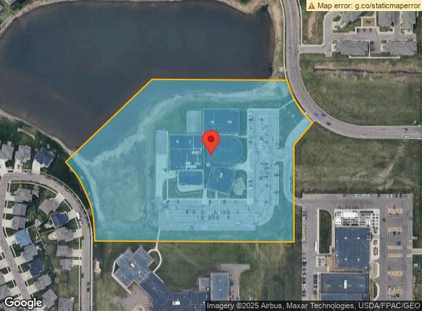
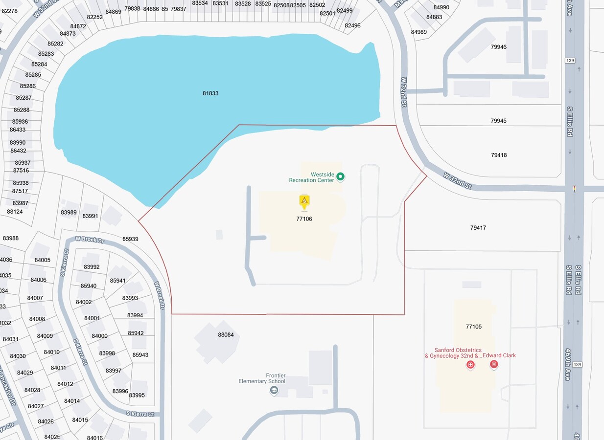
8701 W 32Nd St
Sioux Falls, SD
Riverdale Third Addition
77106
LOT 2A BLOCK 1 WESTWOOD VALLEY ADDN TO CITY OF SIOUX FALLS
Gymhealthspa
Minnehaha
X
South Dakota
46083C0040D
2a
2024
12.43 AC
2023
Sioux Falls
010406
Other Market Areas
72,820 SF
DEMOGRAPHICS near 8701 W 32Nd St
1 Mile
3 Mile
5 Mile
2024 Total Population
10,957
50,617
99,412
2029 Population
12,131
55,097
109,716
Pop Growth 2024-2029
+ 10.71%
+ 8.85%
+ 10.36%
Average Age
35
37
37
2024 Total Households
4,263
19,932
40,807
HH Growth 2024-2029
+ 11.35%
+ 9.19%
+ 10.53%
Median Household Inc
$85,555
$78,577
$71,767
Avg Household Size
2.60
2.50
2.40
2024 Avg HH Vehicles
2.00
2.00
2.00
Median Home Value
$305,382
$259,095
$246,910
Median Year Built
2010
1999
1996
Nearby Places
- Restaurants
- Banks
- Shops
- Fitness
- Groceries
PUBLIC TRANSPORTATION
AIRPORT
Joe Foss Field
DRIVE
WALK
Distance
Joe Foss Field
28 min
10.3 mi
Freight Ports
Port Milwaukee
DRIVE
WALK
Distance
Port Milwaukee
557 min
511.4 mi
Nearby Properties
Address
Land Use
TOTAL SIZE
Lot Size
Zoning
Address
Land Use
TOTAL SIZE
Lot Size
Zoning
13,806 SF
10.99 AC
Address
Land Use
TOTAL SIZE
Lot Size
Zoning
16.45 AC
MUNICIPALI
Address
Land Use
TOTAL SIZE
Lot Size
Zoning
9.27 AC
MUNICIPALI
Address
Land Use
TOTAL SIZE
Lot Size
Zoning
8,768 SF
5.48 AC
Address
Land Use
TOTAL SIZE
Lot Size
Zoning
29,313 SF
9.13 AC
Address
Land Use
TOTAL SIZE
Lot Size
Zoning
9.16 AC
MUNICIPALI
Address
Land Use
TOTAL SIZE
Lot Size
Zoning
72,342 SF
6.09 AC
FP;FP
Address
Land Use
TOTAL SIZE
Lot Size
Zoning
5.68 AC
MUNICIPALI
Address
Land Use
TOTAL SIZE
Lot Size
Zoning
0.57 AC
MUNICIPALI
Address
Land Use
TOTAL SIZE
Lot Size
Zoning
5.12 AC
MUNICIPALI
Address
Land Use
TOTAL SIZE
Lot Size
Zoning
31,533 SF
3.46 AC
C;COMMERCI
Address
Land Use
TOTAL SIZE
Lot Size
Zoning
3.37 AC
MUNICIPALI
Address
Land Use
TOTAL SIZE
Lot Size
Zoning
800 SF
37.96 AC
FP;FP
Address
Land Use
TOTAL SIZE
Lot Size
Zoning
117,026 SF
14.52 AC
RA;APARTME
Address
Land Use
TOTAL SIZE
Lot Size
Zoning
5.35 AC
MUNICIPALI
Address
Land Use
TOTAL SIZE
Lot Size
Zoning
3,664 SF
28.55 AC
Address
Land Use
TOTAL SIZE
Lot Size
Zoning
20,416 SF
5.53 AC
Address
Land Use
TOTAL SIZE
Lot Size
Zoning
72,601 SF
15.33 AC
Address
Land Use
TOTAL SIZE
Lot Size
Zoning
14.66 AC
C4;GENERAL
Address
Land Use
TOTAL SIZE
Lot Size
Zoning
49,798 SF
6.12 AC
NO;SPECIAL
Address
Land Use
TOTAL SIZE
Lot Size
Zoning
1,344 SF
5.90 AC
Address
Land Use
TOTAL SIZE
Lot Size
Zoning
185,662 SF
18.09 AC
Address
Land Use
TOTAL SIZE
Lot Size
Zoning
20,416 SF
5.06 AC
RA;APARTME
Address
Land Use
TOTAL SIZE
Lot Size
Zoning
224 SF
161.91 AC
Address
Land Use
TOTAL SIZE
Lot Size
Zoning
15.88 AC
Address
Land Use
TOTAL SIZE
Lot Size
Zoning
3.03 AC
MUNICIPALI
Address
Land Use
TOTAL SIZE
Lot Size
Zoning
18,502 SF
3.08 AC
FP;FP
Address
Land Use
TOTAL SIZE
Lot Size
Zoning
62,815 SF
6.42 AC
Address
Land Use
TOTAL SIZE
Lot Size
Zoning
118,202 SF
9.73 AC
FP;FP
Address
Land Use
TOTAL SIZE
Lot Size
Zoning
11,922 SF
2.58 AC
PD;PLANNED
The World's #1 Commercial Real Estate Marketplace
Connect with us
© 2025 CoStar Group
The information above has been obtained from sources believed reliable. While we do not doubt its accuracy we have not verified it and make no guarantee, warranty or representation about it. It is your responsibility to independently confirm its accuracy and completeness. Any projections, opinions, assumptions, or estimates used are for example only and do not represent the current or future performance of the property. The value of this transaction to you depends on tax and other factors which should be evaluated by your tax, financial, and legal advisors. You and your advisors should conduct a careful, independent investigation of the property to determine to your satisfaction the suitability of the property for your needs.