Property Record
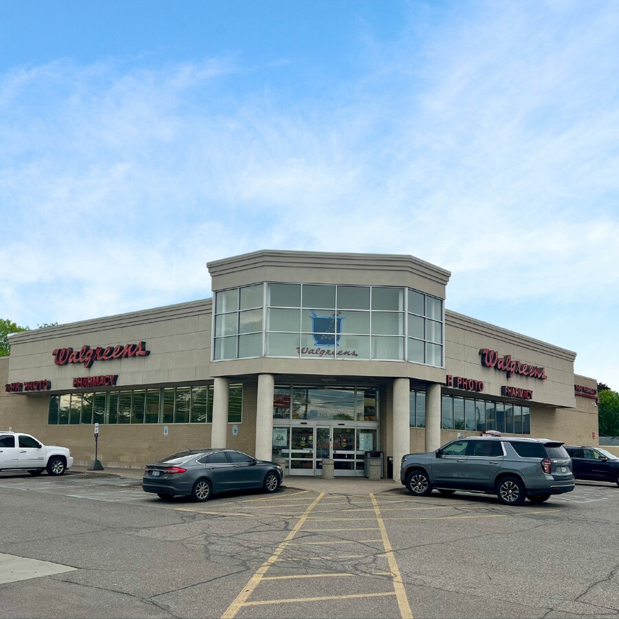
8706 N Telegraph Rd, Dearborn Heights, MI 48127


This Property Is For Sale
NEARBY LISTINGS FOR SALE OR LEASE
Property Detail
8706 N Telegraph Rd
Detroit-Warren-Dearborn, MI
Bon Telegraph Sub
33-001-02-0108-300
Wayne
Drugstorepharmacycvswalgreens
Michigan
X
1.45 AC
26163C0232E
Dearborn
13,836 SF
Detroit
DEMOGRAPHICS near 8706 N Telegraph Rd
1 Mile
3 Mile
5 Mile
2024 Total Population
14,461
121,848
336,350
2029 Population
13,858
118,280
326,194
Pop Growth 2024-2029
(4.17%)
(2.93%)
(3.02%)
Average Age
39
37
38
2024 Total Households
5,377
45,398
127,915
HH Growth 2024-2029
(4.15%)
(2.99%)
(3.07%)
Median Household Inc
$58,369
$54,746
$54,257
Avg Household Size
2.70
2.60
2.60
2024 Avg HH Vehicles
2.00
2.00
2.00
Median Home Value
$147,835
$146,777
$145,960
Median Year Built
1955
1955
1954
Nearby Places
- Restaurants
- Banks
- Shops
- Fitness
- Groceries
PUBLIC TRANSPORTATION
COMMUTER RAIL
Dearborn (Wolverine - Amtrak)
DRIVE
WALK
Distance
Dearborn (Wolverine - Amtrak)
13 min
6.5 mi
AIRPORT
Detroit Metro Wayne County
DRIVE
WALK
Distance
Detroit Metro Wayne County
27 min
14.8 mi
Windsor International
DRIVE
WALK
Distance
Windsor International
42 min
26.1 mi
Freight Ports
Port of Toledo
DRIVE
WALK
Distance
Port of Toledo
79 min
58.1 mi
Nearby Properties
Address
Land Use
TOTAL SIZE
Lot Size
Zoning
Address
Land Use
TOTAL SIZE
Lot Size
Zoning
59.61 AC
Address
Land Use
TOTAL SIZE
Lot Size
Zoning
335,133 SF
22.08 AC
Address
Land Use
TOTAL SIZE
Lot Size
Zoning
85.45 AC
Address
Land Use
TOTAL SIZE
Lot Size
Zoning
75.88 AC
Address
Land Use
TOTAL SIZE
Lot Size
Zoning
300,936 SF
18.40 AC
M4
Address
Land Use
TOTAL SIZE
Lot Size
Zoning
261,917 SF
9.31 AC
PD
Address
Land Use
TOTAL SIZE
Lot Size
Zoning
376,836 SF
34.90 AC
Address
Land Use
TOTAL SIZE
Lot Size
Zoning
835,383 SF
36.85 AC
Address
Land Use
TOTAL SIZE
Lot Size
Zoning
158,354 SF
43.70 AC
M4
Address
Land Use
TOTAL SIZE
Lot Size
Zoning
167,562 SF
9.25 AC
R5
Address
Land Use
TOTAL SIZE
Lot Size
Zoning
286,524 SF
16.58 AC
Address
Land Use
TOTAL SIZE
Lot Size
Zoning
179,412 SF
2.17 AC
Address
Land Use
TOTAL SIZE
Lot Size
Zoning
159,520 SF
6.64 AC
Address
Land Use
TOTAL SIZE
Lot Size
Zoning
129,975 SF
6.89 AC
R5
Address
Land Use
TOTAL SIZE
Lot Size
Zoning
Address
Land Use
TOTAL SIZE
Lot Size
Zoning
113,451 SF
3.94 AC
RE
Address
Land Use
TOTAL SIZE
Lot Size
Zoning
153,517 SF
5.02 AC
Address
Land Use
TOTAL SIZE
Lot Size
Zoning
Address
Land Use
TOTAL SIZE
Lot Size
Zoning
Address
Land Use
TOTAL SIZE
Lot Size
Zoning
171,414 SF
23.57 AC
Address
Land Use
TOTAL SIZE
Lot Size
Zoning
136,409 SF
14.01 AC
C2
Address
Land Use
TOTAL SIZE
Lot Size
Zoning
97,114 SF
2.10 AC
R1
Address
Land Use
TOTAL SIZE
Lot Size
Zoning
160,140 SF
11.15 AC
Address
Land Use
TOTAL SIZE
Lot Size
Zoning
207,088 SF
14.25 AC
R-1
Address
Land Use
TOTAL SIZE
Lot Size
Zoning
41,875 SF
4.88 AC
Address
Land Use
TOTAL SIZE
Lot Size
Zoning
362,981 SF
18.08 AC
M4
Address
Land Use
TOTAL SIZE
Lot Size
Zoning
Address
Land Use
TOTAL SIZE
Lot Size
Zoning
161,940 SF
7.44 AC
RMA
Address
Land Use
TOTAL SIZE
Lot Size
Zoning
106,597 SF
4.71 AC
PD
Address
Land Use
TOTAL SIZE
Lot Size
Zoning
81,197 SF
7.16 AC
RM
The World's #1 Commercial Real Estate Marketplace
Connect with us
© 2025 CoStar Group
The information above has been obtained from sources believed reliable. While we do not doubt its accuracy we have not verified it and make no guarantee, warranty or representation about it. It is your responsibility to independently confirm its accuracy and completeness. Any projections, opinions, assumptions, or estimates used are for example only and do not represent the current or future performance of the property. The value of this transaction to you depends on tax and other factors which should be evaluated by your tax, financial, and legal advisors. You and your advisors should conduct a careful, independent investigation of the property to determine to your satisfaction the suitability of the property for your needs.