Property Record
879 Maple St, Hopkinton, NH 03229
NEARBY LISTINGS FOR SALE OR LEASE
-
-
View all Hopkinton listings for lease on LoopNet.com
Property Detail
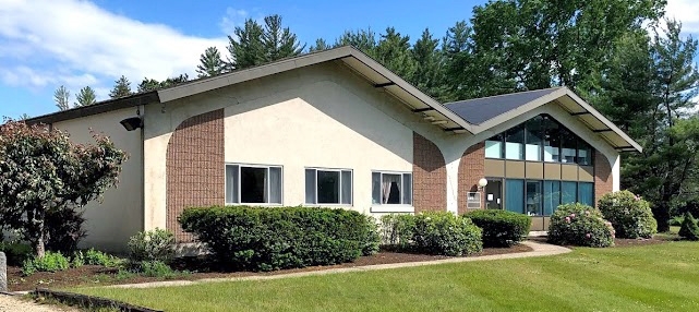
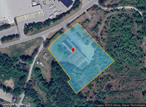
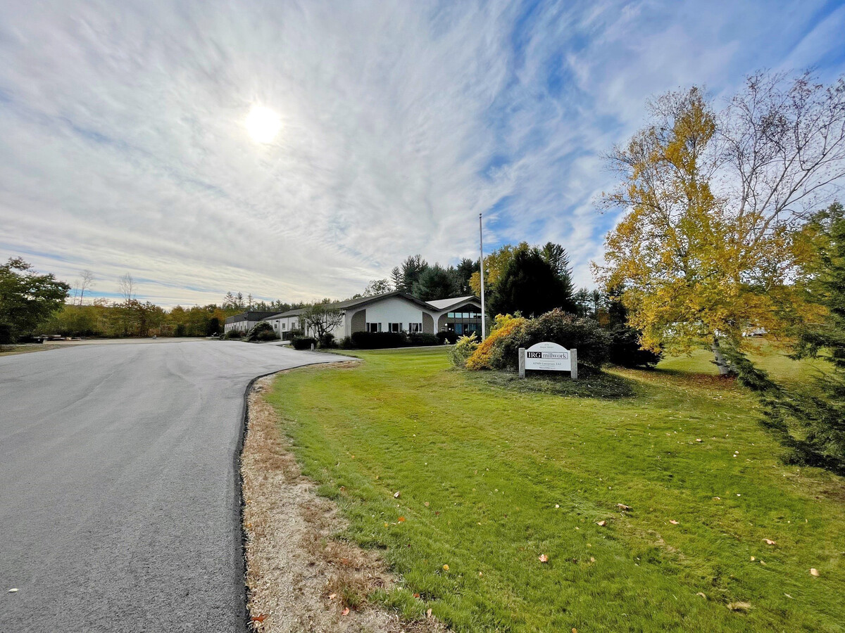
879 Maple St
Commercialbuilding
Merrimack
X
New Hampshire
33013C0504E
7.85 AC
2024
Concord/New Hampshire North Area
2024
Other Market Areas
039000
Concord, NH
46,379 SF
HOPN-000228-000025
DEMOGRAPHICS near 879 Maple St
1 Mile
3 Mile
5 Mile
2024 Total Population
320
4,661
9,635
2029 Population
338
4,901
10,126
Pop Growth 2024-2029
+ 5.63%
+ 5.15%
+ 5.10%
Average Age
44
44
43
2024 Total Households
123
1,827
3,727
HH Growth 2024-2029
+ 4.88%
+ 5.04%
+ 5.02%
Median Household Inc
$131,250
$103,220
$107,596
Avg Household Size
2.60
2.50
2.60
2024 Avg HH Vehicles
2.00
2.00
2.00
Median Home Value
$517,544
$385,102
$379,603
Median Year Built
1970
1971
1977
Nearby Places
- Restaurants
- Banks
- Shops
- Fitness
- Groceries
PUBLIC TRANSPORTATION
AIRPORT
Manchester Boston Regional
DRIVE
WALK
Distance
Manchester Boston Regional
45 min
31.5 mi
Freight Ports
Port of Boston
DRIVE
WALK
Distance
Port of Boston
111 min
80.1 mi
SALE & LEASE HISTORY
LISTING DATE
SALE/LEASE

Jul 15, 2020
For Sale
Aug 02, 2021
For Lease
Nearby Properties
Address
Land Use
TOTAL SIZE
Lot Size
Zoning
Address
Land Use
TOTAL SIZE
Lot Size
Zoning
74,265 SF
9.63 AC
R-1
Address
Land Use
TOTAL SIZE
Lot Size
Zoning
298,175 SF
58.66 AC
M-1
Address
Land Use
TOTAL SIZE
Lot Size
Zoning
55,783 SF
8 AC
HVP1
Address
Land Use
TOTAL SIZE
Lot Size
Zoning
34,307 SF
5.80 AC
R-1
Address
Land Use
TOTAL SIZE
Lot Size
Zoning
10,395 SF
67.85 AC
VR-1 .
Address
Land Use
TOTAL SIZE
Lot Size
Zoning
1,472 SF
46.78 AC
R-1
Address
Land Use
TOTAL SIZE
Lot Size
Zoning
3,245 SF
39.10 AC
R-2
Address
Land Use
TOTAL SIZE
Lot Size
Zoning
55,554 SF
24 AC
M-1
Address
Land Use
TOTAL SIZE
Lot Size
Zoning
69,848 SF
5.72 AC
M-1
Address
Land Use
TOTAL SIZE
Lot Size
Zoning
4,526 SF
4.92 AC
VB-1 .
Address
Land Use
TOTAL SIZE
Lot Size
Zoning
13,830 SF
1.08 AC
VB-1 .
Address
Land Use
TOTAL SIZE
Lot Size
Zoning
1,654 SF
1,307 AC
R-4
Address
Land Use
TOTAL SIZE
Lot Size
Zoning
41,529 SF
7.04 AC
M-1
Address
Land Use
TOTAL SIZE
Lot Size
Zoning
19,980 SF
1.90 AC
VB-1 .
Address
Land Use
TOTAL SIZE
Lot Size
Zoning
59,108 SF
6.71 AC
M-1
Address
Land Use
TOTAL SIZE
Lot Size
Zoning
11,559 SF
5.10 AC
R-1
Address
Land Use
TOTAL SIZE
Lot Size
Zoning
3,432 SF
1.50 AC
HVP1
Address
Land Use
TOTAL SIZE
Lot Size
Zoning
16,951 SF
4.90 AC
B-1 .3
Address
Land Use
TOTAL SIZE
Lot Size
Zoning
29,302 SF
7.10 AC
R-1
Address
Land Use
TOTAL SIZE
Lot Size
Zoning
13,135 SF
2.71 AC
HVP1
Address
Land Use
TOTAL SIZE
Lot Size
Zoning
2,016 SF
33 AC
R-1
Address
Land Use
TOTAL SIZE
Lot Size
Zoning
25,013 SF
2.23 AC
R-1
Address
Land Use
TOTAL SIZE
Lot Size
Zoning
1,798 SF
0.26 AC
VB-1 .
Address
Land Use
TOTAL SIZE
Lot Size
Zoning
0.12 AC
R-1
Address
Land Use
TOTAL SIZE
Lot Size
Zoning
13,333 SF
1.10 AC
VB-1 .
Address
Land Use
TOTAL SIZE
Lot Size
Zoning
2,366 SF
1.12 AC
HEAVY
Address
Land Use
TOTAL SIZE
Lot Size
Zoning
19 AC
RES NE
Address
Land Use
TOTAL SIZE
Lot Size
Zoning
2,669 SF
42.28 AC
R-4
Address
Land Use
TOTAL SIZE
Lot Size
Zoning
5,649 SF
0.91 AC
HVP1
The World's #1 Commercial Real Estate Marketplace
Connect with us
© 2025 CoStar Group
The information above has been obtained from sources believed reliable. While we do not doubt its accuracy we have not verified it and make no guarantee, warranty or representation about it. It is your responsibility to independently confirm its accuracy and completeness. Any projections, opinions, assumptions, or estimates used are for example only and do not represent the current or future performance of the property. The value of this transaction to you depends on tax and other factors which should be evaluated by your tax, financial, and legal advisors. You and your advisors should conduct a careful, independent investigation of the property to determine to your satisfaction the suitability of the property for your needs.